
-
Federal
Ocean Surface Current Analyses Real-time (OSCAR) Surface Currents - Final 0.25 Degree (Version 2.0) recent views
National Aeronautics and Space Administration —
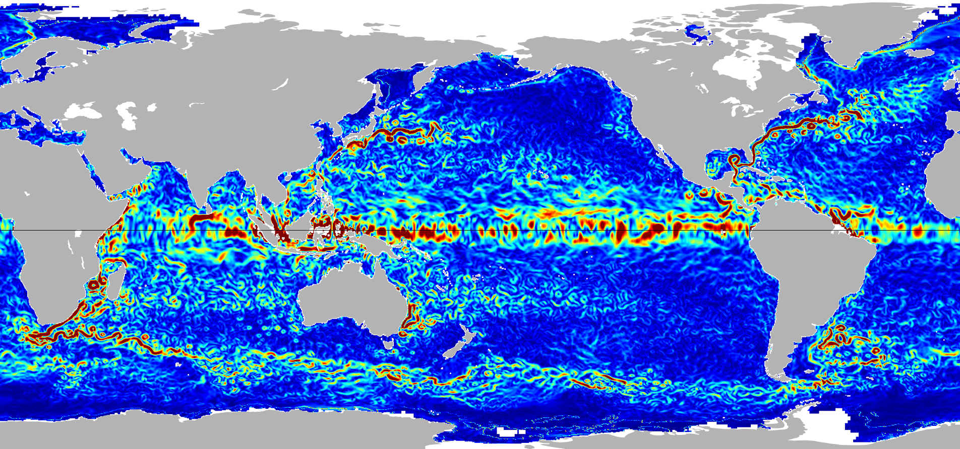
Ocean Surface Current Analyses Real-time (OSCAR) is a global surface current database and NASA funded research project. OSCAR ocean mixed layer velocities are... -
Federal
Ocean Surface Current Analyses Real-time (OSCAR) Surface Currents - Near Real Time 0.25 Degree (Version 2.0) recent views
National Aeronautics and Space Administration —
Ocean Surface Current Analyses Real-time (OSCAR) is a global surface current database and NASA funded research project. OSCAR ocean mixed layer velocities are... -
Federal
OSCAR third degree resolution ocean surface currents - yearly files recent views
National Aeronautics and Space Administration —
OSCAR (Ocean Surface Current Analysis Real-time) contains near-surface ocean current estimates, derived using quasi-linear and steady flow momentum equations. The... -
Federal
Sea Ice in the Belcher Islands, Nunavut, Canada, Version 1 recent views
National Aeronautics and Space Administration —
This data set contains interviews of three hunters from Sanikiliaq, Belcher Islands, in the territory of Nunavut, Canada. The hunters describe their observations of... -
Federal
OSCAR 1 degree ocean surface currents recent views
National Aeronautics and Space Administration —
OSCAR (Ocean Surface Current Analysis Real-time) contains near-surface ocean current estimates, derived using quasi-linear and steady flow momentum equations. The... -
Federal
Northwest Pacific Pre-SWOT Level-4 Hourly MITgcm LLC4320 Native Grid 2km Oceanographic Dataset Version 1.0 recent views
National Aeronautics and Space Administration —
This dataset provides a regional multivariate oceanographic state estimate from a global ocean numerical simulation with a focus on the Northwest Pacific Ocean... -
Federal
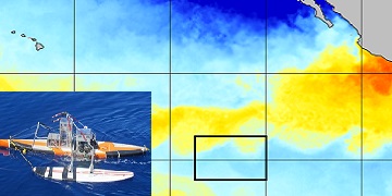
Saildrone field campaign surface and ADCP measurements for the Atlantic Tradewind Ocean-Atmosphere Mesoscale Interaction Campaign (ATOMIC) project recent views
National Aeronautics and Space Administration —
Saildrone is a wind and solar powered unmanned surface vehicle (USV) capable of long distance deployments lasting up to 12 months and providing high quality, near... -
Federal
Local Observations from the Seasonal Ice Zone Observing Network (SIZONet) and Alaska Arctic Observatory and Knowledge Hub (AAOKH), Version 2 recent views
National Aeronautics and Space Administration —
The Seasonal Ice Zone Observing Network (SIZONet) and the Alaska Arctic Observatory and Knowledge Hub (AAOKH) share the Local Observations Interface, which allows... -
Federal
ECCO Ocean and Sea-Ice Surface Freshwater Fluxes - Daily Mean 0.5 Degree (Version 4 Release 4) recent views
National Aeronautics and Space Administration —
This dataset contains daily-averaged ocean and sea-ice surface freshwater fluxes interpolated to a regular 0.5-degree grid from the ECCO Version 4 revision 4 (V4r4)... -
Federal
Waveglider data for the SPURS-1 N. Atlantic field campaign recent views
National Aeronautics and Space Administration —
The SPURS (Salinity Processes in the Upper Ocean Regional Study) project is an oceanographic process study and associated field program that aim to elucidate key... -
Federal
S-MODE L2 Position Data from Surface Drifters Version 1 recent views
National Aeronautics and Space Administration —
This dataset contains in-situ position data from surface drifters from the Sub-Mesoscale Ocean Dynamics Experiment (S-MODE) conducted approximately 300 km offshore of... -
Federal
ECCO Ocean Velocity - Monthly Mean llc90 Grid (Version 4 Release 4) recent views
National Aeronautics and Space Administration —
This dataset provides monthly-averaged ocean velocity on the native Lat-Lon-Cap 90 (LLC90) model grid from the ECCO Version 4 Release 4 (V4r4) ocean and sea-ice state... -
Federal
SPURS-2 Towed surface salinity profile (SSP) data for the E. Tropical Pacific R/V Revelle cruises recent views
National Aeronautics and Space Administration —
The SPURS (Salinity Processes in the Upper Ocean Regional Study) project is a NASA-funded oceanographic process study and associated field program that aim to... -
Federal
ECCO Ocean Mixed Layer Depth - Monthly Mean 0.5 Degree (Version 4 Release 4) recent views
National Aeronautics and Space Administration —
This dataset contains monthly-averaged ocean mixed layer depth interpolated to a regular 0.5-degree grid from the ECCO Version 4 revision 4 (V4r4) ocean and sea-ice... -
Federal
SASSIE Arctic Field Campaign L1 SWIFT Data Fall 2022 recent views
National Aeronautics and Space Administration —
The Salinity and Stratification at the Sea Ice Edge (SASSIE) project is a NASA experiment that aims to understand how salinity anomalies in the upper ocean generated... -
Federal
ECCO Ocean Velocity - Monthly Mean 0.5 Degree (Version 4 Release 4) recent views
National Aeronautics and Space Administration —
This dataset contains monthly-averaged ocean velocity interpolated to a regular 0.5-degree grid from the ECCO Version 4 revision 4 (V4r4) ocean and sea-ice state... -
Federal
Gridded Altimeter Fields with Enhanced Coastal Coverage Daily recent views
National Aeronautics and Space Administration —
The Gridded Altimeter Fields with Enhanced Coastal Coverage data product contains Sea Surface Height Anomalies (SSHA or SLA) and zonal and meridional geostrophic... -
Federal
Gridded Altimeter Fields with Enhanced Coastal Coverage recent views
National Aeronautics and Space Administration —
The Gridded Altimeter Fields with Enhanced Coastal Coverage data product contains Sea Surface Height Anomalies (SSHA or SLA) and zonal and meridional geostrophic... -
Federal
QuikSCAT ESDR Level 2 Modeled Ocean Surface Auxiliary Fields Version 1.0 recent views
National Aeronautics and Space Administration —
This dataset contains the first provisional release of the MEaSUREs-funded Earth Science Data Record (ESDR) of ancillary data corresponding to the QuikSCAT Level 2... -
Federal
Summary Report of Community-Based Environmental and Species Observations from the Bering Sea Sub-Network, 2008-2009, Version 1 recent views
National Aeronautics and Space Administration —
The Bering Sea Sub-Network (BSSN) is comprised of a set of coastal communities representing six indigenous cultures: three in the Russian Federation and three in the...

Official websites use .gov
A
.gov website belongs to an official government
organization in the United States.
Secure .gov websites use HTTPS
A
lock (
) or https:// means you’ve safely connected to
the .gov website. Share sensitive information only on official,
secure websites.