
-
Federal
BOREAS Derived Surface Meteorological Data
National Aeronautics and Space Administration —
Contains surface meteorology data merged/interpolated from four BOREAS sites for the years 1994, 1995, and 1996. -
Federal
MISR Level 3 Component Global Land Regional public Product covering a month V002
National Aeronautics and Space Administration —
MI3MLSR_2 is the Multi-angle Imaging SpectroRadiometer (MISR) Level 3 Component Global Land Regional public Product covering a month version 2. It contains a daily... -
Federal
BOREAS TF-08 NSA-OJP Tower Flux, Meteorological, and Soil Temperature Data
National Aeronautics and Space Administration —
Energy, carbon dioxide, and water vapor flux data collected by the BOREAS TF-08 team. -
Federal
Arctic Tundra Flux Study in the Kuparuk River Basin (Alaska), 1994-1996
National Aeronautics and Space Administration —
CO2 and water vapor fluxes and ecosystem characteristics were measured at 24 sites along a 317-km transect from the Arctic coast to the latitudinal treeline in Alaska... -
Federal
NLDAS Mosaic Land Surface Model L4 Monthly 0.125 x 0.125 degree V2.0 (NLDAS_MOS0125_M) at GES DISC
National Aeronautics and Space Administration —
This data set contains thirty-seven fields simulated from the Mosaic land-surface model (LSM) for Phase 2 of the North American Land Data Assimilation System... -
Federal
NLDAS Mosaic Land Surface Model L4 Monthly Climatology 0.125 x 0.125 degree V002 (NLDAS_MOS0125_MC) at GES DISC
National Aeronautics and Space Administration —
This monthly climatology data set contains a series of land surface parameters simulated from the Mosaic land-surface model (LSM) for Phase 2 of the North American... -
Federal
NLDAS Noah Land Surface Model L4 Monthly Climatology 0.125 x 0.125 degree V2.0 (NLDAS_NOAH0125_MC) at GES DISC
National Aeronautics and Space Administration —
This monthly climatology data set contains a series of land surface parameters simulated from the Noah land-surface model (LSM) for Phase 2 of the North American Land... -
Federal
ABoVE: CO2 and CH4 Fluxes and Meteorology at Flux Tower Sites, Alaska, 2015-2017
National Aeronautics and Space Administration —
This dataset provides CO2 and CH4 fluxes and meteorological parameters from five eddy covariance (EC) tower sites located at Barrow (three sites), Atqasuk (ATQ) and... -
Federal
ISLSCP II AVHRR Albedo and BRDF, 1995 NGDA
National Aeronautics and Space Administration —
This Albedo and BRDF (Bidirectional Reflectance Distribution Function) data set contains three files containing BRDF parameters, white- sky albedo and black-sky... -
Federal
FLUXNET Marconi Conference Gap-Filled Flux and Meteorology Data, 1992-2000
National Aeronautics and Space Administration —
Fluxes of carbon dioxide, water vapor, and energy exchange have been measured at 38 forest, grassland, and crop sites as part of the EUROFLUX and AmeriFlux projects.... -
Federal
MISR Level 2 Surface parameters V002
National Aeronautics and Space Administration —
MIL2ASLS_2 is the Multi-angle Imaging SpectroRadiometer (MISR) Level 2 Land Surface parameters version 2 data product. It contains a variety of information on the... -
Federal
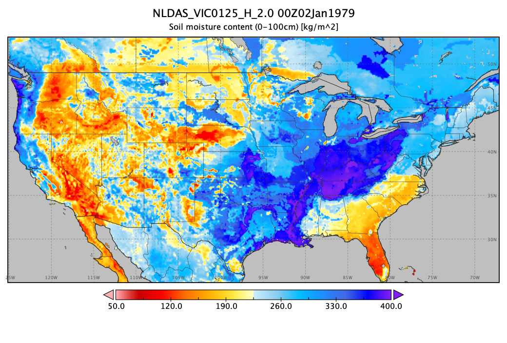
NLDAS VIC Land Surface Model L4 Hourly 0.125 x 0.125 degree V2.0 (NLDAS_VIC0125_H) at GES DISC
National Aeronautics and Space Administration —
This data set contains forty-four fields simulated from the VIC land-surface model (LSM) for Phase 2 of the North American Land Data Assimilation System (NLDAS-2).... -
Federal
MISR Level 3 Component Global Land Regional public Product covering a day V002
National Aeronautics and Space Administration —
MI3DLSR_2 is the Multi-angle Imaging SpectroRadiometer (MISR) Level 3 Component Global Land Regional public Product covering a dayversion 2. It contains a daily... -
Federal
MERRA-2 tavg1_2d_lnd_Nx: 2d,1-Hourly,Time-Averaged,Single-Level,Assimilation,Land Surface Diagnostics 0.625 x 0.5 degree V5.12.4 (M2T1NXLND) at GES DISC
National Aeronautics and Space Administration —
M2T1NXLND (or tavg1_2d_lnd_Nx) is an hourly time-averaged 2-dimensional data collection in Modern-Era Retrospective analysis for Research and Applications version 2... -
Federal
NLDAS Mosaic Land Surface Model L4 Monthly 0.125 x 0.125 degree V002 (NLDAS_MOS0125_M) at GES DISC
National Aeronautics and Space Administration —
This data set contains a series of land surface parameters simulated from the Mosaic land-surface model (LSM) for Phase 2 of the North American Land Data Assimilation... -
Federal
ISLSCP II C4 Vegetation Percentage NGDA
National Aeronautics and Space Administration —
The photosynthetic composition (C3 or C4) of vegetation on the land surface is essential for accurate simulations of biosphere-atmosphere exchanges of carbon, water,... -
Federal
FLUXNET Canada Research Network - Canadian Carbon Program Data Collection, 1993-2014
National Aeronautics and Space Administration —
FLUXNET Canada is a Fluxnet research network comprised of the Fluxnet-Canada Research Network (FCRN) and the Canadian Carbon Program (CCP) operating from 1993 through... -
Federal
NCA-LDAS Noah-3.3 Land Surface Model L4 Daily 0.125 x 0.125 degree V2.0 (NCALDAS_NOAH0125_D) at GES DISC
National Aeronautics and Space Administration —
The National Climate Assessment - Land Data Assimilation System, or NCA-LDAS, is a terrestrial water reanalysis in support of the United States Global Change Research... -
Federal
NLDAS Noah Land Surface Model L4 Monthly 0.125 x 0.125 degree V2.0 (NLDAS_NOAH0125_M) at GES DISC
National Aeronautics and Space Administration —
This data set contains fifty-two fields simulated from the Noah land-surface model (LSM) for Phase 2 of the North American Land Data Assimilation System (NLDAS-2).... -
Federal
ISLSCP II Ecosystem Rooting Depths NGDA
National Aeronautics and Space Administration —
The goal of this study was to predict the global distribution of plant rooting depths based on data about global aboveground vegetation structure and climate....

Official websites use .gov
A
.gov website belongs to an official government
organization in the United States.
Secure .gov websites use HTTPS
A
lock (
) or https:// means you’ve safely connected to
the .gov website. Share sensitive information only on official,
secure websites.