
-
Federal
World Glacier Inventory, Version 1 recent views
National Aeronautics and Space Administration —
The World Glacier Inventory (WGI) contains information for over 130,000 glaciers, or about 85% of the total estimated number of glaciers. Inventory parameters include... -
Federal
JPL GRACE and GRACE-FO Mascon Ocean, Ice, and Hydrology Equivalent Water Height Coastal Resolution Improvement (CRI) Filtered Release 06.3 Version 04 recent views
National Aeronautics and Space Administration —
This dataset contains gridded monthly global water storage/height anomalies relative to a time-mean, derived from GRACE and GRACE-FO and processed at JPL using the... -
Federal
USGS Digital Orthophoto Quadrangles recent views
National Aeronautics and Space Administration —
A Digital Orthophoto Quadrangle (DOQ) is a computer-generated image of an aerial photograph in which the image displacement caused by terrain relief and camera tilt... -
Federal
Western Italian Alps Monthly Snowfall and Snow Cover Duration, Version 1 recent views
National Aeronautics and Space Administration —
This data set consists of snow observations for 18 stations in the western Italian Alps. Two types of data are included: monthly snowfall amounts and monthly snow... -
Federal
CLPX-Ground: ISA Snow Pit Measurements, Version 2 recent views
National Aeronautics and Space Administration —
This data set consists of snow pit data from nine study areas, within three larger-scale areas in northern Colorado (Fraser, North Park, and Rabbit Ears Meso-cell... -
Federal
Sea Ice in the Belcher Islands, Nunavut, Canada, Version 1 recent views
National Aeronautics and Space Administration —
This data set contains interviews of three hunters from Sanikiliaq, Belcher Islands, in the territory of Nunavut, Canada. The hunters describe their observations of... -
Federal
SENTINEL-1B_SINGLE_POL_GRD_HIGH_RES recent views
National Aeronautics and Space Administration —
Sentinel-1B Single-pol ground projected high and full resolution images -
Federal
Arctic Soil Freeze/Thaw Status from SMMR and SSM/I, Version 2 recent views
National Aeronautics and Space Administration —
This data set contains near-surface (< 5 cm) soil freeze/thaw status on snow-free and snow-covered land surfaces over the Arctic terrestrial drainage basin. The... -
Federal
Sea Ice Melt Pond Data from the Canadian Arctic, Version 1 recent views
National Aeronautics and Space Administration —
This data set contains observations of albedo, depth, and physical characteristics of melt ponds on sea ice, taken during the summer of 1994. The melt ponds studied... -
Federal
Descriptions, Depth to Refusal, and Field-Saturated Hydraulic Conductivity of Soils on the Arctic Coastal Plain of Alaska, 2012-2016 recent views
Department of the Interior —
This dataset includes soil data collected from various landscapes adjacent to thaw ponds on the North Slope of Alaska between 2012 and 2018. The landscapes include... -
Federal
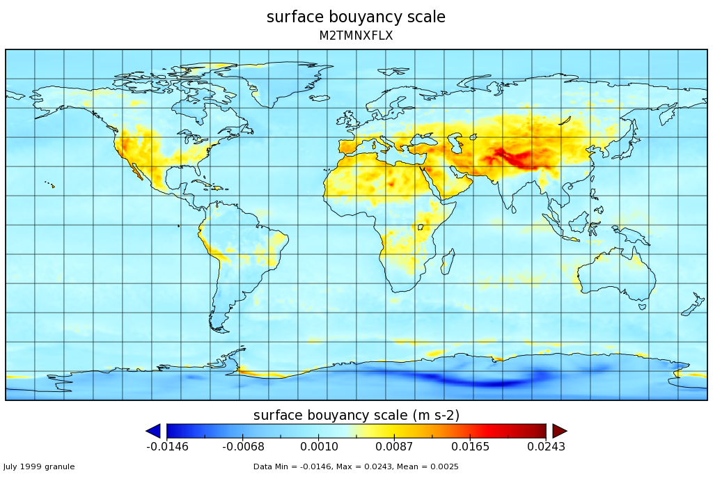
MERRA-2 tavgM_2d_flx_Nx: 2d,Monthly mean,Time-Averaged,Single-Level,Assimilation,Surface Flux Diagnostics 0.625 x 0.5 degree V5.12.4 (M2TMNXFLX) at GES DISC recent views
National Aeronautics and Space Administration —
M2TMNXFLX (or tavgM_2d_flx_Nx) is a time-averaged 2-dimensional monthly mean data collection in Modern-Era Retrospective analysis for Research and Applications... -
Federal
Greenland Ice Sheet Melt Characteristics Derived from Passive Microwave Data, Version 1 recent views
National Aeronautics and Space Administration —
The Greenland ice sheet melt extent data, acquired as part of the NASA Program for Arctic Regional Climate Assessment (PARCA), is a daily (or every other day, prior... -
Federal
CLPX Airborne: Airborne Visible/Infrared Imaging Spectrometer (AVIRIS) Data, Version 1 recent views
National Aeronautics and Space Administration —
This data set consists of apparent surface reflectance, subpixel snow-covered area and grain size inferred from data acquired by the Airborne Visible/Infrared Imaging... -
Federal
Active layer and permafrost properties, including snow depth, soil temperature, and soil moisture, Barrow, Alaska, Version 1 recent views
National Aeronautics and Space Administration —
This data set contains soil temperature, soil moisture, thaw depth, and snow depth data collected at test sites near Barrow, Alaska, during the following years. Soil... -
Federal
RADARSAT-1_LEVEL1 recent views
National Aeronautics and Space Administration —
RADARSAT-1 Level 1 Amplitude Images -
Federal
ALOS_PALSAR_LEVEL2.2 recent views
National Aeronautics and Space Administration —
ALOS PALSAR Level 2.2 -
Federal
CLPX-Ground: ISA Corner Site Meteorological Data, Version 1 recent views
National Aeronautics and Space Administration —
This data set contains meteorological observations at 36 sites throughout the Small Regional Study Area (SRSA) of the NASA Cold Land Processes Field Experiment (CLPX)... -
Federal
Rand Corporation Mean Monthly Global Snow Depth, Version 1 recent views
National Aeronautics and Space Administration —
This data set provides monthly snow depth for the entire globe (excluding Africa and South America) from 1950 to 1976. All available monthly snow depth climatologies... -
Federal
SENTINEL-1A_SINGLE_POL_GRD_FULL_RES recent views
National Aeronautics and Space Administration —
Sentinel-1A Single-pol ground range detected full resolution images -
Federal
Great Lakes Ice Charts, Version 1 recent views
National Aeronautics and Space Administration —
These charts show ice extent and concentration three times weekly during the ice season, for all lakes except Ontario, from the 1973/74 ice season through the...

Official websites use .gov
A
.gov website belongs to an official government
organization in the United States.
Secure .gov websites use HTTPS
A
lock (
) or https:// means you’ve safely connected to
the .gov website. Share sensitive information only on official,
secure websites.