

2 datasets found
-
Federal
Shoreline Mapping Program of Northern Puerto Rico, Arecibo to Isla de Culebra, PR, PR1401D-TB-N NGDA recent views
National Oceanic and Atmospheric Administration, Department of Commerce —
These data provide an accurate high-resolution shoreline compiled from imagery of Northern Puerto Rico, Arecibo to Isla de Culebra, PR . This vector shoreline data is... -
Federal
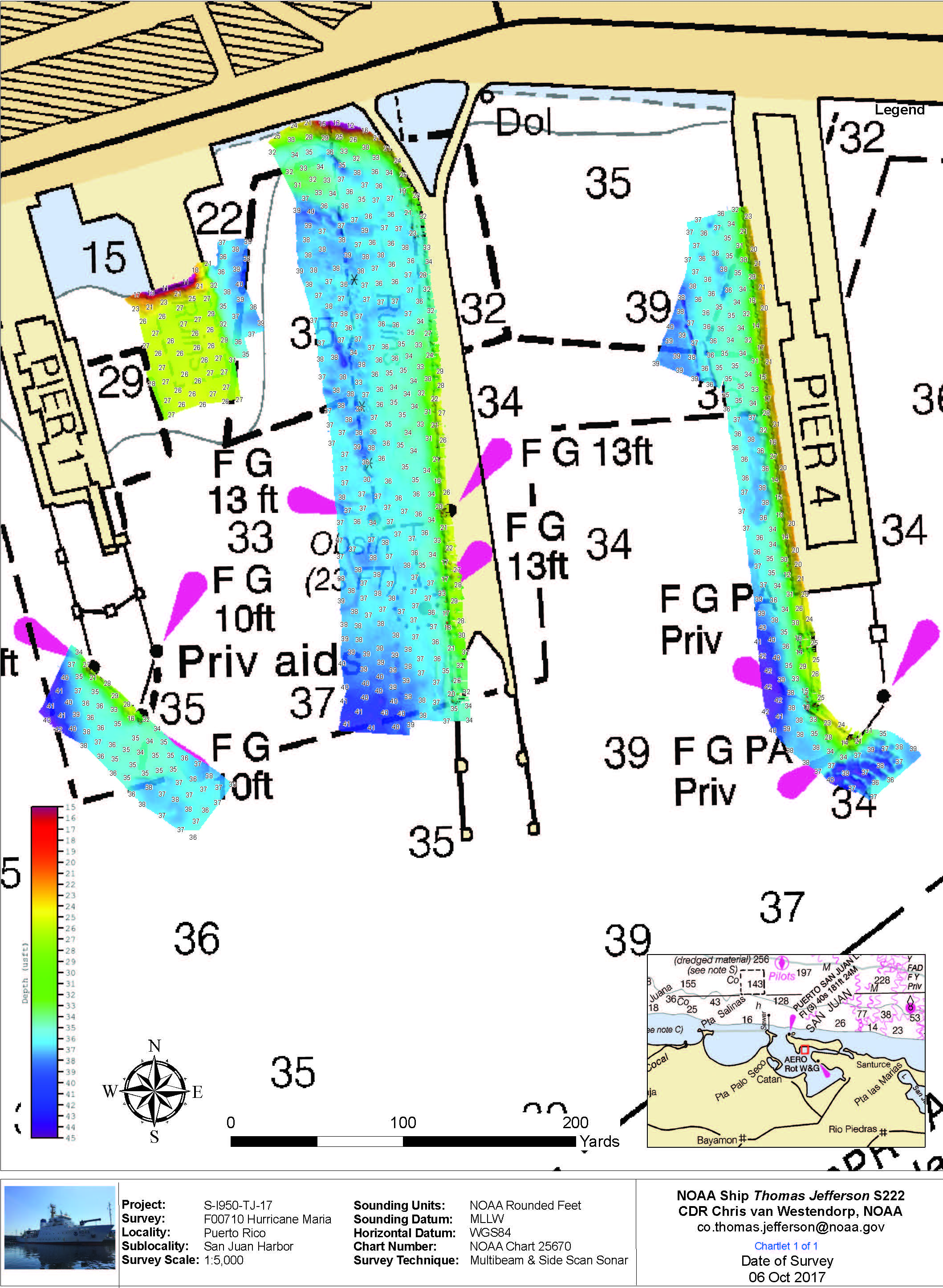
F00710: NOS Hydrographic Survey , 2017-10-06 recent views
National Oceanic and Atmospheric Administration, Department of Commerce —
The National Oceanic and Atmospheric Administration (NOAA) has the statutory mandate to collect hydrographic data in support of nautical chart compilation for safe...
2 datasets found