

7 datasets found
-
Federal
High-resolution record of surface seawater carbon dioxide (CO2) content, water temperature, sea surface salinity and other parameters collected in Sitka Harbor, Alaska, USA from 2017-06-01 to 2021-04-27 (NCEI Accession 0247208)
National Oceanic and Atmospheric Administration, Department of Commerce —
This dataset includes measurements of partial pressure of carbon dioxide (pCO2), sea surface salinity, sea surface temperature and other parameters collected in Sitka... -
Federal
Shoreline Mapping Program of SITKA HARBOR, AK, AK1406 NGDA
National Oceanic and Atmospheric Administration, Department of Commerce —
These data provide an accurate high-resolution shoreline compiled from imagery of SITKA HARBOR, AK . This vector shoreline data is based on an office interpretation... -
Federal
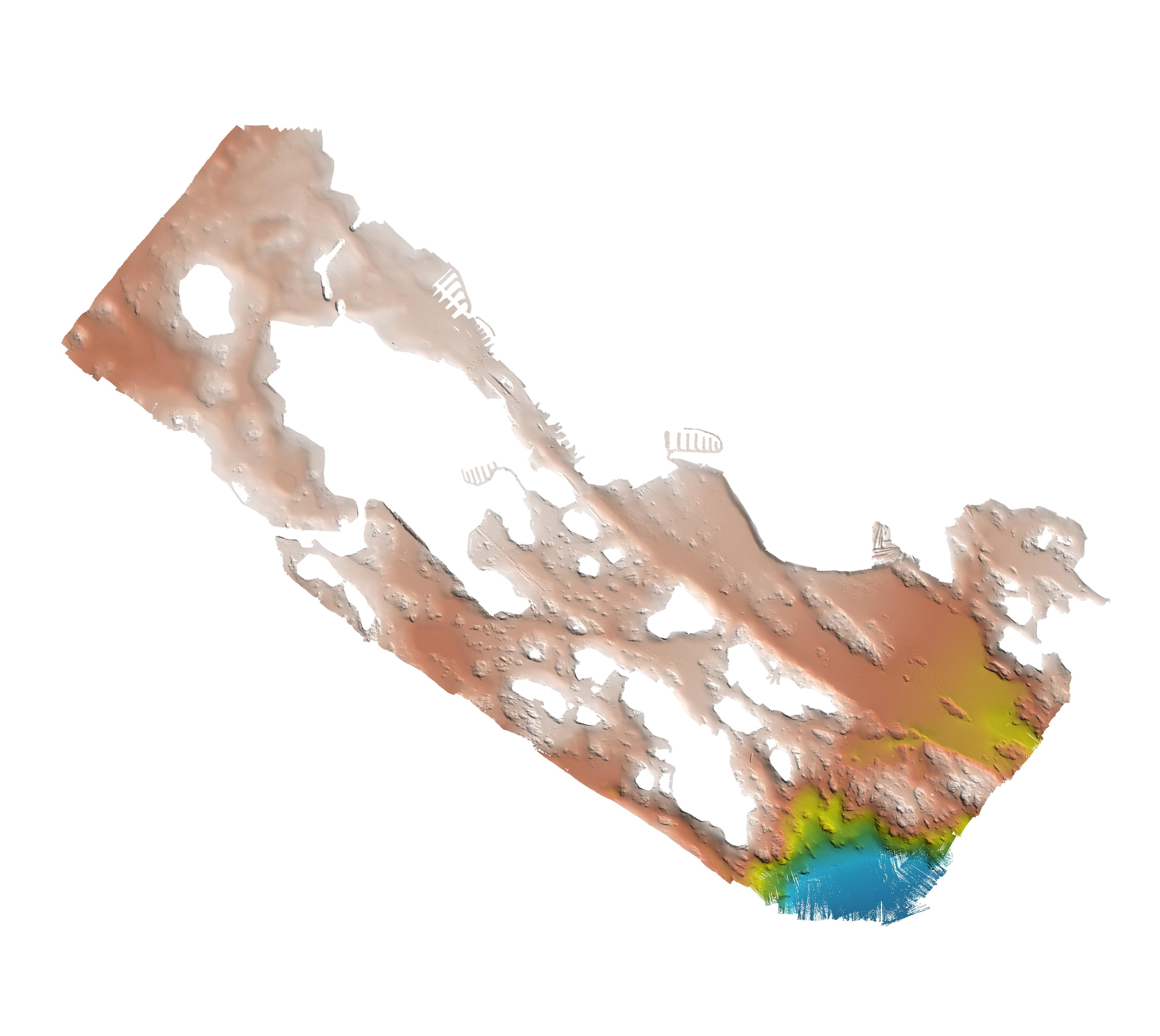
Sitka, Alaska 1/3 arc-second MHW Coastal Digital Elevation Model
National Oceanic and Atmospheric Administration, Department of Commerce —
NOAA's National Geophysical Data Center (NGDC) is building high-resolution digital elevation models (DEMs) for select U.S. coastal regions. These integrated... -
Federal
Sitka, Alaska 3 arc-second MHW Coastal Digital Elevation Model
National Oceanic and Atmospheric Administration, Department of Commerce —
NOAA's National Geophysical Data Center (NGDC) is building high-resolution digital elevation models (DEMs) for select U.S. coastal regions. These integrated... -
Federal
CTD and sound speed profile data acquired in support of hydrographic multibeam surveys to meet NOAA/NOS, Office of Coast Survey charting requirements
National Oceanic and Atmospheric Administration, Department of Commerce —
Multiple sensors are used to acquire sound speed profiles in the survey areas assigned to the ships and navigation response teams. Some vessels have CTDs and acquire... -
Federal
H11121: NOS Hydrographic Survey , Sitka Sound, Alaska, 2002-05-10
National Oceanic and Atmospheric Administration, Department of Commerce —
The National Oceanic and Atmospheric Administration (NOAA) has the statutory mandate to collect hydrographic data in support of nautical chart compilation for safe... -
Federal
Sitka, Alaska Tsunami Forecast Grids for MOST Model
National Oceanic and Atmospheric Administration, Department of Commerce —
The Sitka, Alaska Forecast Model Grids provides bathymetric data strictly for tsunami inundation modeling with the Method of Splitting Tsunami (MOST) model. MOST is a...
.jpg)
7 datasets found