

4 datasets found
-
Federal
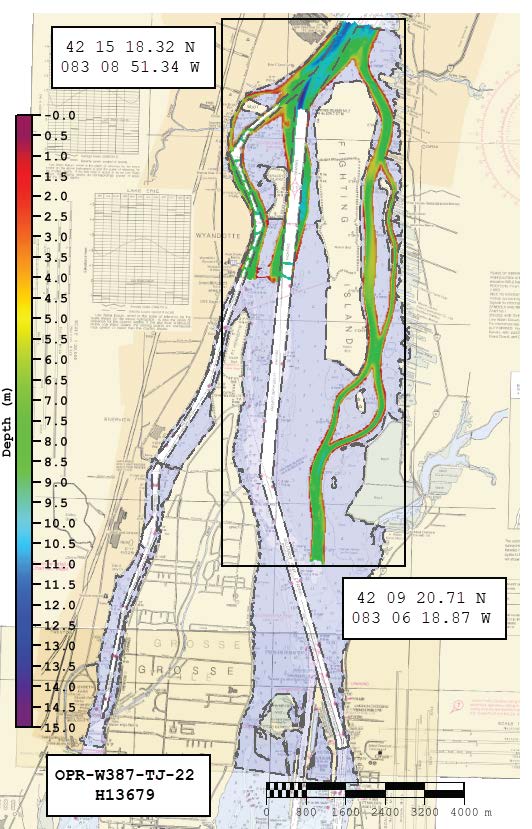
H13679: NOS Hydrographic Survey , 2022-08-22
National Oceanic and Atmospheric Administration, Department of Commerce —
The National Oceanic and Atmospheric Administration (NOAA) has the statutory mandate to collect hydrographic data in support of nautical chart compilation for safe... -
Federal
Shoreline Mapping Program of DETROIT RIVER, LAKE ST CLAIR TO LAKE ERIE, MI-ONT, OH0906A NGDA
National Oceanic and Atmospheric Administration, Department of Commerce —
These data provide an accurate high-resolution shoreline compiled from imagery of DETROIT RIVER, LAKE ST CLAIR TO LAKE ERIE, MI-ONT . This vector shoreline data is... -
Federal
Shoreline Data Rescue Project of Detroit River, PH7118 NGDA
National Oceanic and Atmospheric Administration, Department of Commerce —
These data were automated to provide an accurate high-resolution historical shoreline of Detroit River suitable as a geographic information system (GIS) data layer.... -
Federal
H13619: NOS Hydrographic Survey , 2022-08-23
National Oceanic and Atmospheric Administration, Department of Commerce —
The National Oceanic and Atmospheric Administration (NOAA) has the statutory mandate to collect hydrographic data in support of nautical chart compilation for safe...
4 datasets found