
-
Federal
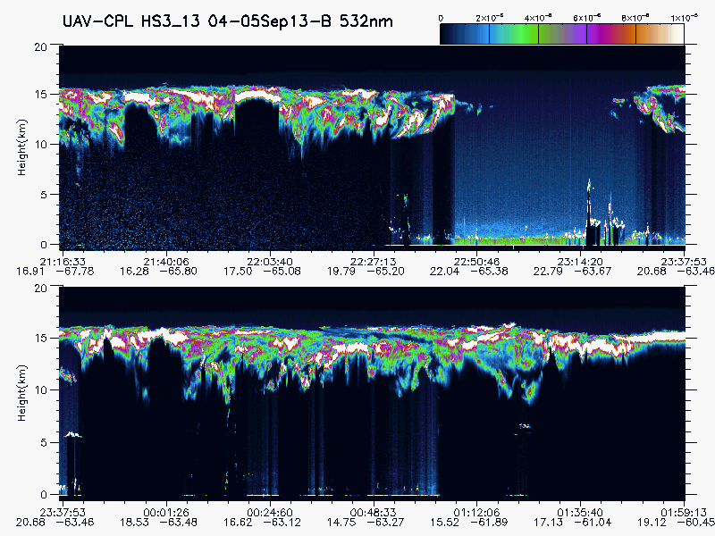
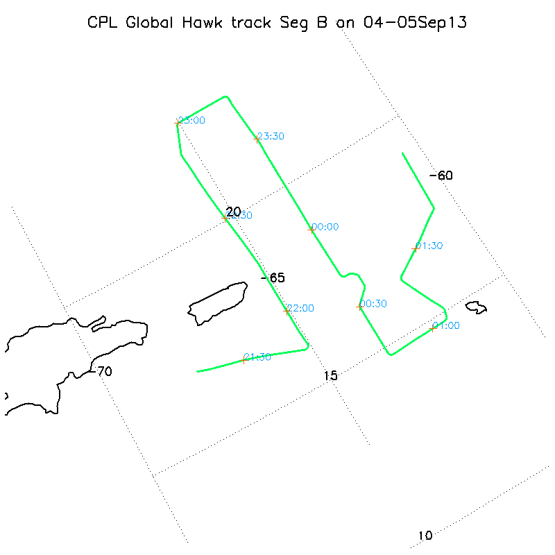
HURRICANE AND SEVERE STORM SENTINEL (HS3) GLOBAL HAWK CLOUD PHYSICS LIDAR (CPL) V1 recent views
National Aeronautics and Space Administration —
The Hurricane and Severe Storm Sentinel (HS3) Global Hawk Cloud Physics Lidar (CPL) dataset includes measurements gathered by the CPL instrument during the HS3... -
Federal
GPM GROUND VALIDATION SATELLITE SIMULATED ORBITS TWP-ICE V1 recent views
National Aeronautics and Space Administration —
The GPM Ground Validation Satellite Simulated Orbits TWP-ICE dataset is available in the Orbital database, which takes account for the atmospheric profiles, the... -
Federal
GPM GROUND VALIDATION SATELLITE SIMULATED ORBITS C3VP V1 recent views
National Aeronautics and Space Administration —
The GPM Ground Validation Satellite Simulated Orbits C3VP dataset is available in the Orbital database, which takes account for the atmospheric profiles, the... -
Federal
GPM GROUND VALIDATION SATELLITE SIMULATED ORBITS LPVEX V1 recent views
National Aeronautics and Space Administration —
The GPM Ground Validation Satellite Simulated Orbits LPVEx dataset is available in the Orbital database, which takes account for the atmospheric profiles, the... -
Federal
GPM GROUND VALIDATION SATELLITE SIMULATED ORBITS MC3E V1 recent views
National Aeronautics and Space Administration —
The GPM Ground Validation Satellite Simulated Orbits MC3E dataset is available in the Orbital database , which takes account for the atmospheric profiles, the... -
Federal
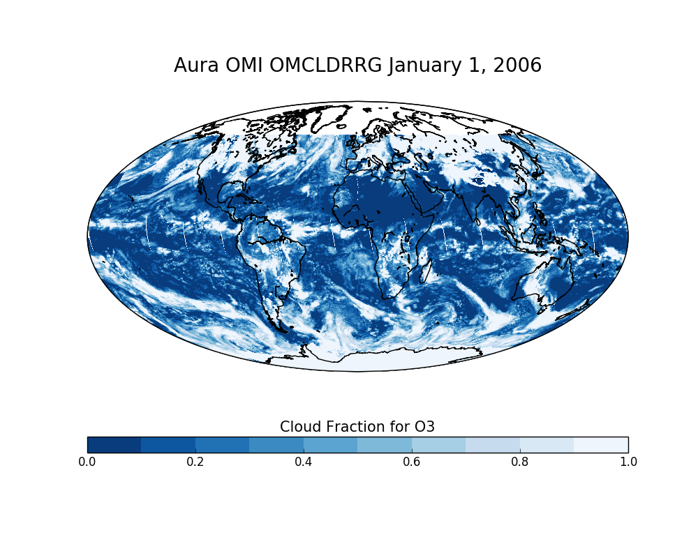
OMI/Aura Effective Cloud Pressure and Fraction (Raman Scattering) Daily L2 Global Gridded 0.25 degree x 0.25 degree V3 (OMCLDRRG) at GES DISC recent views
National Aeronautics and Space Administration —
This Level-2G daily global gridded product OMCLDRRG is based on the pixel level OMI Level-2 CLDRR product OMCLDRR. This level-2G global cloud product (OMCLDRRG)... -
Federal
Global 30-Year Mean Monthly Climatology, 1961-1990 (New et al.) recent views
National Aeronautics and Space Administration —
A data set of mean monthly surface climate over global land areas, excluding Antarctica. Interpolated from station data to 0.5 degrees lat/lon for a range of... -
Federal
Cloud Camera Data (FIFE) recent views
National Aeronautics and Space Administration —
Cloud estimates -
Federal
Surface Meteorology Data: NCDC (FIFE) recent views
National Aeronautics and Space Administration —
NCDC surface meteorology data for 1989 -
Federal
BOREAS AES Five-day Averaged Surface Meteorological and Upper Air Data recent views
National Aeronautics and Space Administration —
Contains 5-day averages of hourly and daily data from 23 meteorological stations across Canada along with full-resolution upper air measurements from 1 station in The... -
Federal
Atmospheric Profiles: TOVS - NOAA (FIFE) recent views
National Aeronautics and Space Administration —
TOVS data received by FIFE -
Federal
BOREAS TF-08 NSA-OJP and SSA-OBS Ceilometer Data recent views
National Aeronautics and Space Administration —
Ceilometer measurements of cloud characteristics made by the TF-08 team at the NSA-OJP and SSA-OBS sites. -
Federal
BOREAS/AES MARS-II 15-minute Surface Meteorological Data: 1994 recent views
National Aeronautics and Space Administration —
Contains 15 minute surface meteorology data collected during the 1994 field campaigns by the Atmospheric Environment Service Meteorological Automatic Reporting System... -
Federal
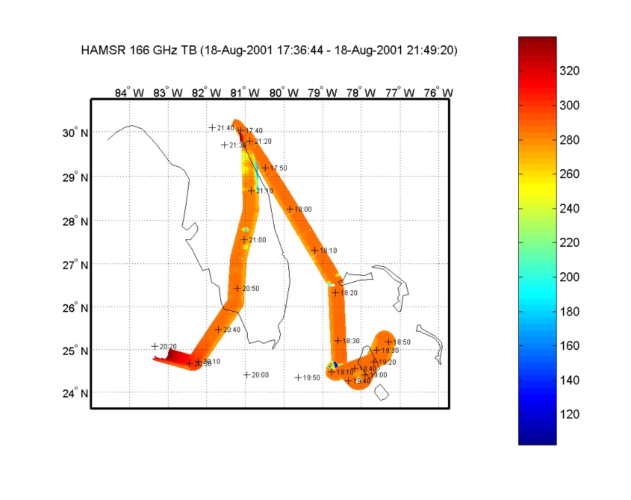
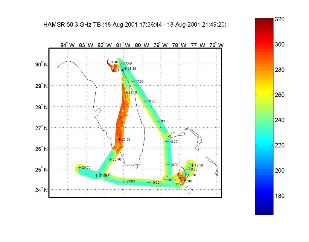
CAMEX-4 HIGH ALTITUDE MMIC SOUNDING RADIOMETER (HAMSR) V1 recent views
National Aeronautics and Space Administration —
The CAMEX-4 High Altitude MMIC Sounding Radiometer (HAMSR) dataset was collected by the High Altitude Monolithic Microwave Integrated Circuit (MMIC) Sounding... -
Federal
Global 10-Year Mean Monthly Climatology, 1901-1990 (New et al.) recent views
National Aeronautics and Space Administration —
A data set of decade-mean monthly surface climate over global land areas, excluding Antarctica. Interpolated from station data to 0.5 degree lat/lon for a range of... -
Federal
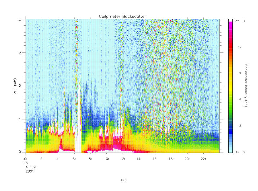
CAMEX-4 MIPS CEILOMETER V1 recent views
National Aeronautics and Space Administration —
The CAMEX-4 MIPS Ceilometer dataset was collected by the University of Alabama in Huntsville (UAH) Mobile Integrated Profiling System (MIPS), which is a mobile... -
Federal
BOREAS/AES READAC 15-minute Surface Meteorological Data recent views
National Aeronautics and Space Administration —
Contains 15 minute surface meteorology data collected during the 1994 field campaigns by the Atmospheric Environment Service Remote Environmental Automatic Data... -
Federal
BOREAS AFM-08 ECMWF Hourly Surface and Upper Air Data for the SSA and NSA recent views
National Aeronautics and Space Administration —
Hourly data from the ECMWF operational model from below the surface to the top of the atmosphere, including the model fluxes at the surface, at Candle Lake,... -
Federal
HIRDLS-MLS/Aura Level 3 Monthly 10 x 20 deg Ice Water Content V002 (HIRMLS3IWC) at GES DISC recent views
National Aeronautics and Space Administration —
HIRMLS3IWC is the Joint EOS High Resolution Dynamics Limb Sounder (HIRDLS) and Microwave Limb Sounder (MLS) monthly 10 degreee lat x 20 degreee lon gridded product...

Official websites use .gov
A
.gov website belongs to an official government
organization in the United States.
Secure .gov websites use HTTPS
A
lock (
) or https:// means you’ve safely connected to
the .gov website. Share sensitive information only on official,
secure websites.