
-
Federal
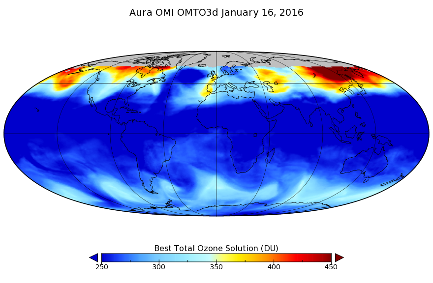
OMI/Aura TOMS-Like Ozone, Aerosol Index, Cloud Radiance Fraction L3 1 day 1 degree x 1 degree V3 (OMTO3d) at GES DISC recent views
National Aeronautics and Space Administration —
The OMI science team produces this Level-3 daily global TOMS-Like Total Column Ozone gridded product OMTO3d (1 deg Lat/Lon grids). The OMTO3d product is produced by... -
Federal
Bowen Ratio Surface Flux: Smith (FIFE) recent views
National Aeronautics and Space Administration —
Retrieval of surface fluxes from a combination of satellite & surface platforms -
Federal
GPM GROUND VALIDATION SATELLITE SIMULATED ORBITS TWP-ICE V1 recent views
National Aeronautics and Space Administration —
The GPM Ground Validation Satellite Simulated Orbits TWP-ICE dataset is available in the Orbital database, which takes account for the atmospheric profiles, the... -
Federal
GPM GROUND VALIDATION SATELLITE SIMULATED ORBITS C3VP V1 recent views
National Aeronautics and Space Administration —
The GPM Ground Validation Satellite Simulated Orbits C3VP dataset is available in the Orbital database, which takes account for the atmospheric profiles, the... -
Federal
GPM GROUND VALIDATION SATELLITE SIMULATED ORBITS LPVEX V1 recent views
National Aeronautics and Space Administration —
The GPM Ground Validation Satellite Simulated Orbits LPVEx dataset is available in the Orbital database, which takes account for the atmospheric profiles, the... -
Federal
UARS High Resolution Doppler Imager (HRDI) Level 3AT V011 (UARHR3AT) at GES DISC recent views
National Aeronautics and Space Administration —
The High Resolution Doppler Imager (HRDI) Level 3AT data product consists of daily, 65.536 second interval time-ordered vertical profiles of meridional and zonal wind... -
Federal
GPM GROUND VALIDATION SATELLITE SIMULATED ORBITS MC3E V1 recent views
National Aeronautics and Space Administration —
The GPM Ground Validation Satellite Simulated Orbits MC3E dataset is available in the Orbital database , which takes account for the atmospheric profiles, the... -
Federal
Bowen Ratio Surface Flux: UNL (FIFE) recent views
National Aeronautics and Space Administration —
Latent & sensible heat flux by Bowen Ratio & aerodynamic characterization of vegetation -
Federal
BOREAS Level-1B TIMS Imagery: At Sensor Radiance in BSQ Format recent views
National Aeronautics and Space Administration —
TIMS imagery, along with other aircraft images, was collected to provide spatially extensive information over the primary study areas. The level-1B TIMS images cover... -
Federal
BIGFOOT Meteorological Data for North and South American Sites, 1991-2004 recent views
National Aeronautics and Space Administration —
The BigFoot Project has compiled daily meteorological measurements for nine EOS Land Validation Sites located from Alaska to Brazil from 1991 to 2004. Each site is... -
Federal
BOREAS/SRC AMS Suite A Surface Meteorological and Radiation Data: 1994 recent views
National Aeronautics and Space Administration —
Contains the data collected in 1994 by the AMS suite A instrument set operated by SRC and provided to BORIS. -
Federal
BOREAS Level-2 MAS Surface Reflectance and Temperature Images in BSQ Format recent views
National Aeronautics and Space Administration —
MAS images, along with other remotely sensed data, were collected to provide spatially extensive information over the primary study areas. This information includes... -
Federal
BOREAS AFM-02 Wyoming King Air 1994 Aircraft Sounding Data recent views
National Aeronautics and Space Administration —
Parameters include wind direction, wind speed, west wind component (u), south wind component (v), static pressure, air dry bulb temperature, potential temperature,... -
Federal
BOREAS Level-1B MAS Imagery: At-Sensor Radiance, Relative X and Y Coordinates recent views
National Aeronautics and Space Administration —
MAS images, along with the other remotely sensed data, were collected to provide spatially extensive information over the primary study areas. This information... -
Federal
Radiant Temp. Multiangle Data (FIFE) recent views
National Aeronautics and Space Administration —
Surface temp. measured w/ Everest IRT, multiple angles & Eppley IR Radiometer -
Federal
BOREAS/SRC AMS Suite A Surface Meteorological and Radiation Data: 1996 recent views
National Aeronautics and Space Administration —
Contains the data collected in 1996 by the AMS suite A instrument set operated by SRC and provided to BORIS. -
Federal
Global 30-Year Mean Monthly Climatology, 1961-1990 (New et al.) recent views
National Aeronautics and Space Administration —
A data set of mean monthly surface climate over global land areas, excluding Antarctica. Interpolated from station data to 0.5 degrees lat/lon for a range of... -
Federal
BOREAS RSS-08 IFC-3 ADS-PSII Measurements of BRDF at SSA-OBS and SSA-OA Sites recent views
National Aeronautics and Space Administration —
Ground BRDF measurements were acquired by the Remote Sensing Science (RSS)-08 team to aid in the development of advanced spectral vegetation indices. The RSS-08 team... -
Federal
BOREAS TE-18, 60-m, Radiometrically Rectified Landsat TM Imagery recent views
National Aeronautics and Space Administration —
The BOREAS TE-18 team used a radiometric rectification process to produce standardized DN values for a series of Landsat TM images of the BOREAS SSA and NSA in order... -
Federal
MMR Calibration Data (FIFE) recent views
National Aeronautics and Space Administration —
Barnes MMR reflected radiance from calibration panels, adjusted for sun angle

Official websites use .gov
A
.gov website belongs to an official government
organization in the United States.
Secure .gov websites use HTTPS
A
lock (
) or https:// means you’ve safely connected to
the .gov website. Share sensitive information only on official,
secure websites.