

79 datasets found for "waste management"
-
Federal
ComBase: A Web Resource for Quantitative and Predictive Food Microbiology
Department of Agriculture —
ComBase includes a systematically formatted database of quantified microbial responses to the food environment with more than 65,000 records, and is used for:... -
Trash and Recycling Collection Points
District of Columbia —
The DPW Point of Collection datasets provide comprehensive information essential for managing waste and recycling services. These datasets include detailed geographic... -
State
California Power Plants
State of California —
The power plant locations and characteristics are part of the California Energy Commission’s (CEC) California Energy Infrastructure geospatial data sets. The data is... -
State
Surface Water Quality Lines
State of Connecticut —
See full Data Guide here. Surface Water Quality Classifications Set: This dataset is a line and a polygon feature-based layer compiled at 1:24,000 scale that includes... -
Federal
Energy Use and Water Consumption at University of Texas at Austin
Department of Energy —
Provides annual energy usage for years 1989 through 2022 for UT at Austin; specifically, electricity usage (kWh), natural gas usage (Mcf), associated costs. Also... -
City
Municipal Waste Operations
City of Philadelphia —
Data includes point-locations and names of Municipal Waster Operations, or a PA Department of Environmental Protection primary facility type related to the Waste... -
County
Groundwater Well Data Search
King County, Washington —
The King County Groundwater Protection Program maintains a database of groundwater wells, water quality and water level sampling data. Users may search the database... -
Federal
Cleanups In My Community (CIMC) - Federal Facility RCRA Sites, National Layer
U.S. Environmental Protection Agency —
Federal facilities are properties owned by the federal government. This data layer provides access to Federal facilities that are Resource Conservation and Recovery... -
Federal
Modified Langmuir Equation Spreadsheet
Department of Agriculture —
Spreadsheet from the paper entitled: Revisiting a Statistical Shortcoming when Fitting the Langmuir Model to Sorption Data by C.H. Bolster, Journal of Environmental... -
Federal
Cleanups In My Community (CIMC) - RCRA and Base Realignment and Closure (BRAC) Federal Facilities, National Layer
U.S. Environmental Protection Agency —
This data layer provides access to Resource Conservation and Recovery Act (RCRA) Base Realignment and Closure (BRAC) sites as part of the CIMC web service. The... -
State
Chronic Wasting Disease Positive Detections - 2024-2025 - CDFW [ds3183]
State of California —
The California Department of Fish and Wildlife (CDFW) has detected Chronic Wasting Disease (CWD) within the state and is working diligently to monitor and manage the... -
Federal
Inspector General webpage
Department of Energy —
Office of Inspector General mission is to help the Department and the American taxpayer by: --Identifying opportunities for cost savings and operational efficiencies... -
City
Jefferson County KY Urban Heat Management Study
Louisville Metro Government —
Click here to view the Metro Office of Sustainability web site about this study and here to view the complete report.This data includes a land cover assessment for... -
State
Warden Districts
Vermont Center for Geographic Information —
The Vermont Warden Districts layer is part of a dataset that contains administrative boundaries for Vermont's Agency of Natural Resources. The dataset includes... -
Federal
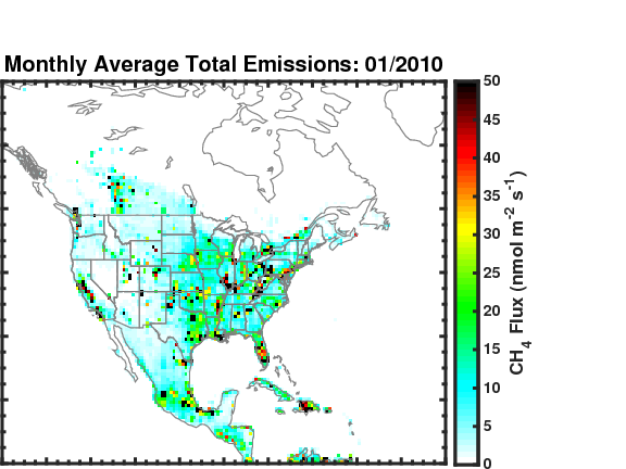
Methane (CH4) Flux for North America L4 Daily V1 (CMS_CH4_FLX_NAD) at GES DISC
National Aeronautics and Space Administration —
The CMS Methane (CH4) Flux for North America data set contains estimates of methane emission in North America based on an inversion of the GEOS-Chem chemical... -
County
Hydrologic Information Center - Station Search
King County, Washington —
Search for monitoring stations maintained by King County's Hydrologic Information Center. (use a blank search to see all stations). -
State
Food Scrap Generators
Vermont Center for Geographic Information —
Here you will find Vermont businesses and institutions (such as restaurants, grocery stores, markets, hospitals, schools, food manufacturers, assisted living... -
State
Surface Water Quality Classifications Set
State of Connecticut —
See full Data Guide here. Surface Water Quality Classifications Set: This dataset is a line and a polygon feature-based layer compiled at 1:24,000 scale that includes... -
County
Groundwater Well Data Viewer
King County, Washington —
The King County Groundwater Protection Program maintains a database of groundwater wells, water quality and water level sampling data. Users may search the database...
79 datasets found for "waste management"