
-
Federal
Satellite Observations of Arctic Change, Version 1
National Aeronautics and Space Administration —
The purpose of this site is to expose NASA satellite data and research on Arctic change in the form of maps that illustrate the changes taking place in the Arctic... -
Federal
A Compilation of Global Soil Microbial Biomass Carbon, Nitrogen, and Phosphorus Data
National Aeronautics and Space Administration —
This data set provides the concentrations of soil microbial biomass carbon (C), nitrogen (N) and phosphorus (P), soil organic carbon, total nitrogen, and total... -
Federal
Global Land Cover Mapping and Estimation Yearly 30 m V001
National Aeronautics and Space Administration —
NASA's Making Earth System Data Records for Use in Research Environments (MEaSUREs)... -
Federal
MODIS/Terra+Aqua Leaf Area Index/FPAR 4-Day L4 Global 500m SIN Grid V061
National Aeronautics and Space Administration —
The MCD15A3H Version 6.1 Moderate Resolution Imaging Spectroradiometer (MODIS) Level 4, Combined Fraction of Photosynthetically Active Radiation (FPAR), and Leaf Area... -
Federal
HLS Sentinel-2 Multi-spectral Instrument Vegetation Indices Daily Global 30 m V2.0
National Aeronautics and Space Administration —
The Harmonized Landsat and Sentinel-2 (HLS) project provides consistent data products from the Operational Land Imager (OLI) aboard the joint NASA/USGS Landsat 8 and... -
Federal
PhenoCam Dataset v2.0: Digital Camera Imagery from the PhenoCam Network, 2000-2018
National Aeronautics and Space Administration —
This dataset provides a time series of visible-wavelength digital camera imagery collected through the PhenoCam Network at each of 393 sites predominantly in North... -
Federal
FIREX-AQ ER-2 In-Situ Meteorological and Navigational Data
National Aeronautics and Space Administration —
FIREXAQ_MetNav_AircraftInSitu_ER2_Data_1 are meteorological and navigational data collected onboard the Earth Resources-2 (ER-2) aircraft during the Fire Influence on... -
Federal
NACP Integrated Wildland and Cropland 30-m Fuel Characteristics Map, U.S.A., 2010
National Aeronautics and Space Administration —
The data set provides a 30-m comprehensive fuelbed characteristics map for both the wildland and cropland areas of the conterminous United States (CONUS) for 2010.... -
Federal
RLC State and Regional Boundaries for the Former Soviet Union
National Aeronautics and Space Administration —
This data set of state and regional boundaries was derived from the 1:3 million scale administrative boundaries (ESRI, 1998) for the land area of the Former Soviet... -
Federal
NACP Aboveground Biomass and Carbon Baseline Data, V.2 (NBCD 2000), U.S.A., 2000
National Aeronautics and Space Administration —
The NBCD 2000 (National Biomass and Carbon Dataset for the Year 2000) data set provides a high-resolution (30 m) map of year-2000 baseline estimates of basal area-... -
Federal
MISR Level 1B2 Ellipsoid Data subset for the UAE region V003
National Aeronautics and Space Administration —
UAEMIB2E_003 is the Multi-angle Imaging SpectroRadiometer (MISR) Level 1B2 Ellipsoid Data subset for the UAE region version 3. It contains Ellipsoid-projected TOA... -
Federal
Radiant Temp. Multiangle Data (FIFE)
National Aeronautics and Space Administration —
The Surface Temperatures Measured at Multiple Angles Data Set was collected at two locations within the northwest quadrant of the FIFE study area during July and... -
Federal
MISR Level 3 Component Global Land Regional public Product covering a month V002
National Aeronautics and Space Administration —
MI3MLSR_2 is the Multi-angle Imaging SpectroRadiometer (MISR) Level 3 Component Global Land Regional public Product covering a month version 2. It contains a daily... -
Federal
CERES and GEO-Enhanced TOA, Within-Atmosphere and Surface Fluxes, Clouds and Aerosols Monthly-Averaged 1-Hourly Terra-Aqua-NOAA20 Edition4B
National Aeronautics and Space Administration —
CER_SYN1deg-MHour_Terra-Aqua-NOAA20_Edition4B is the Clouds and the Earth's Radiant Energy System (CERES) and geostationary (GEO)-Enhanced Top-of-Atmosphere (TOA),... -
Federal
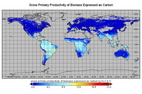
Global Monthly GPP from an Improved Light Use Efficiency Model, 1982-2016
National Aeronautics and Space Administration —
This dataset provides global monthly average gross primary productivity (GPP; g carbon/m2/d) modeled at 8 km spatial resolution for each of the 35 years from... -
Federal
Global MODIS and FLUXNET-derived Daily Gross Primary Production, V2
National Aeronautics and Space Administration —
This dataset provides global gridded daily estimates of gross primary production (GPP) and uncertainties at 0.05-degree resolution for the period 2000-03-01 to the... -
Federal
MISR Level 2 Aerosol parameters subset for the UAE region V002
National Aeronautics and Space Administration —
UAEMIAAE_002 is the Multi-angle Imaging spectro-radiometer (MISR). It contains aerosol optical depth, particle type, and associated atmospheric data. The MISR... -
Federal
MISR L1B2 Ellipsoid Product subset for the ARCTAS region V003
National Aeronautics and Space Administration —
ATSMIB2E_003 is the Multi-angle Imaging SpectroRadiometer (MISR) Level 1B2 Ellipsoid Product subset for the ARCTAS region. It contains an Ellipsoid-projected TOA... -
Federal
BOREAS TF-10 NSA-YJP Tower Flux, Meteorological, and Porometry Data
National Aeronautics and Space Administration —
The BOREAS TF-10 team collected tower flux and meteorological data at two sites, a fen and a young jack pine forest, near Thompson, Manitoba, Canada, as part of... -
Federal
VIIRS/JPSS1 BRDF/Albedo Parameter 2 Band M5 Daily L3 Global 30 ArcSec CMG V002
National Aeronautics and Space Administration —
The NOAA-20 Visible Infrared Imaging Radiometer Suite (VIIRS) Bidirectional Reflectance Distribution Function (BRDF) and Albedo Model Parameter 2 Band M5 product...

Official websites use .gov
A
.gov website belongs to an official government
organization in the United States.
Secure .gov websites use HTTPS
A
lock (
) or https:// means you’ve safely connected to
the .gov website. Share sensitive information only on official,
secure websites.