

254 datasets found for "Towers"
-
University
National Park Boundaries
Earth Data Analysis Center, University of New Mexico —
National Park Service unit boundaries. -
Federal
Current Tract Polygons of National Park System Units
Department of the Interior —
National Park Service Unit tract polygons -
Federal
Administrative Boundaries Centroids of National Park System Units
Department of the Interior —
National Park Service unit points. -
City
Mandatory Housing Affordability (MHA) Zones
City of Seattle —
Note: This map is not an official zoning map. For precise zoning information, please call or visit the Seattle Municipal Tower, Seattle Department of Construction and... -
Federal
NACP Site: Terrestrial Biosphere Model and Aggregated Flux Data in Standard Format
National Aeronautics and Space Administration —
This data set provides standardized output variables for gross primary productivity (GPP), net ecosystem exchange (NEE), leaf area index (LAI), ecosystem respiration... -
Federal
BOREAS TF-11 CO2 and CH4 Flux Data from the SSA-Fen
National Aeronautics and Space Administration —
The BOREAS TF-11 team collected several data sets in their efforts to fully describe the flux and site characteristics at the SSA-Fen site. This data set contains... -
Federal
BOREAS TGB-01 CH4 Concentration and Flux Data from NSA Tower Sites
National Aeronautics and Space Administration —
The BOREAS TGB-01 team made numerous measurements of trace gas concentrations and fluxes at various NSA sites. This data set contains half-hourly averages of ambient... -
Federal
Global Forest Ecosystem Structure and Function Data For Carbon Balance Research
National Aeronautics and Space Administration —
A comprehensive global database has been assembled to quantify CO2 fluxes and pathways across different levels of integration (from photosynthesis up to net ecosystem... -
Federal
BOREAS TF-10 NSA-YJP Tower Flux, Meteorological, and Porometry Data
National Aeronautics and Space Administration —
The BOREAS TF-10 team collected tower flux and meteorological data at two sites, a fen and a young jack pine forest, near Thompson, Manitoba, Canada, as part of... -
County
Loudoun Telecom Towers
Loudoun County, Virginia —
More MetadataTelecommunication is used to show the existing telecommunication antenna sites in Loudoun County. The coverage includes antennas mounted on buildings as... -
Federal
The Long-Term Agroecosystem Research (LTAR) Network Standard GIS Data Layers, 2020 version
Department of Agriculture —
The USDA Long-Term Agroecosystem Research was established to develop national strategies for sustainable intensification of agricultural production. As part of the... -
Federal
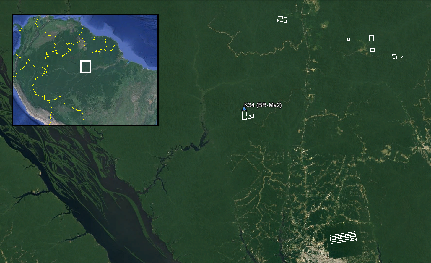
LiDAR and DTM Data from Forested Land Near Manaus, Amazonas, Brazil, 2008
National Aeronautics and Space Administration —
This data set provides LiDAR point clouds and digital terrain models (DTM) from surveys over the K34 tower site in the Cuieiras Biological Reserve, over forest... -
Federal
LBA-ECO CD-10 H2O Profiles at km 67 Tower Site, Tapajos National Forest
National Aeronautics and Space Administration —
This data set reports vertical profiles of H2O vapor concentrations measured at the Para Western (Santarem) - km 67, Primary Forest Tower Site (Figure 1). This site... -
Federal
LBA-ECO CD-03 Cloud Base-Backscatter Data, km 67 Tower Site, Tapajos National Forest
National Aeronautics and Space Administration —
A Vaisala CT-25K ceilometer was installed at an old-growth forest site located at the km 67 Eddy Flux Tower site in the Tapajos National Forest, Para, Brazil, off... -
City
Station Area Overlay (light rail)
City of Seattle —
Note: This map is not an official zoning map. For precise zoning information, please call or visit the Seattle Municipal Tower, Seattle Department of Construction and... -
University
Soil Survey Geographic (SSURGO) database for Eddy Area, New Mexico
Earth Data Analysis Center, University of New Mexico —
This data set is a digital soil survey and generally is the most detailed level of soil geographic data developed by the National Cooperative Soil Survey. The... -
City
Current Land Use Zoning Detail
City of Seattle —
Note: This map is not an official zoning map. For precise zoning information, please call or visit the Seattle Municipal Tower, Seattle Department of Construction and... -
Federal
Digital Geologic-GIS Map of Devils Tower National Monument, Wyoming (NPS, GRD, GRI, DETO, DETO digital map) adapted from a U.S. Geological Survey Bulletin map by Robinson (1956)
Department of the Interior —
The Digital Geologic-GIS Map of Devils Tower National Monument, Wyoming is composed of GIS data layers and GIS tables, and is available in the following GRI-supported... -
Federal
A Materials Properties Dataset for Elastomeric Foam Impact Mitigating Materials
National Institute of Standards and Technology —
The database includes mechanical data for structure-properties relationships and mechanical modeling of elastic impact protection foams from a variety of imaging...
254 datasets found for "Towers"