
-
Federal
Snake River Plain FORGE: Site Characterization Data
Department of Energy —
The site characterization data used to develop the conceptual geologic model for the Snake River Plain site in Idaho, as part of phase 1 of the Frontier Observatory... -
Federal
NOAA/WDS Paleoclimatology - Baisan fire data from Eagle Feather - IMPD USEGF001
National Oceanic and Atmospheric Administration, Department of Commerce —
This archived Paleoclimatology Study is available from the NOAA National Centers for Environmental Information (NCEI), under the World Data Service (WDS) for... -
Federal
NOAA/WDS Paleoclimatology - Veblen fire data from BM39 - IMPD USBM-039
National Oceanic and Atmospheric Administration, Department of Commerce —
This archived Paleoclimatology Study is available from the NOAA National Centers for Environmental Information (NCEI), under the World Data Service (WDS) for... -
Federal
Global Land Cover Mapping and Estimation Yearly 30 m V001
National Aeronautics and Space Administration —
NASA's Making Earth System Data Records for Use in Research Environments (MEaSUREs) Global Land Cover Mapping and Estimation (GLanCE) annual 30 meter (m) Version 1... -
Federal
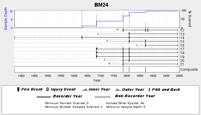
NOAA/WDS Paleoclimatology - Veblen fire data from BM24 - IMPD USBM-024
National Oceanic and Atmospheric Administration, Department of Commerce —
This archived Paleoclimatology Study is available from the NOAA National Centers for Environmental Information (NCEI), under the World Data Service (WDS) for... -
Federal
EMIT L2B Estimated Mineral Identification and Band Depth and Uncertainty 60 m V001
National Aeronautics and Space Administration —
The Earth Surface Mineral Dust Source Investigation (EMIT) instrument measures surface mineralogy, targeting the Earth’s arid dust source regions. EMIT is installed... -
Federal
NOAA/WDS Paleoclimatology - Dieterich fire data from Thomas Creek - IMPD USTHC001
National Oceanic and Atmospheric Administration, Department of Commerce —
This archived Paleoclimatology Study is available from the NOAA National Centers for Environmental Information (NCEI), under the World Data Service (WDS) for... -
Federal
Global Vegetation Types, 1971-1982 (Matthews)
National Aeronautics and Space Administration —
The global vegetation type data of 1 x 1 degree latitude and longitude resolution were designed for use in studies of climate and climate change. Vegetation data were... -
Federal
NOAA/WDS Paleoclimatology - Heyerdahl fire data from Big Hole - IMPD USBGH001
National Oceanic and Atmospheric Administration, Department of Commerce —
This archived Paleoclimatology Study is available from the NOAA National Centers for Environmental Information (NCEI), under the World Data Service (WDS) for... -
Federal
VISSR/SMS-1 Level 1 Atmospheric and Oceanographic Image Processing System (AOIPS) Data V001 (VISSRSMS1L1AOIPS) at GES DISC
National Aeronautics and Space Administration —
VISSRSMS1L1AOIPS is the Visible Infrared Spin-Scan Radiometer (VISSR) Level 1 Atmospheric and Oceanographic Image Processing System (AOIPS) data product from the... -
Federal
VEMAP 2: Monthly Ecosystem Model Responses to U.S. Climate Change, 1994-2100
National Aeronautics and Space Administration —
The Vegetation-Ecosystem Modeling and Analysis Project (VEMAP) was a large, collaborative, multi-institutional, international effort whose goal was to evaluate the... -
Federal
NOAA/WDS Paleoclimatology - Veblen fire data from BM17 - IMPD USBM-017
National Oceanic and Atmospheric Administration, Department of Commerce —
This archived Paleoclimatology Study is available from the NOAA National Centers for Environmental Information (NCEI), under the World Data Service (WDS) for... -
Federal
SAFARI 2000 Wetlands Data Set, 1-Deg (Matthews and Fung)
National Aeronautics and Space Administration —
This database, compiled by Matthews and Fung (1987), provides information on the distribution and environmental characteristics of natural wetlands. The database was... -
Federal
LiDAR-based Biomass Estimates, Boreal Forest Biome, Eurasia, 2005-2006
National Aeronautics and Space Administration —
This data set provides estimates of aboveground biomass (AGB) for defined land cover types within World Wildlife Fund (WWF) ecoregions across the boreal biome of... -
Federal
LBA Regional Carbon in Live Vegetation, 0.5-degree (Olson)
National Aeronautics and Space Administration —
This data set is a subset of Olson et al. (1985, 2000) "Major World Ecosystem Complexes Ranked by Carbon in Live Vegetation." This subset was created for the study... -
Federal
NOAA/WDS Paleoclimatology - Veblen fire data from BM3 - IMPD USBM-003
National Oceanic and Atmospheric Administration, Department of Commerce —
This archived Paleoclimatology Study is available from the NOAA National Centers for Environmental Information (NCEI), under the World Data Service (WDS) for... -
Federal
SAFARI 2000 Meteorological Tower Measurements, Kruger National Park, 2000-2002
National Aeronautics and Space Administration —
An eddy covariance system mounted on a tower near the Skukuza Camp in Kruger National Park, South Africa, has been operating continuously since early 2000.... -
Federal
NOAA/WDS Paleoclimatology - Veblen fire data from BM28 - IMPD USBM-028
National Oceanic and Atmospheric Administration, Department of Commerce —
This archived Paleoclimatology Study is available from the NOAA National Centers for Environmental Information (NCEI), under the World Data Service (WDS) for... -
Federal
NOAA/WDS Paleoclimatology - Donnegan fire data from Peabody Spur - IMPD USPEA002
National Oceanic and Atmospheric Administration, Department of Commerce —
This archived Paleoclimatology Study is available from the NOAA National Centers for Environmental Information (NCEI), under the World Data Service (WDS) for... -
Federal
NOAA/WDS Paleoclimatology - Veblen fire data from BM33 - IMPD USBM-033
National Oceanic and Atmospheric Administration, Department of Commerce —
This archived Paleoclimatology Study is available from the NOAA National Centers for Environmental Information (NCEI), under the World Data Service (WDS) for...

Official websites use .gov
A
.gov website belongs to an official government
organization in the United States.
Secure .gov websites use HTTPS
A
lock (
) or https:// means you’ve safely connected to
the .gov website. Share sensitive information only on official,
secure websites.