

7 datasets found for "National Archives Artifact Series 2016 Water Summit"
-
State
California's Groundwater Update 2020 (Bulletin 118)
State of California —
California's Groundwater Update 2020 (CalGW) is California's foremost technical publication on groundwater in the state of California. CalGW, formally known as... -
Federal
W00448: NOS Hydrographic Survey , External Source Data 2018, 2016-10-12
National Oceanic and Atmospheric Administration, Department of Commerce —
The National Oceanic and Atmospheric Administration (NOAA) has the statutory mandate to collect hydrographic data in support of nautical chart compilation for safe... -
Federal
W00504: NOS Hydrographic Survey , External Source Data 2020, 2016-06-24
National Oceanic and Atmospheric Administration, Department of Commerce —
The National Oceanic and Atmospheric Administration (NOAA) has the statutory mandate to collect hydrographic data in support of nautical chart compilation for safe... -
Federal
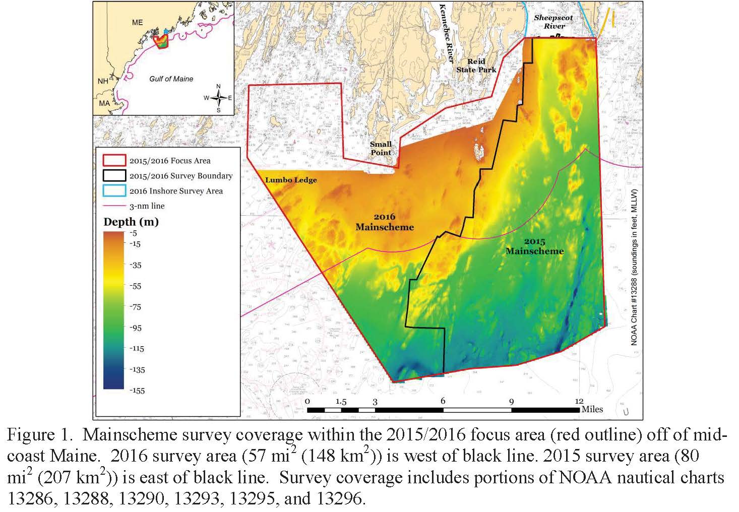
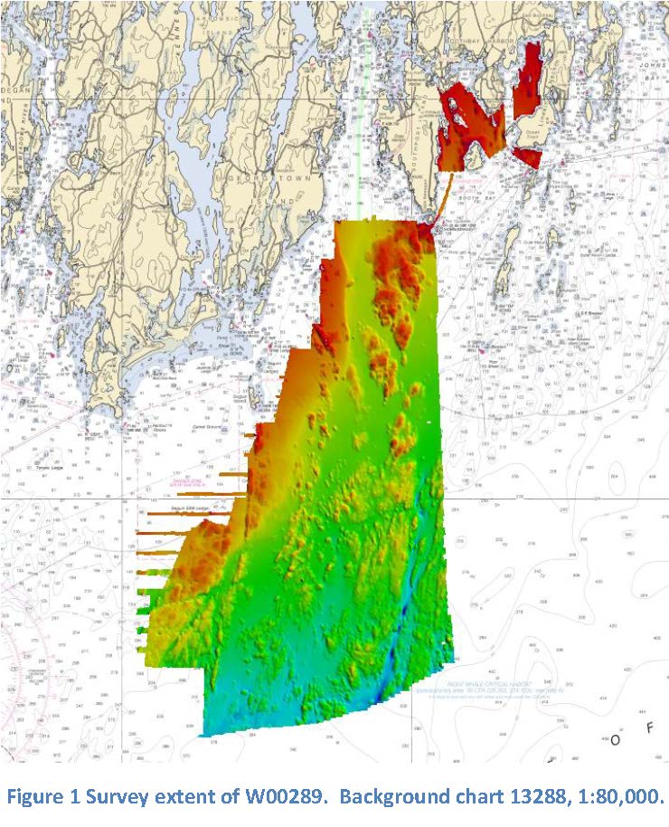
W00289: NOS Hydrographic Survey , Outside Source Data Surveys - 2016, 2015-11-03
National Oceanic and Atmospheric Administration, Department of Commerce —
The National Oceanic and Atmospheric Administration (NOAA) has the statutory mandate to collect hydrographic data in support of nautical chart compilation for safe... -
Federal
2016 Oregon II 318 Hypoxia Watch Bottom CTD Station Locations
National Oceanic and Atmospheric Administration, Department of Commerce —
The NOAA Hypoxia Watch project provides near-real-time, web-based maps of dissolved oxygen near the sea floor over the Texas-Louisiana continental shelf during a... -
Federal
Density of Cetaceans and Turtles in the Gulf of Mexico
National Oceanic and Atmospheric Administration, Department of Commerce —
The goal of this research was to develop Gulf-wide cetacean and sea turtle spatial density models (SDMs) based on line-transect surveys conducted in the U.S. waters... -
Federal
2016 Oregon II 318 Hypoxia Watch Bottom Dissolved Oxygen Contours
National Oceanic and Atmospheric Administration, Department of Commerce —
The NOAA Hypoxia Watch project provides near-real-time, web-based maps of dissolved oxygen near the sea floor over the Texas-Louisiana continental shelf during a...
7 datasets found for "National Archives Artifact Series 2016 Water Summit"