
-
Federal
ECOSTRESS Evapotranspiration dis-ALEXI USDA Daily L3 Global 30m V001
National Aeronautics and Space Administration —
The ECOsystem Spaceborne Thermal Radiometer Experiment on Space Station (ECOSTRESS) mission measures the temperature of plants to better understand how much water... -
Federal
Global Historical Climatology Network, 1753-1990
National Aeronautics and Space Administration —
This data set contains monthly temperature, precipitation, sea-level pressure, and station-pressure data for thousands of meteorological stations worldwide. The... -
Federal
ANTARES monitoring station at the EPEA Station on the Argentina shelf
National Aeronautics and Space Administration —
The EPEA (Estación Permanente de Estudios Ambientales) time series station was started in 2000 and since 2003 belongs to ANTARES (www.antares.ws), a network of Latin... -
Federal
ECOSTRESS Evapotranspiration dis-ALEXI Daily L3 CONUS 70 m V001
National Aeronautics and Space Administration —
The ECOsystem Spaceborne Thermal Radiometer Experiment on Space Station (ECOSTRESS) mission measures the temperature of plants to better understand how much water... -
Federal
TSIS SIM Level 3 Solar Spectral Irradiance 12-Hour Means V13 (TSIS_SSI_L3_12HR) at GES DISC
National Aeronautics and Space Administration —
Version 13 is the current release of this data product, and supercedes all previous versions.The TSIS SIM Level 3 Solar Spectral Irradiance (SSI) 12-Hour Means data... -
Federal
MAXI Master Catalog
National Aeronautics and Space Administration —
The MAXIMASTER database table records high-level information of the Monitor of All-sky X-ray Image (MAXI) observations and provides access to the data archive. MAXI... -
Federal
Ground-Based Satellite Laser Ranging (SLR) Observation Data (full-rate, monthly files) from NASA CDDIS
National Aeronautics and Space Administration —
This dataset consists of ground-based Satellite Laser Ranging observation data (full-rate, monthly files) from the NASA Crustal Dynamics Data Information System... -
Federal
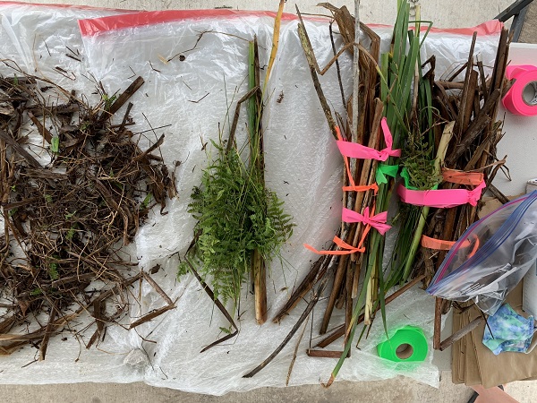
Delta-X: Aboveground Vegetation Structure, Herbaceous Wetlands, MRD, LA, USA, V2
National Aeronautics and Space Administration —
This dataset provides mean stem diameter, mean height, dominant species, hydrogeomorphic zone (HGM), and stem density for vegetation in herbaceous wetlands collected... -
Federal
Exposure to elevated relative humidity in laboratory chambers alters fungal gene expression in dust from the International Space Station (ISS)
National Aeronautics and Space Administration —
Microbes are present in all occupied indoor environments, including the International Space Station (ISS). An unexpected ventilation system failure may lead to... -
Federal
The International Space Station Has a Unique and Extreme Microbial and Chemical Environment Driven by Use Patterns
National Aeronautics and Space Administration —
Space habitation provides unique challenges in built environments isolated from Earth. We produced a 3D map of the microbes and metabolites throughout the... -
Federal
SAGE III/ISS L2 Monthly Lunar Event Species Profiles (NetCDF) V006
National Aeronautics and Space Administration —
g3blmnc_6 is the Stratospheric Aerosol and Gas Experiment III (SAGE III) on the International Space Station (ISS) (SAGE III/ISS) Level 2 Monthly Lunar Event Species... -
Federal
Ground-Based Satellite Laser Ranging (SLR) Observation Data (normal points, daily, 24 hour files) from NASA CDDIS
National Aeronautics and Space Administration —
This dataset consists of ground-based Satellite Laser Ranging observation data (normal points, daily 24 hour files) from the NASA Crustal Dynamics Data Information... -
Federal
Earth Radiation Budget Experiment (ERBE) Total Solar Irradiance (TSI) from the Earth Radiation Budget Satellite in Native Format
National Aeronautics and Space Administration —
ERBE_TSI_ERBS_NAT is the Earth Radiation Budget Experiment (ERBE) Total Solar Irradiance (TSI) from the Earth Radiation Budget Satellite in Native Format data set.... -
Federal
SAFARI 2000 Global Historical Climatology Network, V. 1, 1874-1990
National Aeronautics and Space Administration —
This data set consists of a southern African subset of the Global Historical Climatology Network (GHCN) Version 1 database. All stations with the following bounding... -
Federal
TSIS SIM Level 3 Solar Spectral Irradiance 24-Hour Means V13 (TSIS_SSI_L3_24HR) at GES DISC
National Aeronautics and Space Administration —
Version 13 is the current release of this data product, and supercedes all previous versions.The TSIS SIM Level 3 Solar Spectral Irradiance (SSI) 24-Hour Means data... -
Federal
NICER Master Catalog
National Aeronautics and Space Administration —
This table records high-level information for the observations obtained with NICER (Neutron star Interior Composition ExploreR) and provides access to the NICER data... -
Federal
Global Inventory of Methane Emissions from Fuel Exploitation V1 (GFEI_CH4)
National Aeronautics and Space Administration —
This is a global inventory of methane emissions from fuel exploitation (GFEI) created for the NASA Carbon Monitoring System (CMS). The emission sources represented in... -
Federal
Ground-Based Satellite Laser Ranging (SLR) Observation Data (normal points, hourly files) from NASA CDDIS
National Aeronautics and Space Administration —
This dataset consists of ground-based Satellite Laser Ranging observation data (normal points, hourly files) from the NASA Crustal Dynamics Data Information System... -
Federal
NARSTO 1998 Model-Intercomparison Study Verification Data: NARSTO-Northeast 1995 Surface Ozone, NO, and NOx Langley Data Center Data Set
National Aeronautics and Space Administration —
NARSTO_NE_MODEL is the North American Research Strategy for Tropospheric Ozone (NARSTO) 1998 Model-Intercomparison Study Verification Data: NARSTO-Northeast 1995... -
Federal
NARSTO EPA Supersite (SS) Houston, Texas Air Quality Study 2000 (TexAQS2000) Texas Natural Resource Conservation Commission (TNRCC) continuous ambient monitoring stations (CAMS) Air Quality Data
National Aeronautics and Space Administration —
NARSTO_EPA_HOUSTON_TEXAQS2000_CAMS_DATA is the North American Research Strategy for Tropospheric Ozone (NARSTO) Environmental Protection Agency (EPA) Supersite (SS)...

Official websites use .gov
A
.gov website belongs to an official government
organization in the United States.
Secure .gov websites use HTTPS
A
lock (
) or https:// means you’ve safely connected to
the .gov website. Share sensitive information only on official,
secure websites.