

59 datasets found for "Crop Yield"
-
Federal
GRACEnet (Greenhouse gas Reduction through Agricultural Carbon Enhancement network)
Department of Agriculture —
GRACEnet (Greenhouse gas Reduction through Agricultural Carbon Enhancement network) is a research program initiated in the early 2000s . Goals are to better quantify... -
Federal
EnviroAtlas - Average Annual Soil Loss (Scaled) - Existing Land Use / Land Cover Scenario for the Conterminous United States
U.S. Environmental Protection Agency —
This EnviroAtlas national dataset shows the average annual soil loss from each pixel in metric tons per hectare*10,000 for the conterminous United States for 2011... -
Federal
Great Plains sunflower variety trials
Department of Agriculture —
Abstract: This dataset contains aggregated data from sunflower (Helianthus annuus) variety trials conducted across multiple locations in the Great Plains, with a... -
Federal
Process-structure-properties investigations for laser powder bed fused IN718 in the as-built condition
National Institute of Standards and Technology —
This data repository provides a central location for a body of work using one build of nickel-based alloy 718 (IN718) material and resulted in three different... -
Federal
USDA Beltsville Agricultural Research Center (BARC) Gridded Yield Data Archive, version 1
Department of Agriculture —
[Note, 1/20/2026: Farm management PDF files added.]The USDA Beltsville Agricultural Research Center (BARC) Gridded Yield Data Archive is a multi-year, gridded yield... -
Federal
EnviroAtlas - Average annual soil loss and sediment yield to waterbodies by 12-digit HUC for the Conterminous United States
U.S. Environmental Protection Agency —
This EnviroAtlas national dataset shows the average annual soil loss and sediment yield to waterbodies by 12-digit HUC subwatershed for the conterminous United States... -
Federal
NUOnet (Nutrient Use and Outcome Network) database
Department of Agriculture —
NUOnet Vision: Efficient use of nutrients to optimize production and product quality of food for animals and humans, fuel and fiber in a sustainable manner that... -
Federal
EnviroAtlas - Fruit and vegetable crops by 12-digit HUC for the Conterminous United States
U.S. Environmental Protection Agency —
This EnviroAtlas dataset includes data on the area, yield, and number of fruit and vegetable crops grown per 12-digit Hydrologic Unit (HUC) in the conterminous USA.... -
Federal
Data from: Carbon Fluxes from a Spring Wheat-Corn-Soybean Crop Rotation Under No-Tillage Management
Department of Agriculture —
The increase in corn (Zea mays L.) and soybean [Glycine max (L.) Merr.] production in rainfed cropping systems of the northern Great Plains has altered the delivery... -
Federal
A BIOENERGETIC MODEL USED TO EVALUATE MANAGEMENT STRATEGIES FOR WINTERING WATERFOWL AT SEQUOYAH NATIONAL WILDLIFE REFUGE, VIAN, OKLAHOMA https://doi.org/10.7944/W3HT01
Department of the Interior —
A primary focus of Sequoyah National Wildlife Refuge (SNWR) is to provide habitat and foraging opportunities for waterfowl and other wetland dependent species. SNWR... -
Federal
Data Repository for StreamCatNNI and LakeCatNNI: Watershed and Local Catchment Nitrogen and Phosphorus Budgets for U.S. Streams and Lakes
U.S. Environmental Protection Agency —
Spatially explicit nutrient budgets are critical for managing nutrients and improving water quality. Yet, these budgets are resource-intensive to develop at the... -
Federal
High efficiency Nitrogen Study for Greenhouse gas Reduction through Agricultural Carbon Enhancement network in Fort Collins, Colorado
Department of Agriculture —
High efficiency Nitrogen Study for Greenhouse gas Reduction through Agricultural Carbon Enhancement network in Fort Collins, Colorado Nitrogen fertilization is... -
Federal
The Bronson Files, Dataset 4, Field 105, 2013
Department of Agriculture —
Dr. Kevin Bronson provides this unique nitrogen and water management in wheat agricultural research dataset for compute. Ten irrigation treatments from a linear... -
Federal
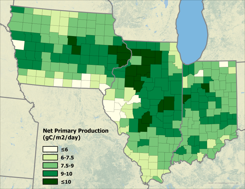
Ecosys Model-Estimated Cropland Carbon Fluxes, Illinois, Indiana, and Iowa, 2001-2018
National Aeronautics and Space Administration —
This dataset contains daily estimates of carbon fluxes in croplands derived from the "ecosys" model covering a portion of the Midwestern US (Illinois, Indiana, and... -
Federal
EnviroAtlas - Average Annual Soil Loss Avoided due to Vegetation (Scaled) for the Conterminous United States
U.S. Environmental Protection Agency —
This EnviroAtlas national dataset shows the average annual soil loss from each pixel avoided due to natural vegetation in metric tons per hectare*10,000 for the... -
Federal
A BIOENERGETIC MODEL USED TO EVALUATE MANAGEMENT STRATEGIES FOR WINTERING WATERFOWL AT SEQUOYAH NATIONAL WILDLIFE REFUGE, VIAN, OKLAHOMA https://doi.org/10.7944/W3HT01
Department of the Interior —
A primary focus of Sequoyah National Wildlife Refuge (SNWR) is to provide habitat and foraging opportunities for waterfowl and other wetland dependent species. SNWR... -
Federal
Goodwater Creek Experimental Watershed caves herbicide, nutrient, and suspended sediment data (1991-2010)
Department of Agriculture —
The Goodwater Creek, Missouri cave stream data file contains nutrient and herbicide concentrations, loads, and daily discharge data for Devils Icebox Cave and Hunters... -
Federal
EnviroAtlas - Average Annual Sediment Delivery Ratio (Scaled) - Natural Vegetation Removal Scenario for the Conterminous United States
U.S. Environmental Protection Agency —
This EnviroAtlas national dataset shows the average sediment delivery ratio (SDR) - the percentage of soil eroding from a pixel that is transported to a downstream... -
Federal
S&T Project 19246: BPCLAWS code
Department of the Interior —
This zip file contains the Python code used in the crop simulations published in the final report. Users must change the file type from .txt to .py prior to use. -
Federal
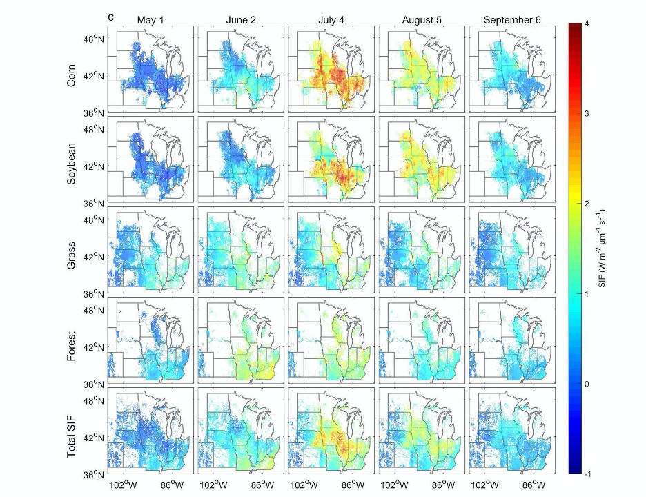
High Resolution Land Cover-Specific Solar-Induced Fluorescence, Midwestern USA, 2018
National Aeronautics and Space Administration —
This dataset provides estimated solar-induced chlorophyll fluorescence (SIF) of specific vegetation types and total SIF under clear-sky and real/cloudy conditions at...
59 datasets found for "Crop Yield"