
-
Federal
Coastal Relief Models (CRMs)
National Oceanic and Atmospheric Administration, Department of Commerce —
Coastal Relief Models CRMs provide seamless topographic and bathymetric bare-earth elevation profiles of coastal regions for US states and territories. Extents span... -
Federal
F00860: NOS Hydrographic Survey , 2022-07-30
National Oceanic and Atmospheric Administration, Department of Commerce —
The National Oceanic and Atmospheric Administration (NOAA) has the statutory mandate to collect hydrographic data in support of nautical chart compilation for safe... -
Federal
H13806: NOS Hydrographic Survey , 2023-08-24
National Oceanic and Atmospheric Administration, Department of Commerce —
The National Oceanic and Atmospheric Administration (NOAA) has the statutory mandate to collect hydrographic data in support of nautical chart compilation for safe... -
Federal
The NGDC Seafloor Sediment Geotechnical Database
National Oceanic and Atmospheric Administration, Department of Commerce —
The NGDC Seafloor Sediment Geotechnical Properties Database contains test engineering properties data coded by students at NGDC from primarily U.S. Naval... -
Federal
PTWC station 1618431: Milolii, Hawaii, HI 15-second Raw Tsunami Water Level Data
National Oceanic and Atmospheric Administration, Department of Commerce —
-
Federal
International Bathymetric Chart of the Arctic Ocean, Version 1.0
National Oceanic and Atmospheric Administration, Department of Commerce —
The goal of this initiative is to develop a digital data base that contains all available bathymetric data north of 64 degrees North, for use by mapmakers,... -
Federal
Bar Harbor, Maine 1/3 Arc-second MHW Coastal Digital Elevation Model
National Oceanic and Atmospheric Administration, Department of Commerce —
NOAA's National Geophysical Data Center (NGDC) is building high-resolution digital elevation models (DEMs) for select U.S. coastal regions. These integrated... -
Federal
CO-OPS station 8411060: CUTLER FARRIS WHARF, LITTLE RIVER 1-minute Raw Tsunami Water Level Data
National Oceanic and Atmospheric Administration, Department of Commerce —
CO-OPS has been involved with tsunami warning and mitigation since the Coast and Geodetic Survey started the Tsunami Warning System in 1948 to provide warnings to the... -
Federal
NOAA/WDS Paleoclimatology - Stahle - Pearl River - TADI - ITRDB MS001
National Oceanic and Atmospheric Administration, Department of Commerce —
This archived Paleoclimatology Study is available from the NOAA National Centers for Environmental Information (NCEI), under the World Data Service (WDS) for... -
Federal
CO-OPS station 8411250: CUTLER NAVAL BASE, MACHIAS BAY 1-minute Raw Tsunami Water Level Data
National Oceanic and Atmospheric Administration, Department of Commerce —
CO-OPS has been involved with tsunami warning and mitigation since the Coast and Geodetic Survey started the Tsunami Warning System in 1948 to provide warnings to the... -
Federal
EK80 Water Column Sonar Data Collected During SH1701
National Oceanic and Atmospheric Administration, Department of Commerce —
The primary goals of the survey are to characterize the winter distribution of hake, the hake aggregations, and the fish within those aggregations in order to support... -
Federal
EK80 Water Column Sonar Data Collected During RL1603
National Oceanic and Atmospheric Administration, Department of Commerce —
Multi-frequency (18-, 38-, 70-, 120-, 200-, and 333-kHz) General Purpose Transceivers (Simrad EK60 GPTs), were configured with split-beam transducers (Simrad ES18-11,... -
Federal
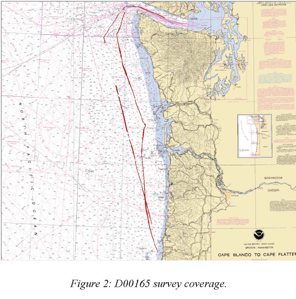
D00165: NOS Hydrographic Survey , 2012-11-01
National Oceanic and Atmospheric Administration, Department of Commerce —
The National Oceanic and Atmospheric Administration (NOAA) has the statutory mandate to collect hydrographic data in support of nautical chart compilation for safe... -
Federal
EK60 Water Column Sonar Data Collected During SE1703
National Oceanic and Atmospheric Administration, Department of Commerce —
Leeward Oahu Pelagic Ecosystem Characterization (LOPEC-1) (SE1703, EK60). The first primary component of LOPEC-1 on SE1703 was to perform a midwater trawl and bongo... -
Federal
EK60 Water Column Sonar Data Collected During SH1701
National Oceanic and Atmospheric Administration, Department of Commerce —
The primary goals of the survey are to characterize the winter distribution of hake, the hake aggregations, and the fish within those aggregations in order to support... -
Federal
ME70 Water Column Sonar Data Collected During RL1603
National Oceanic and Atmospheric Administration, Department of Commerce —
Multi-frequency (18-, 38-, 70-, 120-, 200-, and 333-kHz) General Purpose Transceivers (Simrad EK60 GPTs), were configured with split-beam transducers (Simrad ES18-11,... -
Federal
NOAA/WDS Paleoclimatology - Eastern Equatorial Atlantic Primary Productivity, Sea Surface Temperature and Salinity Reconstructions over the last 44 kyr
National Oceanic and Atmospheric Administration, Department of Commerce —
This archived Paleoclimatology Study is available from the NOAA National Centers for Environmental Information (NCEI), under the World Data Service (WDS) for... -
Federal
Experimental testing of detection, localization, and call density of synthetic sounds using Navy surplus sonobuoys.
National Oceanic and Atmospheric Administration, Department of Commerce —
A series of synthesized sounds were played back from multiple locations around and within a grid of four DIFAR sonobuoys. Four type 53F DIFAR sonobuoys with attached... -
Federal
PTWC station 1617001: Kapoho, Hawaii, HI 15-second Raw Tsunami Water Level Data
National Oceanic and Atmospheric Administration, Department of Commerce —
-
Federal
Maine Offshore Free-air Anomaly Gravity
National Oceanic and Atmospheric Administration, Department of Commerce —
The gravity station data (5,363 records) were compiled by the U. S. Geological Survey. This data base was received on February 23, 1993. Principal gravity parameters...

Official websites use .gov
A
.gov website belongs to an official government
organization in the United States.
Secure .gov websites use HTTPS
A
lock (
) or https:// means you’ve safely connected to
the .gov website. Share sensitive information only on official,
secure websites.