

232 datasets found for ""Source Water""
-
Federal
Atlantic Ocean water mass fraction estimates based on GLODAPv2 Atlantic database (NCEI Accession 0225455)
National Oceanic and Atmospheric Administration, Department of Commerce —
This dataset contains estimates of water mass contributions to the GLODAPv2 Atlantic data. The major water masses in the Atlantic Ocean were characteristics as Source... -
Federal
Physical, chemical, and biological water quality monitoring data to support detection of Harmful Algal Blooms (HABs) in Saginaw Bay, Lake Huron, Great Lakes collected by the Great Lakes Environmental Research Laboratory and the Cooperative Institute for Great Lakes Research since 2012
National Oceanic and Atmospheric Administration, Department of Commerce —
Blooms of nuisance and toxic cyanobacteria, referred to as cyanobacteria harmful algal blooms (cHABs), occur seasonally in Saginaw Bay, Lake Huron, and pose a threat... -
State
Surface Water Drinking Water Source Areas
State of Oregon —
This data layer is an element of the Oregon GIS Framework. This map includes Oregon Department of Environmental Quality (DEQ) and Oregon Department of Human Services’... -
State
i03 dwr region offices
State of California —
Description for i03_DAU_county_cnty2018 is as follows:Detailed Analysis Unit-(DAU) Convergence via County Boundary cnty18_1 for Cal-Fire, (See metadata for CAL-FIRE... -
Federal
WaterTAP3 Model Input Data for NAWI's Eight Source Water Baseline Analyses
Department of Energy —
This folder contains the input data for the WaterTAP3 model that was used for the eight NAWI (National Alliance for Water Innovation) source water baselines studies... -
State
Aquifer Protection Areas Set
State of Connecticut —
See full Data Guide here. Aquifer Protection Areas Set is a 1:24,000-scale, polygon feature-based layer that includes all Preliminary (Level B) and Final (Level A)... -
State
i03 Water Plan Planning Areas
State of California —
Description for i03_DAU_county_cnty2018 is as follows:Detailed Analysis Unit-(DAU) Convergence via County Boundary cnty18_1 for Cal-Fire, (See metadata for CAL-FIRE... -
State
i03 Hydrologic Regions
State of California —
Description for i03_DAU_county_cnty2018 is as follows:Detailed Analysis Unit-(DAU) Convergence via County Boundary cnty18_1 for Cal-Fire, (See metadata for CAL-FIRE... -
Federal
Brackish Groundwater National Desalination Research Facility (BGNDRF) Well 2 Manganese (Total)-mg/L Time Series Data
Department of the Interior —
BGNDRF has four brackish groundwater wells that provide source water to the various testing areas throughout the facility. Generally, water from these wells is... -
State
Aquifer Protection Area
State of Connecticut —
See full Data Guide here. Aquifer Protection Areas Set is a 1:24,000-scale, polygon feature-based layer that includes all Preliminary (Level B) and Final (Level A)... -
Federal
Brackish Groundwater National Desalination Research Facility (BGNDRF) Well 4 Alkalinity, Carbonate-mg/L Time Series Data
Department of the Interior —
BGNDRF has four brackish groundwater wells that provide source water to the various testing areas throughout the facility. Generally, water from these wells is... -
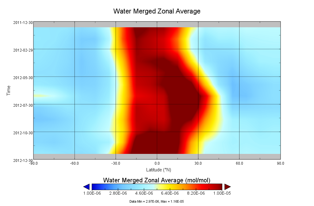
Federal
GOZCARDS Source Water Vapor 1 month L3 10 degree Zonal Means on a Vertical Pressure Grid V1 (GozSmlpH2O) at GES DISC
National Aeronautics and Space Administration —
The GOZCARDS Source Data for Water Vapor 1 month L3 10 degree Zonal Averages on a Vertical Pressure Grid product (GozSmlpH2O) contains zonal means and related... -
State
i03 DAU county cnty2018
State of California —
Detailed Analysis Unit-(DAU) Convergence via County Boundary cnty18_1 for Cal-Fire, (See metadata for CAL-FIRE cnty18_1), State of California.The existing DAU... -
Federal
ru22-20140825T1505
National Oceanic and Atmospheric Administration, Department of Commerce —
The project is a comprehensive observational and analytical program to examine the dynamics and source waters of the relaxation flows in a coastal upwelling system on... -
Federal
ru22-20140804T1632
National Oceanic and Atmospheric Administration, Department of Commerce —
The project is a comprehensive observational and analytical program to examine the dynamics and source waters of the relaxation flows in a coastal upwelling system on... -
State
Wellhead Protection Areas - Adjacent State
State of Connecticut —
See full Data Guide here. Aquifer Protection Areas Set is a 1:24,000-scale, polygon feature-based layer that includes all Preliminary (Level B) and Final (Level A)... -
Federal
Brackish Groundwater National Desalination Research Facility (BGNDRF) Well 2 Nitrate+Nitrite (as N)-mg/L Time Series Data
Department of the Interior —
BGNDRF has four brackish groundwater wells that provide source water to the various testing areas throughout the facility. Generally, water from these wells is... -
Federal
Brackish Groundwater National Desalination Research Facility (BGNDRF) Well 4 Total Alkalinity (as CaCO3)-mg/L Time Series Data
Department of the Interior —
BGNDRF has four brackish groundwater wells that provide source water to the various testing areas throughout the facility. Generally, water from these wells is... -
Federal
Brackish Groundwater National Desalination Research Facility (BGNDRF) Well 3 Water Temperature-DegC Time Series Data
Department of the Interior —
BGNDRF has four brackish groundwater wells that provide source water to the various testing areas throughout the facility. Generally, water from these wells is... -
Federal
Brackish Groundwater National Desalination Research Facility (BGNDRF) Well 2 Solids, Filterable Total Dissolved Solids-mg/L Time Series Data
Department of the Interior —
BGNDRF has four brackish groundwater wells that provide source water to the various testing areas throughout the facility. Generally, water from these wells is...
232 datasets found for ""Source Water""