

5 datasets found for "soil"
-
Federal
Global Landslide Hazard Distribution
National Aeronautics and Space Administration —
The Global Landslide Hazard Distribution is a 2.5 minute grid of global landslide and snow avalanche hazards based upon work of the Norwegian Geotechnical Institute... -
Federal
Global Pesticide Grids (PEST-CHEMGRIDS), Version 1.01
National Aeronautics and Space Administration —
The Global Pesticide Grids (PEST-CHEMGRIDS), Version 1.01 data set contains 20 of the most-used pesticide active ingredients on 6 dominant crops and 4 aggregated crop... -
Federal
Central American Vegetation/Land Cover Classification and Conservation Status
National Aeronautics and Space Administration —
The Central American Vegetation/Land Cover Classification and Conservation Status consists of GIS coverages of vegetation classes (forests, woodlands, savannas,... -
Federal
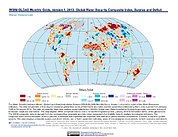
Water Security Indicator Model - Global Land Data Assimilation System (WSIM-GLDAS) Monthly Grids, Version 1
National Aeronautics and Space Administration —
The Water Security Indicator Model - Global Land Data Assimilation System (WSIM-GLDAS) Monthly Grids, Version 1 data set identifies and characterizes surpluses and...
5 datasets found for "soil"