
-
Federal
FIFE CDROM Vol. 3 Contents: NS001 Thematic Mapper Simulator (TMS) Imagery, 1987-1989
National Aeronautics and Space Administration —
This data set provides aircraft-based NS001 Thematic Mapper Simulator (TMS) images of the study area associated with The First ISLSCP (International Satellite Land... -
Federal
BOREAS/SRC AMS Suite A Surface Meteorological and Radiation Data: 1996
National Aeronautics and Space Administration —
Contains the data collected in 1996 by the AMS suite A instrument set operated by SRC and provided to BORIS. -
Federal
Arctic Vegetation Plots, Prudhoe Bay ArcSEES Road Study, Lake Colleen, Alaska, 2014
National Aeronautics and Space Administration —
This dataset provides environmental, soil, and vegetation data collected from study plots in the vicinity of Lake Colleen off the Spine Road at Prudhoe Bay, Alaska,... -
Federal
Arctic Vegetation Plots in Northern NWT and YT, Canada, 1965-1966
National Aeronautics and Space Administration —
This dataset provides vegetation, soil, and plot characteristics for 154 study plots located at three sites across the Richardson Mountains, Northwest Territories... -
Federal
Global Soil Profile Data (ISRIC-WISE)
National Aeronautics and Space Administration —
The ISRIC-WISE International soil profile data set consists of a homogenized, global set of 1,125 soil profiles for use by global modelers. These profiles provided... -
Federal
BOREAS/SRC AMS Suite A Surface Meteorological and Radiation Data: 1994
National Aeronautics and Space Administration —
Contains the data collected in 1994 by the AMS suite A instrument set operated by SRC and provided to BORIS. -
Federal
LBA-ECO CD-06 Carbon Cycling in Rivers in Amazonas and Acre, Brazil: 2005-2006
National Aeronautics and Space Administration —
This data set provides measured and calculated variables describing the carbon pools in river waters, CO2 respired from the water and total amount of CO2 evaded,... -
Federal
LBA-ECO ND-30 Water Chemistry, Rainfall Exclusion, km 67, Tapajos National Forest
National Aeronautics and Space Administration —
This data set reports the results of chemical analyses of rainfall, throughfall, litter leachate, and soil water samples collected before, during, and after a... -
Federal
Delta-X: AVIRIS-NG L1B Spectral Radiance Products, MRD, Louisiana, 2021
National Aeronautics and Space Administration —
This dataset provides Level 1B (L1B) radiance products from NASA's Airborne Visible Infrared Imaging Spectrometer- Next Generation (AVIRIS-NG) instrument acquired... -
Federal
Maps of Vegetation, NDVI, Snow and Thaw Depths: North Slope, Alaska and NWT, Canada
National Aeronautics and Space Administration —
This dataset includes vegetation cover maps, Normalized Difference Vegetation Index (NDVI) maps, snow depth and thaw depth data that were obtained as part of a... -
Federal
LBA-ECO TG-05 NPP, Carbon Pool, Soil Characteristics, Soil Gas Flux Maps of Brazil
National Aeronautics and Space Administration —
This data set provides maps produced from model output data from the National Aeronautics and Space Administration-Carnegie Ames Stanford Approach (NASA-CASA) model... -
Federal
NACP MsTMIP: Global 0.5-degree Model Outputs in Standard Format, Version 1.0
National Aeronautics and Space Administration —
This data set provides global gridded estimates of carbon, energy, and hydrologic fluxes between the land and atmosphere from 15 Terrestrial Biosphere Models (TBMs)... -
Federal
BOREAS SERM Forest Cover Data Layers of the SSA in Vector Format
National Aeronautics and Space Administration —
This data set was prepared by the SERM-FBIU. The data include information on forest parameters and cover the area in and near the BOREAS SSA, excluding the PANP. -
Federal
CO2 and CH4 Fluxes from Waterbodies, Yukon-Kuskokwim Delta, Alaska, 2016-2019
National Aeronautics and Space Administration —
This dataset provides estimates of carbon dioxide (CO2) and methane (CH4) diffusive fluxes from waterbodies, and watershed landcover data for the central-interior of... -
Federal
BOREAS TF-10 NSA-Fen Tower Flux and Meteorological Data
National Aeronautics and Space Administration —
The flux and ancillary data collected at the NSA-Fen tower flux site by the TF-10 group. -
Federal
BOREAS TGB-12 Soil Carbon and Flux Data of NSA-MSA in Raster Format
National Aeronautics and Space Administration —
This data set contains (1) estimates of soil carbon stocks by horizon based on soil survey data and analyses of data from individual soil profiles; (2) estimates of... -
Federal
BOREAS TF-01 SSA-OA Understory Flux, Meteorological, and Soil Temperature Data
National Aeronautics and Space Administration —
Energy, carbon dioxide, and momentum flux data collected under the canopy along with meteorological and soils data at the BOREAS SSA-OA site from mid-October to mid-... -
Federal
BOREAS TF-11 SSA-FEN Tower Flux and Meteorological Data
National Aeronautics and Space Administration —
The flux and ancillary data collected at the SSA-Fen tower flux site by the TF-11 group. -
Federal
ABoVE: Soil Active Layer Thaw Depths at CRREL sites near Fairbanks, Alaska, 2014-2018
National Aeronautics and Space Administration —
This dataset provides soil active layer thaw depth measurements collected along transects at three sites near Fairbanks, Alaska, USA. Measurements were made during... -
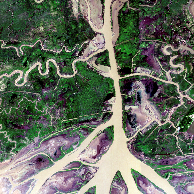
Federal
Pre-LBA FLOODAMA Project Data
National Aeronautics and Space Administration —
This data set provides a digital mosaic of the Amazon River floodplain that was compiled using Landsat TM images. This mosaic was planned in July 1995 as an activity...

Official websites use .gov
A
.gov website belongs to an official government
organization in the United States.
Secure .gov websites use HTTPS
A
lock (
) or https:// means you’ve safely connected to
the .gov website. Share sensitive information only on official,
secure websites.