
-
Federal
Global Vegetation Greenness (NDVI) from AVHRR GIMMS-3G+, 1981-2022 recent views
National Aeronautics and Space Administration —
This dataset holds the Global Inventory Modeling and Mapping Studies-3rd Generation V1.2 (GIMMS-3G+) data for the Normalized Difference Vegetation Index (NDVI). NDVI... -
Federal
Global Maps of Atmospheric Nitrogen Deposition, 1860, 1993, and 2050 recent views
National Aeronautics and Space Administration —
This data set provides global gridded estimates of atmospheric deposition of total inorganic nitrogen (N), NHx (NH3 and NH4+), and NOy (all oxidized forms of nitrogen... -
Federal
Arctic Vegetation Plots at Atqasuk, Alaska, 1975, 2000, and 2010 recent views
National Aeronautics and Space Administration —
This data set provides vegetation species abundance data collected in 1975 from 60 sites on the Arctic Coastal Plain near Atqasuk, Alaska, as well as environmental... -
Federal
Probabilistic Freeze-Thaw Record for the Northern Hemisphere, 2016-2020 recent views
National Aeronautics and Space Administration —
This dataset provides a probabilistic freeze/thaw (FT) data record from 2016 to 2020 for the Northern Hemisphere derived using a deep learning model (U-Net). The... -
Federal
LiDAR Surveys over Selected Forest Research Sites, Brazilian Amazon, 2008-2018 recent views
National Aeronautics and Space Administration —
This dataset provides the complete catalog of point cloud data collected during LiDAR surveys over selected forest research sites across the Amazon rainforest in... -
Federal
Methane Emissions from Dairy Sources (Vista-CA), State of California, USA, 2019 recent views
National Aeronautics and Space Administration —
This dataset provides estimates of methane (CH4) emissions from dairies in California at a resolution of 0.1 degrees (~ 10 km x 10 km) for the year 2019. The mapped... -
Federal
Global Vegetation Height Metrics from GEDI and ICESat2 recent views
National Aeronautics and Space Administration —
This dataset provides global rasters of relative height metrics for vegetation from Global Ecosystem Dynamics Investigation (GEDI) L2A data and Ice, Cloud, and Land... -
Federal
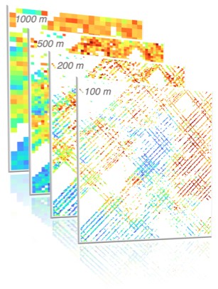
MASTER: Airborne Science, western US, June, 1999 recent views
National Aeronautics and Space Administration —
This dataset includes Level 1B (L1B) data products from the MODIS/ASTER Airborne Simulator (MASTER) instrument. The spectral data were collected during 10 flights... -
Federal
ABoVE: Photochemical Reflectance and Tree Growth, Brooks Range, Alaska, 2018-2019 recent views
National Aeronautics and Space Administration —
This dataset provides simultaneous in-situ measurements of the photochemical reflectance index (PRI) and radial tree growth of selected white spruce trees (Picea... -
Federal
ABoVE: Distribution Maps of Wildland Fire Fuel Components across Alaskan Tundra, 2015 recent views
National Aeronautics and Space Administration —
This dataset provides maps of the distribution of three major wildland fire fuel types at 30 m spatial resolution covering the Alaskan arctic tundra, circa 2015. The... -
Federal
ABoVE: Reflectance Spectra of Tundra Plant Communities across Northern Alaska recent views
National Aeronautics and Space Administration —
This dataset reports full-spectrum (350-2500 nm) reflectance measurements of diverse plant communities at the plot-level and individual plant species at the leaf-... -
Federal
ABoVE: Environmental Conditions and Subsistence Resource Access, Alaska, 2016-2017 recent views
National Aeronautics and Space Administration —
This dataset provides descriptions and photos of environmental conditions that impacted availability to subsistence resources by residents in nine rural communities... -
Federal
ACT-America: L2 Remotely Sensed Column-avg CO2 by Airborne Lidar, Lite, Eastern USA recent views
National Aeronautics and Space Administration —
This dataset provides a direct subset (i.e., the Lite version) of the Level 2 (L2) remotely sensed column-average carbon dioxide (CO2) concentrations measured during... -
Federal
ABoVE: Thaw Depth at Selected Unburned and Burned Sites Across Alaska recent views
National Aeronautics and Space Administration —
This dataset provides thaw depth measurements made at seven locations across Alaska, during August 2016, June and September 2017, and July-August 2018. Three of the... -
Federal
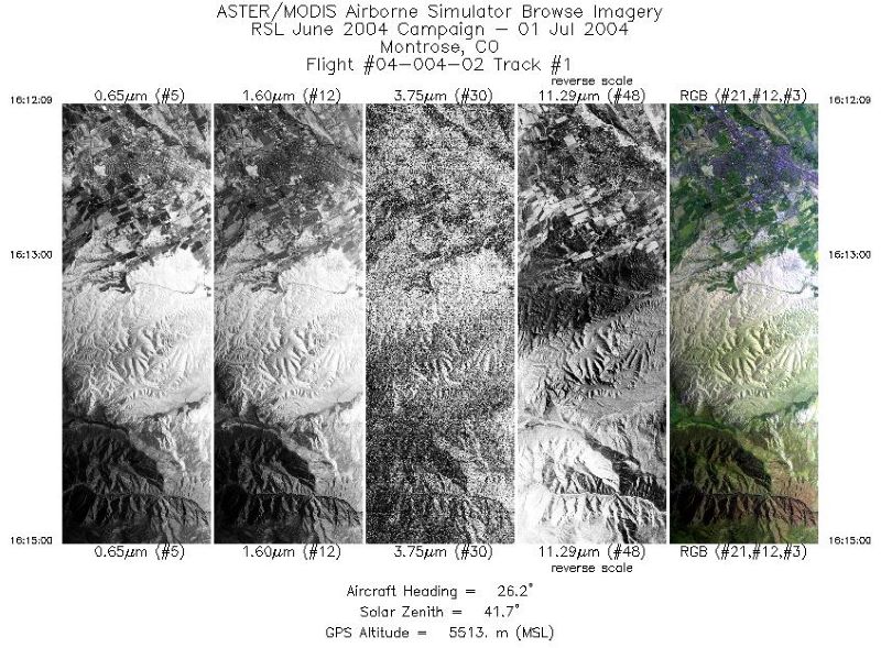
MASTER: Geological substrate mapping, Utah-Colorado, June, 2004 recent views
National Aeronautics and Space Administration —
This dataset includes Level 1B (L1B) data products from the MODIS/ASTER Airborne Simulator (MASTER) instrument. The spectral data were collected during two flights... -
Federal
FIFE CDROM Vol. 3 Contents: NS001 Thematic Mapper Simulator (TMS) Imagery, 1987-1989 recent views
National Aeronautics and Space Administration —
This data set provides aircraft-based NS001 Thematic Mapper Simulator (TMS) images of the study area associated with The First ISLSCP (International Satellite Land... -
Federal
Global Aboveground and Belowground Biomass Carbon Density Maps for the Year 2010 recent views
National Aeronautics and Space Administration —
This dataset provides temporally consistent and harmonized global maps of aboveground and belowground biomass carbon density for the year 2010 at a 300-m spatial... -
Federal
Vulcan: High-Resolution Annual Fossil Fuel CO2 Emissions in USA, 2010-2015, Version 3 recent views
National Aeronautics and Space Administration —
The Vulcan version 3.0 annual dataset provides estimates of annual carbon dioxide (CO2) emissions from the combustion of fossil fuels (FF) and CO2 emissions from... -
Federal
ABoVE: Modeled Top Cover by Plant Functional Type over Alaska and Yukon, 1985-2020 recent views
National Aeronautics and Space Administration —
This dataset contains data files of modeled top cover estimates by plant functional type (PFT) for the Arctic and Boreal Alaska and Yukon regions. Estimates are... -
Federal
Ground-Based Vegetation Community Photos, Toolik Lake Area, Alaska, 2014-2015 recent views
National Aeronautics and Space Administration —
This dataset contains 731 ground-based nadir vegetation community and ground surface photographs of selected field plots taken as ground reference data for vegetation...

Official websites use .gov
A
.gov website belongs to an official government
organization in the United States.
Secure .gov websites use HTTPS
A
lock (
) or https:// means you’ve safely connected to
the .gov website. Share sensitive information only on official,
secure websites.