
-
Federal
ABoVE: High Resolution Cloud-Free Snow Cover Extent and Snow Depth, Alaska, 2001-2017
National Aeronautics and Space Administration —
This dataset provides estimates of maximum snow cover extent (SCE) and snow depth for each 8-day composite period from 2001 to 2017 at 1 km resolution across Alaska.... -
Federal
Delta-X: AVIRIS-NG L3 Derived Herbaceous Aboveground Biomass, MRD, Louisiana, USA, V3
National Aeronautics and Space Administration —
This dataset includes high-resolution (~5 m) gridded estimates of aboveground biomass (AGB), aboveground necromass (AGN), and aboveground net primary productivity... -
Federal
Delta-X: Delft3D Sediment Model, Site 322, Terrebonne Basin, MRD, Louisiana, USA
National Aeronautics and Space Administration —
This dataset contains the Delft3D model of the intensive site 322 in the Terrebonne Basin along the Mississippi River Delta (MRD) in coastal Louisiana. Simulations... -
Federal
SNF Forest Cover by Species/Strata
National Aeronautics and Space Administration —
The purpose of the SNF study was to improve our understanding of the relationship between remotely sensed observations and important biophysical parameters in the... -
Federal
Delta-X: Bed and Suspended Sediment Grain Size, MRD, LA, USA, 2019-2021, V3
National Aeronautics and Space Administration —
This dataset includes sediment concentration and grain size distribution measurements from suspended and bed sediment samples collected in the Atchafalaya River and... -
Federal
Delta-X: Digital Elevation Model, MRD, LA, USA, 2021
National Aeronautics and Space Administration —
This dataset provides an updated digital elevation model (DEM) for the Atchafalaya and Terrebonne basins in coastal Louisiana, USA. The DEM is updated from the Pre-... -
Federal
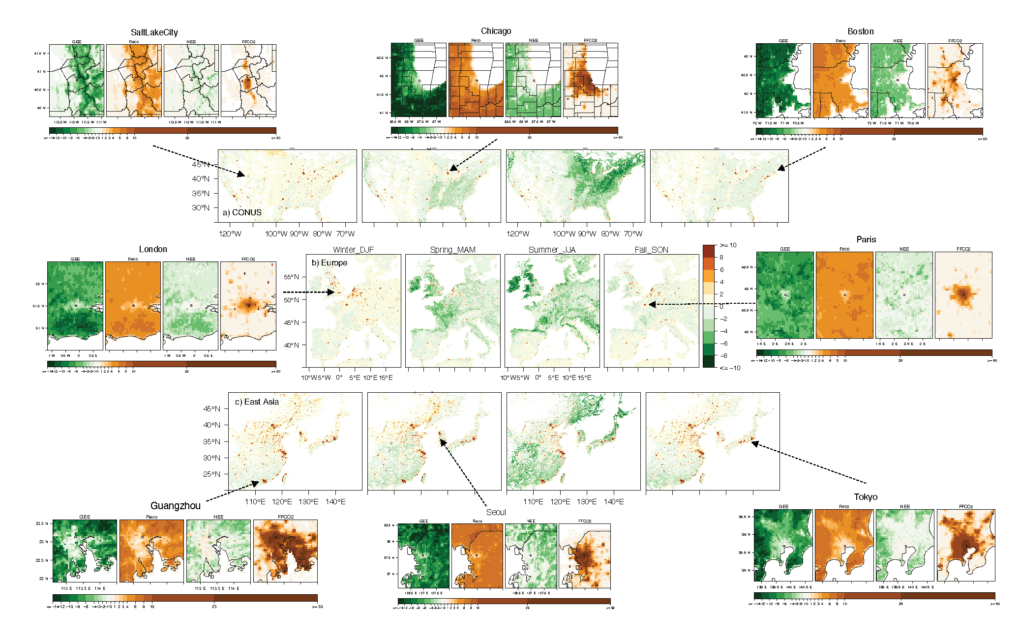
Urban Biogenic CO2 fluxes: GPP, Reco and NEE Estimates from SMUrF, 2010-2019
National Aeronautics and Space Administration —
This dataset contains estimates of biogenic CO2 flux components at 0.05 degree resolution from the Solar-Induced Fluorescence (SIF) for Modeling Urban biogenic Fluxes... -
Federal
Site Averaged AMS Data: 1989 (Betts)
National Aeronautics and Space Administration —
The Site Averaged AMS Data: 1989 (Betts) Data Set contains the site averaged product of the Portable Automatic Meteorological Station (AMS) data acquired during the... -
Federal
Simulated Fine Particulate Matter (PM2.5) Estimates over Alaska, 2001-2015
National Aeronautics and Space Administration —
The dataset provides simulated PM2.5 concentration estimates over Alaska, U.S. PM2.5 (particulate matter with diameter <= 2.5 microns) concentrations in air... -
Federal
Pre-Delta-X: L3 AirSWOT-derived Water Level Profiles, Wax Lake Outlet, LA, USA, 2015
National Aeronautics and Space Administration —
This dataset contains water level profiles generated from the AirSWOT data collected in the Atchafalaya Basin in Southern Louisiana, USA, within the Mississippi River... -
Federal
NWS Daily Climatology Data: 1990 (SNF)
National Aeronautics and Space Administration —
Weather data were collected by the National Weather Service in International Falls, Minnesota. International Falls is about 80 miles from the SNF, but the weather... -
Federal
NWS Daily Climatology Data: 1988 (SNF)
National Aeronautics and Space Administration —
Weather data were collected by the National Weather Service in International Falls, Minnesota. International Falls is about 80 miles from the SNF, but the weather... -
Federal
Aircraft Flux-Filtered: U of Wy. (FIFE)
National Aeronautics and Space Administration —
The University of Wyoming (UW) King Air atmospheric boundary layer measurement missions were flown in 1987 during IFCs 3 and 4. This Boundary Layer Fluxes data set... -
Federal
BOREAS HYD-03 Snow Water Equivalent: 1996
National Aeronautics and Space Administration —
The BOREAS HYD-03 team collected several data sets related to the hydrology of forested areas. This data set contains measurements of snow depth, snow density in 3-cm... -
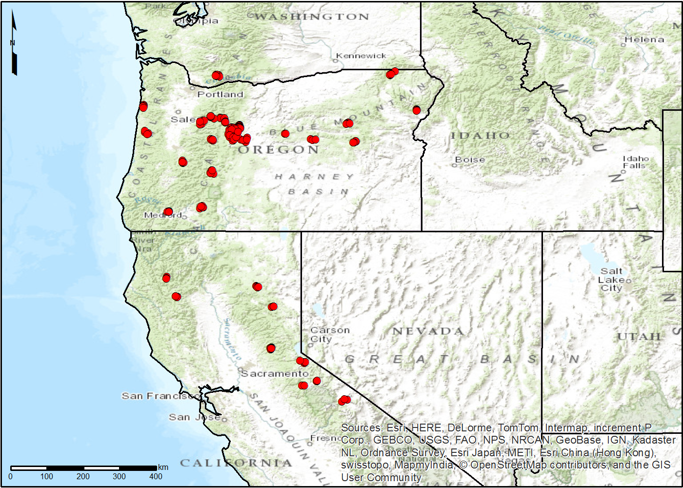
Federal
NACP TERRA-PNW: Forest Plant Traits, NPP, Biomass, and Soil Properties, 1999-2014
National Aeronautics and Space Administration —
This data set contains measurements and estimates of leaf, tree, and soil data from six projects conducted by the Terrestrial Ecosystem Research and Regional... -
Federal
ABoVE: Vegetation Composition across Fire History Gradients on the Y-K Delta, Alaska
National Aeronautics and Space Administration —
This dataset provides ecological field data that were collected during July 2017 and July 2018 from 43 plots spanning gradients of fire history in the upland tundra... -
Federal
ABoVE: Permafrost Measurements and Distribution Across the Y-K Delta, Alaska, 2016
National Aeronautics and Space Administration —
This dataset provides field observations of thaw depth and dominant vegetation types, a LiDAR-derived elevation map, and permafrost distribution and probability maps... -
Federal
Delta-X: Aboveground Vegetation Structure, Herbaceous Wetlands, MRD, LA, USA, V2
National Aeronautics and Space Administration —
This dataset provides mean stem diameter, mean height, dominant species, hydrogeomorphic zone (HGM), and stem density for vegetation in herbaceous wetlands collected... -
Federal
Delta-X: AVIRIS-NG BRDF-Adjusted Surface Reflectance and Mosaics, MRD, LA, 2021, V3
National Aeronautics and Space Administration —
This data provides AVIRIS-NG Bidirectional Reflectance Distribution Function (BRDF) and sunglint-corrected surface spectral reflectance images over the Atchafalaya... -
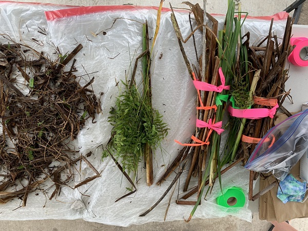
Federal
SNF Forest Understory Cover Data (Table)
National Aeronautics and Space Administration —
The purpose of the SNF study was to improve our understanding of the relationship between remotely sensed observations and important biophysical parameters in the...

Official websites use .gov
A
.gov website belongs to an official government
organization in the United States.
Secure .gov websites use HTTPS
A
lock (
) or https:// means you’ve safely connected to
the .gov website. Share sensitive information only on official,
secure websites.