
-
Federal
Global Vegetation Greenness (NDVI) from AVHRR GIMMS-3G+, 1981-2022
National Aeronautics and Space Administration —
This dataset holds the Global Inventory Modeling and Mapping Studies-3rd Generation V1.2 (GIMMS-3G+) data for the Normalized Difference Vegetation Index (NDVI). NDVI... -
Federal
Global Data Set of Derived Soil Properties, 0.5-Degree Grid (ISRIC-WISE)
National Aeronautics and Space Administration —
The World Inventory of Soil Emission Potentials (WISE) database currently contains data for over 4300 soil profiles collected mostly between 1950 and 1995. This... -
Federal
VEMAP 2: U.S. Daily Climate Change Scenarios
National Aeronautics and Space Administration —
The Vegetation/Ecosystem Modeling and Analysis Project (VEMAP) Phase 2 has developed a number of transient climate change scenarios based on coupled atmosphere-ocean... -
Federal
LBA-ECO CD-04 Soil Respiration, km 83 Tower Site, Tapajos National Forest, Brazil
National Aeronautics and Space Administration —
This data set reports on the flux of carbon dioxide from logged forest soils near the eddy flux tower at the km 83 site, Para, Brazil. The automated soil respiration... -
Federal
GEDI L4A Footprint Level Aboveground Biomass Density, Version 1
National Aeronautics and Space Administration —
This dataset contains Global Ecosystem Dynamics Investigation (GEDI) Level 4A (L4A) predictions of the aboveground biomass density (AGBD; in Mg/ha) and estimates of... -
Federal
VEMAP 2: U.S. Annual Climate Change Scenarios
National Aeronautics and Space Administration —
The Vegetation/Ecosystem Modeling and Analysis Project (VEMAP) Phase 2 has developed a number of transient climate change scenarios based on coupled atmosphere-ocean... -
Federal
BioSCape Vegetation Surveys Berg and Eerste River Catchments, South Africa, 2022-2023
National Aeronautics and Space Administration —
This dataset contains vegetation plot survey data collected at 36 sites across the Berg and Eerste River catchments in the Western Cape, South Africa collected during... -
Federal
Vulcan: High-Resolution Hourly Fossil Fuel CO2 Emissions in USA, 2010-2015, Version 3
National Aeronautics and Space Administration —
The Vulcan version 3.0 hourly dataset quantifies hourly emissions at a 1-km resolution for the 2010-2015 time period. Estimates are provided of hourly carbon dioxide... -
Federal
Soil Moisture Profiles and Temperature Data from SoilSCAPE Sites, USA
National Aeronautics and Space Administration —
This data set contains in-situ soil moisture profile and soil temperature data collected at 20-minute intervals at SoilSCAPE (Soil moisture Sensing Controller and... -
Federal
High Resolution Global Contiguous SIF Estimates from OCO-2 SIF and MODIS, Version 2
National Aeronautics and Space Administration —
This dataset provides spatially-contiguous global mean daily solar-induced chlorophyll fluorescence (SIF) estimates at 0.05 degree (approximately 5 km at the equator)... -
Federal
Timeseries of Arctic-Boreal Lake Area Derived from CubeSat Imagery, 2017
National Aeronautics and Space Administration —
This dataset provides near-daily lake area timeseries for 85,358 lakes across four study areas in Northern Canada and Alaska, USA, between May 1 and October 1, 2017.... -
Federal
Mowing Experiment Exotech Data (FIFE)
National Aeronautics and Space Administration —
Light radiation striking a vegetative canopy interacts with individual phyto-elements (i.e., leaves, stems, branches) and the underlying substrate. The interaction... -
Federal
LBA-ECO ND-02 Soil Gas Flux, Rainfall Exclusion, km 67, Tapajos National Forest
National Aeronautics and Space Administration —
Moist tropical forests in Amazonia and elsewhere are subjected to increasingly severe drought episodes through the El Nino-Southern Oscillation (ENSO) and possibly... -
Federal
LBA-ECO LC-07 Aquatic Marcophyte Biomass, Monte Alegre Lake, Para, Brazil: 2003-2004
National Aeronautics and Space Administration —
This data set reports measurements of aquatic macrophyte biomass, phenology, leaf characteristics, and length and diameter of stems of both submerged and unsubmerged... -
Federal
LBA-ECO CD-06 Flux of CO2 from Amazon Mainstem Rivers, Tributaries, and Floodplains
National Aeronautics and Space Administration —
This data set provides estimates of monthly carbon dioxide (CO2) flux from the Amazon mainstem rivers, tributary stream networks, and their associated varzeas... -
Federal
LBA-ECO CD-10 CO2 and H2O Eddy Flux Data at km 67 Tower Site, Tapajos National Forest
National Aeronautics and Space Administration —
This data set reports eddy flux measurements of CO2 and H2O exchange and associated meteorological measurements at the Para Western (Santarem) - km 67, Primary Forest... -
Federal
LBA-ECO CD-10 Forest Litter Data for km 67 Tower Site, Tapajos National Forest
National Aeronautics and Space Administration —
This data set reports litter type and mass in the old-growth upland forest at the Para Western (Santarem) - km 67, Primary Forest Tower Site. This site is in the... -
Federal
MASTER: HyspIRI Airborne Campaign, California, Spring 2015
National Aeronautics and Space Administration —
This dataset includes Level 1B (L1B) and Level 2 (L2) data products from the MODIS/ASTER Airborne Simulator (MASTER) instrument. The spectral data were collected as... -
Federal
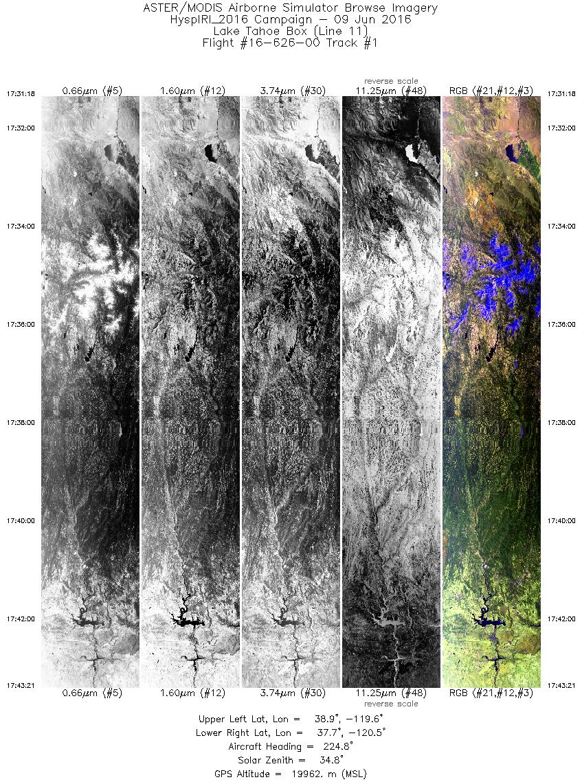
MASTER: HyspIRI Airborne Campaign, California and Nevada, Summer 2016
National Aeronautics and Space Administration —
This dataset includes Level 1B (L1B) and Level 2 (L2) data products from the MODIS/ASTER Airborne Simulator (MASTER) instrument. The data were collected as part of...

Official websites use .gov
A
.gov website belongs to an official government
organization in the United States.
Secure .gov websites use HTTPS
A
lock (
) or https:// means you’ve safely connected to
the .gov website. Share sensitive information only on official,
secure websites.