
-
Federal
MASTER: FireSense, western US, October 2023
National Aeronautics and Space Administration —
This dataset includes Level 1B (L1B) data products from the MODIS/ASTER Airborne Simulator (MASTER) instrument. The spectral data were collected as part of the... -
Federal
MASTER: Airborne Science, Nevada, May 2006
National Aeronautics and Space Administration —
This dataset includes Level 1B (L1B) data products from the MODIS/ASTER Airborne Simulator (MASTER) instrument. The spectral data were collected during five flights... -
Federal
Remote Sensing Data Before and After California Rim and King Forest Fires, 2010-2015
National Aeronautics and Space Administration —
This data set provides high-resolution surface reflectance, thermal imagery, burn severity metrics, and LiDAR-derived structural measures of forested areas in the... -
Federal
BOREAS RSS-18 Level 1B AVIRIS At-Sensor Radiance Imagery
National Aeronautics and Space Administration —
This dataset holds Level 1B (L1B) radiance data collected by the AVIRIS-Classic instrument near Prince Albert, Saskatchewan, Canada, on August 14, 1996. This imagery... -
Federal
MASTER: Costa Rica Airborne Research and Technology Applications (CARTA), 2005
National Aeronautics and Space Administration —
This dataset includes Level 1B (L1B) data products from the MODIS/ASTER Airborne Simulator (MASTER) instrument. The spectral data were collected during 23 flights... -
Federal
AVIRIS-3 L2A Orthocorrected Surface Reflectance, Facility Instrument Collection
National Aeronautics and Space Administration —
This dataset contains Level 2A (L2A) surface reflectance images from the Airborne Visible / Infrared Imaging Spectrometer-3 (AVIRIS-3) instrument. This is the NASA... -
Federal
L2 Daily Solar-Induced Fluorescence (SIF) from ERS-2 GOME, 1995-2003
National Aeronautics and Space Administration —
This dataset provides Level 2 Solar-Induced Fluorescence (SIF) of Chlorophyll estimates derived from the Global Ozone Monitoring Experiment (GOME) instrument on the... -
Federal
MASTER: Airborne Science, California-Nevada-New Mexico, May, 2002, V2
National Aeronautics and Space Administration —
This dataset includes Level 1B (L1B) data products from the MODIS/ASTER Airborne Simulator (MASTER) instrument. The spectral data were collected during seven flights... -
Federal
Arctic Boreal Annual Burned Area, Circumpolar Boreal Forest and Tundra, V2, 2002-2022
National Aeronautics and Space Administration —
This dataset provides annual cumulative end-of-season burned area in circumpolar boreal forests and tundra for the years 2002-2022. The data were generated using the... -
Federal
GEDI L4C Footprint Level Waveform Structural Complexity Index, Version 2
National Aeronautics and Space Administration —
This dataset contains Global Ecosystem Dynamics Investigation (GEDI) Level 4C (L4C) Version 2 predictions of the Waveform Structural Complexity Index (WSCI) and... -
Federal
ABoVE: Passive Microwave-derived Annual Snowpack Main Melt Onset Date Maps, 1988-2023
National Aeronautics and Space Administration —
This dataset provides the annual date of snowpack seasonal beginning melt (i.e., main melt onset date, MMOD) across northwest Canada, Alaska, US, and parts of far... -
Federal
ABoVE: Boreal Forest Resilience Study 2020-2022, Fairbanks AK
National Aeronautics and Space Administration —
This dataset includes five metrics of forest resilience (recruitment, invasives, permafrost change, tree damage, and radial growth) at five recently burned forest... -
Federal
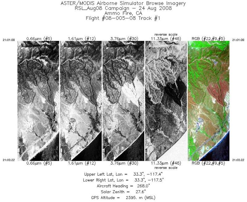
MASTER: California Fire-Burn Area Emergency Response, California, August 2008
National Aeronautics and Space Administration —
This dataset includes Level 1B (L1B) data products from the MODIS/ASTER Airborne Simulator (MASTER) instrument. The spectral data were collected during four flights... -
Federal
MASTER: California Fire-Burn Area Emergency Response, California, April 2008
National Aeronautics and Space Administration —
This dataset includes Level 1B (L1B) data products from the MODIS/ASTER Airborne Simulator (MASTER) instrument. The spectral data were collected as part of the... -
Federal
MASTER: California Fires, California, November 2007
National Aeronautics and Space Administration —
This dataset includes Level 1B (L1B) data products from the MODIS/ASTER Airborne Simulator (MASTER) instrument. The spectral data were collected during six flights... -
Federal
Gridded GEDI Vegetation Structure Metrics and Biomass Density at Multiple Resolutions
National Aeronautics and Space Administration —
This dataset consists of near-global, analysis-ready, multi-resolution gridded vegetation structure metrics derived from NASA Global Ecosystem Dynamics Investigation... -
Federal
MASTER: FireSense, California and Southern US, Spring 2025
National Aeronautics and Space Administration —
This dataset includes Level 1B (L1B) and Level 2 (L2) data products from the MODIS/ASTER Airborne Simulator (MASTER) instrument. The spectral data were collected as...

Official websites use .gov
A
.gov website belongs to an official government
organization in the United States.
Secure .gov websites use HTTPS
A
lock (
) or https:// means you’ve safely connected to
the .gov website. Share sensitive information only on official,
secure websites.