
-
Federal
NACP North American Forest Dynamics Project: Forest Disturbance and Regrowth Data
National Aeronautics and Space Administration —
This data set provides the results of time-series analyses of Landsat imagery for 55 selected forested sites across the conterminous U.S.A. The output is a pair of... -
Federal
A Global Database of Gas Fluxes from Soils after Rewetting or Thawing, Version 1.0
National Aeronautics and Space Administration —
This database contains information compiled from published studies on gas flux from soil following rewetting or thawing. The resulting database includes 222 field and... -
Federal
NACP Regional: National Greenhouse Gas Inventories and Aggregated Gridded Model Data
National Aeronautics and Space Administration —
This data set provides two products that were derived from the recently published North American Carbon Program (NACP) Regional Synthesis 1-degree terrestrial... -
Federal
NACP Integrated Wildland and Cropland 30-m Fuel Characteristics Map, U.S.A., 2010
National Aeronautics and Space Administration —
The data set provides a 30-m comprehensive fuelbed characteristics map for both the wildland and cropland areas of the conterminous United States (CONUS) for 2010.... -
Federal
Daymet: Daily Surface Weather Data on a 1-km Grid for North America, Version 4 R1
National Aeronautics and Space Administration —
This dataset provides Daymet Version 4 R1 data as gridded estimates of daily weather parameters for North America, Hawaii, and Puerto Rico. Daymet variables include... -
Federal
Global Hydrologic Soil Groups (HYSOGs250m) for Curve Number-Based Runoff Modeling
National Aeronautics and Space Administration —
This dataset - HYSOGs250m - represents a globally consistent, gridded dataset of hydrologic soil groups (HSGs) with a geographical resolution of 1/480 decimal... -
Federal
Global Soil Types, 0.5-Degree Grid (Modified Zobler)
National Aeronautics and Space Administration —
A global data set of soil types is available at 0.5-degree latitude by 0.5-degree longitude resolution. There are 106 soil units, based on Zobler?s (1986) assessment... -
Federal
LBA-ECO LC-21 Soil Characteristics, Logged Areas, Tapajos Forest, Para, Brazil: 2003
National Aeronautics and Space Administration —
This data set provides measurements for soil nutrients from areas that were selectively logged and from control areas in the Tapajos National Forest, Para Western... -
Federal
Leaf Area Index Maps at 30-m Resolution, VALERI Site, Larose, Canada
National Aeronautics and Space Administration —
This data set provide local LAI maps for the Larose (Ontario) site in Canada. These derived maps may also be useful for validating other LAI maps over this same site... -
Federal
SHIFT: AVIRIS-NG Full-Resolution True Color Images
National Aeronautics and Space Administration —
This dataset holds full-resolution 3-band (true color) imagery acquired by NASA's Airborne Visible / Infrared Imaging Spectrometer-Next Generation (AVIRIS-NG)... -
Federal
Global Gridded Soil Phosphorus Distribution Maps at 0.5-degree Resolution
National Aeronautics and Space Administration —
This data set provides estimates of different forms of naturally occurring soil phosphorus (P) including labile inorganic P, organic P, occluded P, secondary mineral... -
Federal
Post-fire Recovery of Soil Organic Layer Carbon in Canadian Boreal Forests, 2015-2018
National Aeronautics and Space Administration —
This dataset provides site moisture, soil organic layer thickness, soil organic carbon, nonvascular plant functional group, stand dominance, ecozone, time-after-fire,... -
Federal
BOREAS TF-11 CO2 and CH4 Flux Data from the SSA-Fen
National Aeronautics and Space Administration —
The BOREAS TF-11 team collected several data sets in their efforts to fully describe the flux and site characteristics at the SSA-Fen site. This data set contains... -
Federal
BOREAS CanSIS Regional Soils Data in Vector Format, V2
National Aeronautics and Space Administration —
This data set contains soils data from the Canada Soil Information System (CanSIS) in ESRI Shapefile format for the provinces of Saskatchewan and Manitoba. They are... -
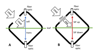
Federal
Tundra Plant Leaf-level Spectral Reflectance and Chlorophyll Fluorescence, 2019-2021
National Aeronautics and Space Administration —
This dataset provides leaf-level visible-near infrared spectral reflectance, chlorophyll fluorescence spectra, species, plant functional type (PFT), and chlorophyll... -
Federal
Radiant Temp. Multiangle Data (FIFE)
National Aeronautics and Space Administration —
The Surface Temperatures Measured at Multiple Angles Data Set was collected at two locations within the northwest quadrant of the FIFE study area during July and... -
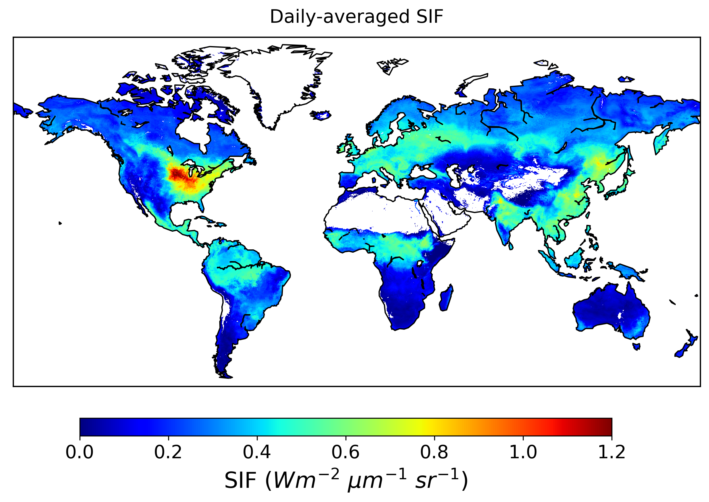
Federal
Global High-Resolution Estimates of SIF from Fused SCIAMACHY and GOME-2, V2
National Aeronautics and Space Administration —
This dataset provides global solar-induced chlorophyll fluorescence (SIF) estimates at a 0.05-degree resolution (approximately 5 km at the equator) for each month... -
Federal
LiDAR Surveys over Selected Forest Research Sites, Brazilian Amazon, 2008-2018
National Aeronautics and Space Administration —
This dataset provides the complete catalog of point cloud data collected during LiDAR surveys over selected forest research sites across the Amazon rainforest in... -
Federal
BOREAS RSS-14 GOES-8 Level-1a Visible, Infrared and Water Vapor Images
National Aeronautics and Space Administration —
The BOREAS RSS-14 team collected and processed several GOES-7 and GOES-8 image data sets that covered the BOREAS study region. The level-1a GOES-8 images were created... -
Federal
Stream Flow Daily Data: USGS (FIFE)
National Aeronautics and Space Administration —
The Daily Stream Flow Amounts Data Set contains daily measurements of stream flow for the four LTER stations and for the USGS stream-flow station located on...

Official websites use .gov
A
.gov website belongs to an official government
organization in the United States.
Secure .gov websites use HTTPS
A
lock (
) or https:// means you’ve safely connected to
the .gov website. Share sensitive information only on official,
secure websites.