
-
Federal
LiDAR Surveys over Selected Forest Research Sites, Brazilian Amazon, 2008-2018
National Aeronautics and Space Administration —
This dataset provides the complete catalog of point cloud data collected during LiDAR surveys over selected forest research sites across the Amazon rainforest in... -
Federal
A Global Database of Gas Fluxes from Soils after Rewetting or Thawing, Version 1.0
National Aeronautics and Space Administration —
This database contains information compiled from published studies on gas flux from soil following rewetting or thawing. The resulting database includes 222 field and... -
Federal
Delta-X: AVIRIS-NG L3 Derived Herbaceous Aboveground Biomass, MRD, Louisiana, USA, V3
National Aeronautics and Space Administration —
This dataset includes high-resolution (~5 m) gridded estimates of aboveground biomass (AGB), aboveground necromass (AGN), and aboveground net primary productivity... -
Federal
Impacts of Wildfires on Boreal Forest Ecosystem Carbon Dynamics
National Aeronautics and Space Administration —
This dataset contains simulations of net primary production (NPP), heterotrophic respiration (RH), net ecosystem production (NEP), and soil temperature data in North... -
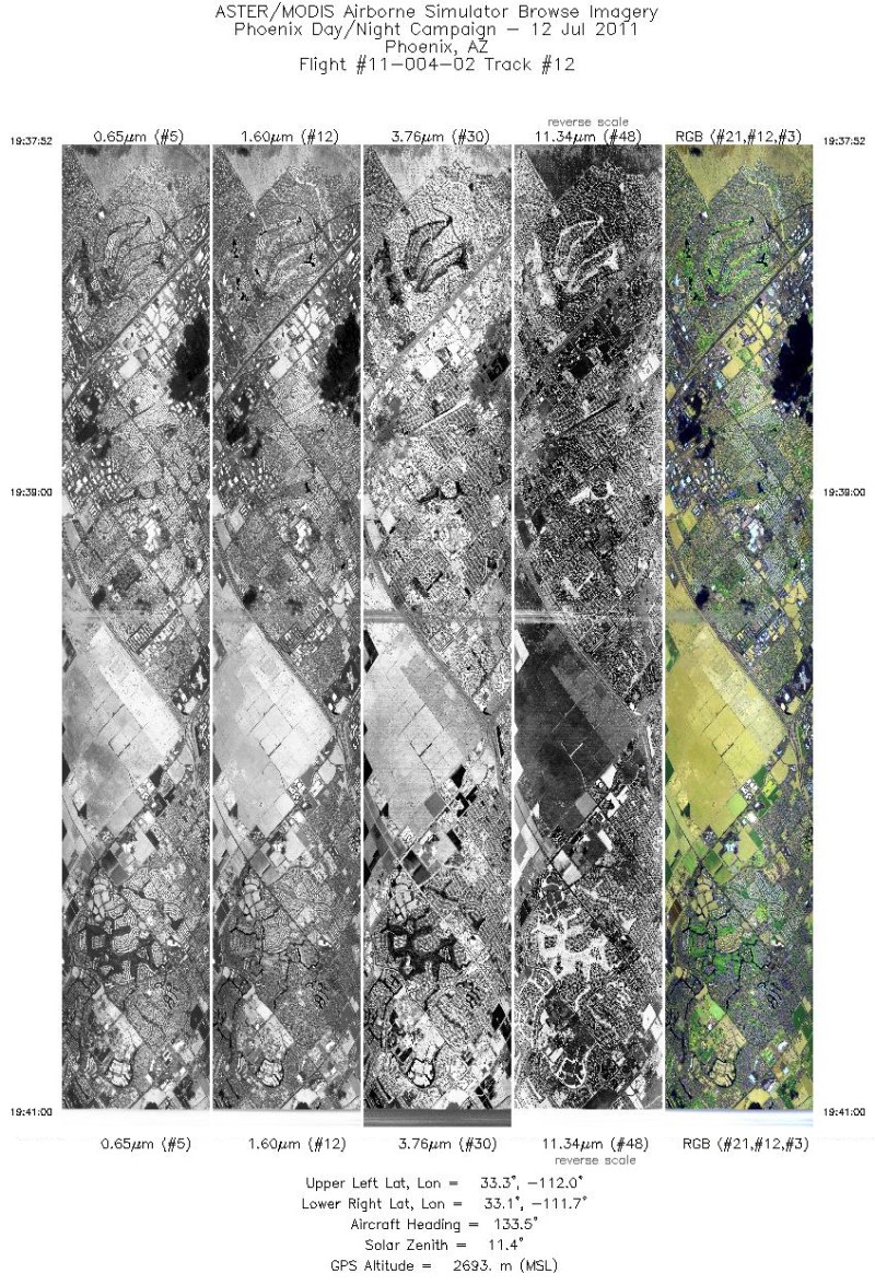
Federal
MASTER: Heat Island Airborne Study, Phoenix, Arizona, 2011
National Aeronautics and Space Administration —
This dataset includes Level 1B (L1B) data products from the MODIS/ASTER Airborne Simulator (MASTER) instrument. The spectral data were collected during five flights... -
Federal
MASTER: HyspIRI Airborne Campaign, California, Spring 2015
National Aeronautics and Space Administration —
This dataset includes Level 1B (L1B) and Level 2 (L2) data products from the MODIS/ASTER Airborne Simulator (MASTER) instrument. The spectral data were collected as... -
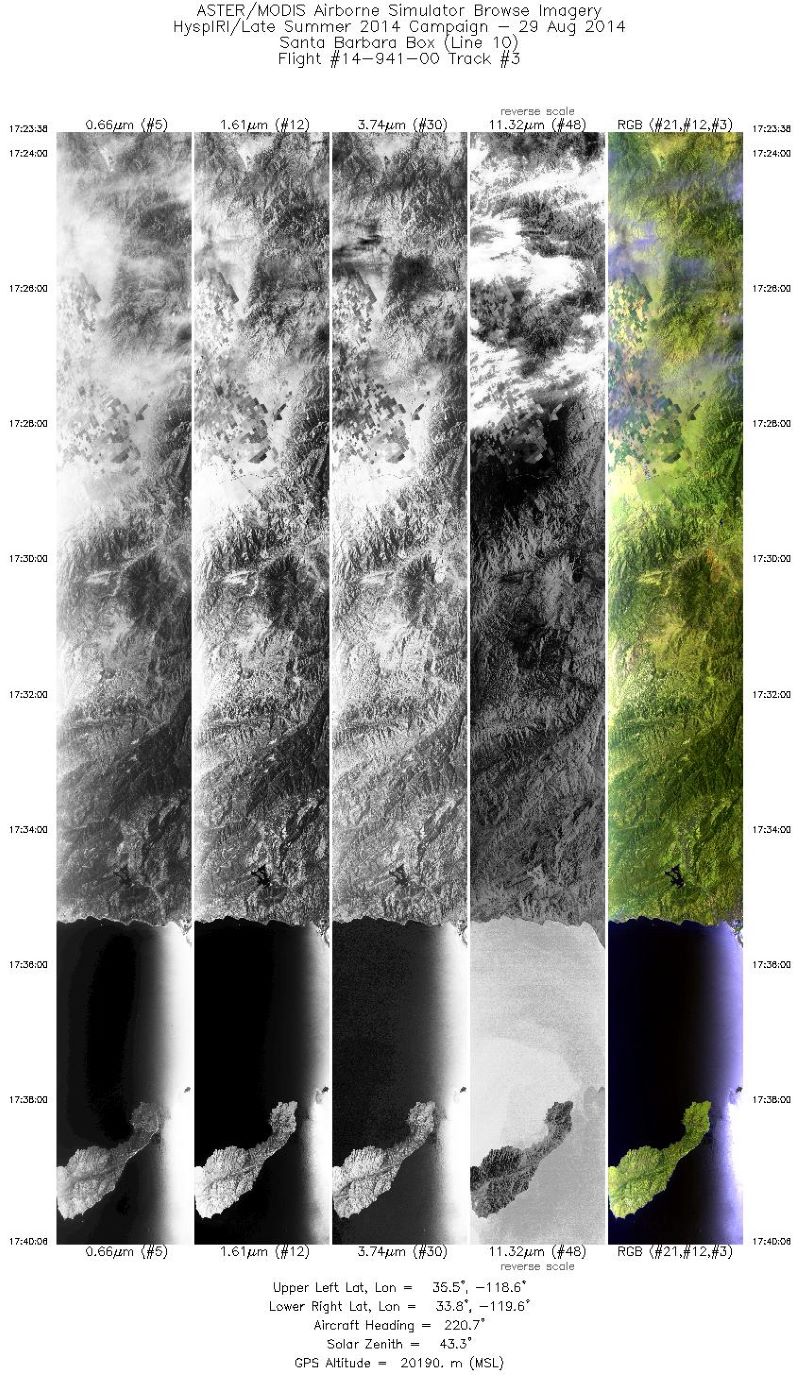
Federal
MASTER: HyspIRI Airborne Campaign, California, Summer 2014
National Aeronautics and Space Administration —
This dataset includes Level 1B (L1B) and Level 2 (L2) data products from the MODIS/ASTER Airborne Simulator (MASTER) instrument. The spectral data were collected as... -
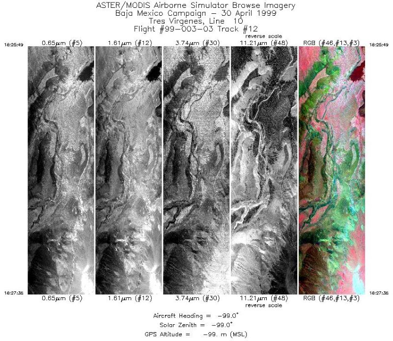
Federal
MASTER: Airborne Science, Baja Mexico-Nevada, April-May, 1999
National Aeronautics and Space Administration —
This dataset includes Level 1B (L1B) data products from the MODIS/ASTER Airborne Simulator (MASTER) instrument. The spectral data were collected during 7 flights... -
Federal
MASTER: Airborne Science, California-Nevada, May-June, 2008
National Aeronautics and Space Administration —
This dataset includes Level 1B (L1B) and Level 2 (L2) data products from the MODIS/ASTER Airborne Simulator (MASTER) instrument. The spectral data were collected as... -
Federal
MASTER: Airborne Science, Nevada, May 2006
National Aeronautics and Space Administration —
This dataset includes Level 1B (L1B) data products from the MODIS/ASTER Airborne Simulator (MASTER) instrument. The spectral data were collected during five flights... -
Federal
RLC State and Regional Boundaries for the Former Soviet Union
National Aeronautics and Space Administration —
This data set of state and regional boundaries was derived from the 1:3 million scale administrative boundaries (ESRI, 1998) for the land area of the Former Soviet... -
Federal
Soil Organic Carbon and Wetland Intrinsic Potential, Hoh River Watershed, WA, 2012-13
National Aeronautics and Space Administration —
This dataset contains estimates of soil organic carbon stocks and wetland intrinsic potential (WIP) across the Hoh River Watershed in the Olympic Peninsula, WA, USA... -
Federal
Simulated Fine Particulate Matter (PM2.5) Estimates over Alaska, 2001-2015
National Aeronautics and Space Administration —
The dataset provides simulated PM2.5 concentration estimates over Alaska, U.S. PM2.5 (particulate matter with diameter <= 2.5 microns) concentrations in air... -
Federal
Coastal Wetland Elevation and Carbon Flux Inventory with Uncertainty, USA, 2006-2011
National Aeronautics and Space Administration —
This dataset provides maps of coastal wetland carbon and methane fluxes and coastal wetland surface elevation from 2006 to 2011 at 30 m resolution for coastal... -
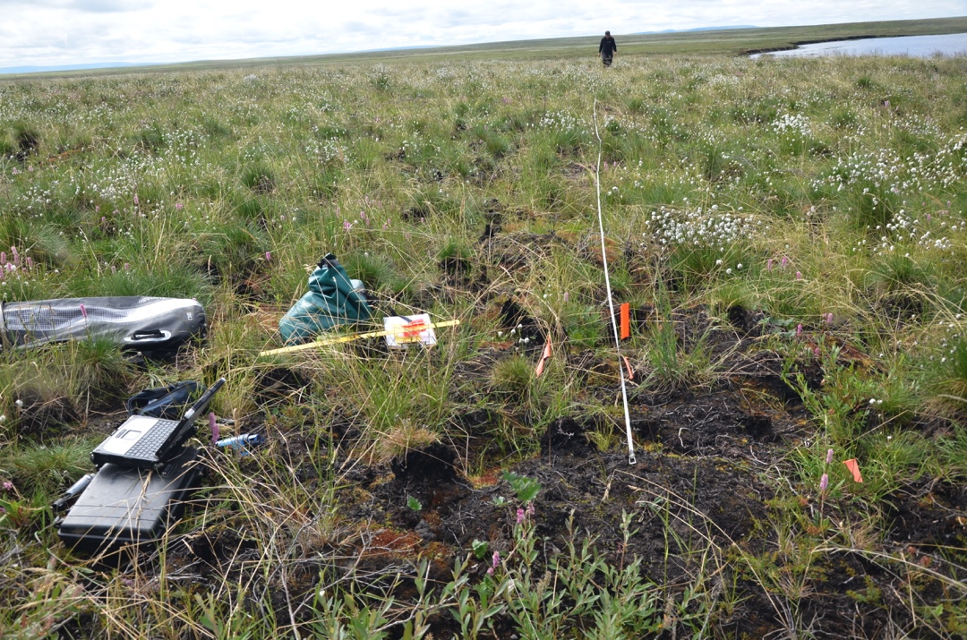
Federal
Arctic Vegetation Plots in Burned and Unburned Tundra, Alaska, 2011-2012
National Aeronautics and Space Administration —
This dataset provides environmental and vegetation data collected in late June and July of 2011 and of 2012 from study plots located in tundra fire scars and adjacent... -
Federal
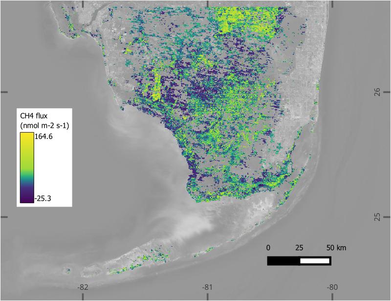
BlueFlux: Modeled Daily CO2 and CH4 Wetland Fluxes, Southern Florida, 2000-2024
National Aeronautics and Space Administration —
This dataset contains gridded estimates of carbon dioxide (CO2) and methane (CH4) fluxes at daily resolution covering the Southern Florida region from 2000 to 2024.... -
Federal
COMEX: Flight Information for AJAX Airborne In Situ CO2 and CH4, 2014-2015, USA
National Aeronautics and Space Administration —
This dataset provides information to access NASA Earthdata published flight data and flight information collected by the Alpha Jet Atmospheric eXperiment (AJAX) and... -
Federal
MODIS-derived Aggregate, Woody and Herbaceous Leaf Area Index for Africa, 2002-2022
National Aeronautics and Space Administration —
This dataset provides leaf area index (LAI) estimates for Sub-Saharan Africa for woody, herbaceous, and aggregate vegetation types. The estimates were derived from...

Official websites use .gov
A
.gov website belongs to an official government
organization in the United States.
Secure .gov websites use HTTPS
A
lock (
) or https:// means you’ve safely connected to
the .gov website. Share sensitive information only on official,
secure websites.