
-
Federal
LUH1: Harmonized Global Land Use for Years 1500-2100, V1
National Aeronautics and Space Administration —
These data represent fractional land use and land cover patterns annually for the years 1500 - 2100 for the globe at 0.5-degree (~50-km) spatial resolution. Land use... -
Federal
NACP Site: Terrestrial Biosphere Model Output Data in Original Format
National Aeronautics and Space Administration —
This data set contains the original model output data submissions from the 24 terrestrial biosphere models (TBM) that participated in the North American Carbon... -
Federal
CARVE: L2 Atmospheric Gas Concentrations, Airborne Flasks, Alaska, 2012-2015
National Aeronautics and Space Administration —
This data set provides atmospheric carbon dioxide (CO2), methane (CH4), carbon monoxide (CO), molecular hydrogen (H2), nitrous oxide (N2O), sulfur hexafluoride (SF6),... -
Federal
Global 1-degree Maps of Forest Area, Carbon Stocks, and Biomass, 1950-2010
National Aeronautics and Space Administration —
This data set provides global forest area, forest growing stock, and forest biomass data at 1-degree resolution for the period 1950-2010. The data set is based on a... -
Federal
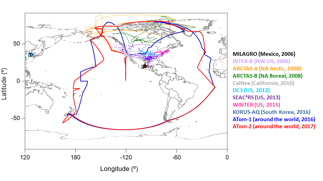
Airborne Observations and Modeling Comparison of Global Inorganic Aerosol Acidity
National Aeronautics and Space Administration —
This dataset provides observations collected during eleven airborne campaigns from 2006–2017 and associated input and output from nine widely used chemical transport... -
Federal
BOREAS HYD-03 Snow Temperature Profiles
National Aeronautics and Space Administration —
The BOREAS HYD-03 team collected several data sets related to the hydrology of forested areas. This data set contains measurements of snow depth, snow density in 3-cm... -
Federal
Global Data Set of Derived Soil Properties, 0.5-Degree Grid (ISRIC-WISE)
National Aeronautics and Space Administration —
The World Inventory of Soil Emission Potentials (WISE) database currently contains data for over 4300 soil profiles collected mostly between 1950 and 1995. This... -
Federal
Regridded Harmonized World Soil Database v1.2
National Aeronautics and Space Administration —
This data set describes select global soil parameters from the Harmonized World Soil Database (HWSD) v1.2, including additional calculated parameters such as area... -
Federal
Global Vegetation Greenness (NDVI) from AVHRR GIMMS-3G+, 1981-2022
National Aeronautics and Space Administration —
This dataset holds the Global Inventory Modeling and Mapping Studies-3rd Generation V1.2 (GIMMS-3G+) data for the Normalized Difference Vegetation Index (NDVI). NDVI... -
Federal
Global Fire Atlas with Characteristics of Individual Fires, 2003-2016
National Aeronautics and Space Administration —
The Global Fire Atlas is a global dataset that tracks the day-to-day dynamics of individual fires to determine the timing and location of ignitions, fire size,... -
Federal
SAFARI 2000 Wetlands Data Set, 1-Deg (Matthews and Fung)
National Aeronautics and Space Administration —
This database, compiled by Matthews and Fung (1987), provides information on the distribution and environmental characteristics of natural wetlands. The database was... -
Federal
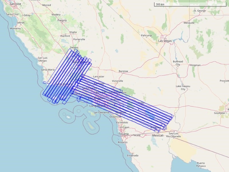
COMEX: AVIRIS-Classic Facility Instrument Associated Flights and Information, 2014
National Aeronautics and Space Administration —
This dataset lists flight lines and provides data access links and contextual flight information for a subset of the AVIRIS-Classic Facility Instrument Collection... -
Federal
ABoVE: CO2 and CH4 Fluxes and Meteorology at Flux Tower Sites, Alaska, 2015-2017
National Aeronautics and Space Administration —
This dataset provides CO2 and CH4 fluxes and meteorological parameters from five eddy covariance (EC) tower sites located at Barrow (three sites), Atqasuk (ATQ) and... -
Federal
Canopy Height and Biomass from LiDAR Surveys at La Selva, Costa Rica, 1998 and 2005
National Aeronautics and Space Administration —
This data set contains land-use, canopy height, and aboveground carbon estimates derived from LiDAR data collected at La Selva Biological Station in Costa Rica in... -
Federal
ABoVE: Ignitions, Burned Area, and Emissions of Fires in AK, YT, and NWT, 2001-2018
National Aeronautics and Space Administration —
This dataset provides estimates of daily burned area, carbon emissions, and uncertainty, and daily fire ignition locations for boreal fires in Alaska, U.S., and in... -
Federal
BOREAS TE-10 Leaf Chemistry Data
National Aeronautics and Space Administration —
The BOREAS TE-10 team collected several data sets in support of its efforts to characterize and interpret information on the reflectance, transmittance, gas exchange,... -
Federal
LBA-ECO CD-06 Biogeochemistry of Ji-Parana River and Tributaries, Brazil: 1999-2003
National Aeronautics and Space Administration —
This data set provides spatially extensive and temporally intensive surveys of the river biogeochemistry of the Ji-Parana River Basin in Western Amazonia, Rondonia,... -
Federal
BOREAS HYD-06 Moss/Humus Moisture Data
National Aeronautics and Space Administration —
This data set contains water content measurements of the moss/humus layer, where it existed. These data were collected along various flight lines in the Southern and...

Official websites use .gov
A
.gov website belongs to an official government
organization in the United States.
Secure .gov websites use HTTPS
A
lock (
) or https:// means you’ve safely connected to
the .gov website. Share sensitive information only on official,
secure websites.