

6 datasets found for "florida "
-
Federal
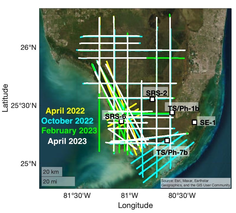
BlueFlux Airborne Trace Gases, Fluxes, and Mixing Ratios, Southern Florida, 2022-2023
National Aeronautics and Space Administration —
This dataset includes airborne in situ measurements of greenhouse gas mixing ratios, meteorological parameters, and fluxes (CO2, CH4, latent heat fluxes, friction... -
Federal
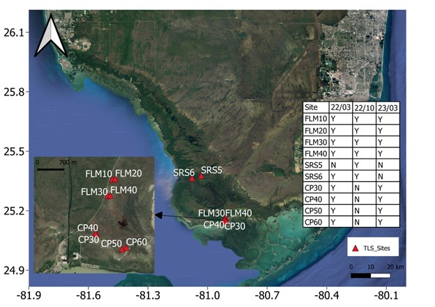
Blueflux: Terrestrial Lidar Scans of Mangrove Forests, Everglades, FL, USA, 2022-2023
National Aeronautics and Space Administration —
This dataset contains point clouds of three-dimensional (3D) mangrove forest structure and volume collected from 10 sites in Everglades National Park, Florida. Data... -
Federal
MASTER: BP Oil Spill Mapping, Louisiana-Gulf of Mexico-Wisconsin, Fall, 2010
National Aeronautics and Space Administration —
This dataset includes Level 1B (L1B) and Level 2 (L2) data products from the MODIS/ASTER Airborne Simulator (MASTER) instrument. The raw data were collected during 9... -
Federal
MASTER: BP Oil Spill Mapping, Louisiana-Gulf of America-Wisconsin, Fall, 2010
National Aeronautics and Space Administration —
This dataset includes Level 1B (L1B) and Level 2 (L2) data products from the MODIS/ASTER Airborne Simulator (MASTER) instrument. The raw data were collected during 9... -
Federal
MASTER: FireSense, California and Southern US, Spring 2025
National Aeronautics and Space Administration —
This dataset includes Level 1B (L1B) and Level 2 (L2) data products from the MODIS/ASTER Airborne Simulator (MASTER) instrument. The spectral data were collected as... -
Federal
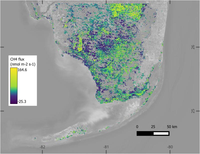
BlueFlux: Modeled Daily CO2 and CH4 Wetland Fluxes, Southern Florida, 2000-2024
National Aeronautics and Space Administration —
This dataset contains gridded estimates of carbon dioxide (CO2) and methane (CH4) fluxes at daily resolution covering the Southern Florida region from 2000 to 2024....
6 datasets found for "florida "