
-
Federal
ABoVE: Active Layer Thickness from Remote Sensing Permafrost Model, Alaska, 2001-2015
National Aeronautics and Space Administration —
This dataset provides annual estimates of active layer thickness (ALT) at 1 km resolution across Alaska from 2001-2015. The ALT was estimated using a remote sensing-... -
Federal
BOREAS HYD-03 Snow Temperature Profiles
National Aeronautics and Space Administration —
The BOREAS HYD-03 team collected several data sets related to the hydrology of forested areas. This data set contains measurements of snow depth, snow density in 3-cm... -
Federal
ABoVE: CO2 and CH4 Fluxes and Meteorology at Flux Tower Sites, Alaska, 2015-2017
National Aeronautics and Space Administration —
This dataset provides CO2 and CH4 fluxes and meteorological parameters from five eddy covariance (EC) tower sites located at Barrow (three sites), Atqasuk (ATQ) and... -
Federal
Daily SnowModel Outputs Covering the ABoVE Core Domain, 3-km Resolution, 1980-2020
National Aeronautics and Space Administration —
This dataset provides daily SnowModel simulation outputs on a 3-km grid for the period 1 September 1980 through 31 August 2020, covering the Core ABoVE Domain. The... -
Federal
BOREAS Derived Surface Meteorological Data
National Aeronautics and Space Administration —
In 1995, the BOREAS science teams identified the need for a continuous surface meteorological and radiation data set to support flux and surface process modeling... -
Federal
Passive Microwave-derived Annual Snowoff Date Maps, 1988-2023
National Aeronautics and Space Administration —
This dataset provides annual maps of the snowoff (SO) date from 1988-2023 across Alaska and parts of Far East Russia and northwest Canada at a resolution of 6.25 km.... -
Federal
Maps of Vegetation, NDVI, Snow and Thaw Depths: North Slope, Alaska and NWT, Canada
National Aeronautics and Space Administration —
This dataset includes vegetation cover maps, Normalized Difference Vegetation Index (NDVI) maps, snow depth and thaw depth data that were obtained as part of a... -
Federal
ABoVE: Environmental Conditions and Subsistence Resource Access, Alaska, 2016-2017
National Aeronautics and Space Administration —
This dataset provides descriptions and photos of environmental conditions that impacted availability to subsistence resources by residents in nine rural communities... -
Federal
ABoVE: Dall Sheep Response to Snow and Landscape Covariates, Alaska, 2005-2008
National Aeronautics and Space Administration —
This dataset provides daily estimates of snow depth and snow density for the study area in Lake Clark National Park and Preserve (LCNPP), Alaska. The data were... -
Federal
ABoVE: Dall Sheep Track Sinking Depths, Snow Depth, Hardness, and Density, 2017
National Aeronautics and Space Administration —
This dataset contains Dall sheep (Ovis dalli dalli) hoof sinking depths in snow tracks, and snow depth, hardness, and density measurements in snow pits adjacent to... -
Federal
Alaska's Changing YK Delta: Knowledge Exchange between Elders and Geoscientists, 2018
National Aeronautics and Space Administration —
This dataset provides a booklet documenting the discussions and outcomes from a knowledge-exchange meeting with Yup'ik elders from the Yukon-Kuskokwim Delta (YKD),... -
Federal
BOREAS AES Canadian Hourly and Daily Surface Meteorological Data, R1
National Aeronautics and Space Administration —
This data set contains hourly and daily meteorological data from 23 meteorological stations across Canada from January 1975 to January 1997. The surface meteorology... -
Federal
BOREAS HYD-03 Snow Water Equivalent: 1996
National Aeronautics and Space Administration —
The BOREAS HYD-03 team collected several data sets related to the hydrology of forested areas. This data set contains measurements of snow depth, snow density in 3-cm... -
Federal
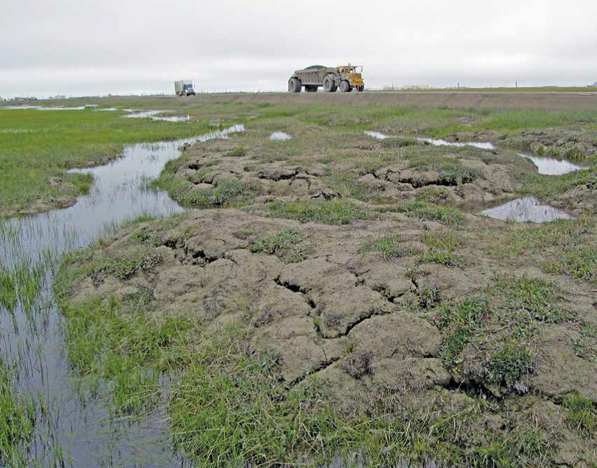
Arctic Vegetation Plots, Prudhoe Bay ArcSEES Road Study, Lake Colleen, Alaska, 2014
National Aeronautics and Space Administration —
This dataset provides environmental, soil, and vegetation data collected from study plots in the vicinity of Lake Colleen off the Spine Road at Prudhoe Bay, Alaska,... -
Federal
BOREAS HYD-04 Areal Snow Course Survey Data
National Aeronautics and Space Administration —
The BOREAS HYD-04 work was focused on collecting data during the winter field campaign (FFC-W) to improve the understanding of winter processes within the boreal... -
Federal
BOREAS HYD-03 Snow Water Equivalent Data
National Aeronautics and Space Administration —
The BOREAS HYD-03 team collected several data sets related to the hydrology of forested areas. This data set contains measurements of snow depth, snow density in 3-cm... -
Federal
Snow Properties and Wildlife Tracks in Washington and Alaska
National Aeronautics and Space Administration —
This dataset contains three field seasons of snow-wildlife observations conducted at 707 sites from January 2021 to March 2023 in Washington and Alaska, spanning a... -
Federal
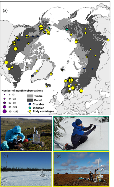
The ABCflux Database: Arctic-Boreal CO2 Flux and Site Environmental Data, 1989-2020
National Aeronautics and Space Administration —
This Arctic-Boreal CO2 fluxes (ABCflux) dataset contains monthly aggregates of terrestrial net ecosystem CO2 exchange and its derived partitioned component fluxes:... -
Federal
BOREAS/AES Campbell Scientific 15-minute Surface Meteorological Data: 1993
National Aeronautics and Space Administration —
Canadian AES personnel collected data related to surface and atmospheric meteorological conditions over the BOREAS Region. This data set contains 15 minute... -
Federal
ABoVE: Passive Microwave-derived Annual Snowoff Date Maps, 1988-2018
National Aeronautics and Space Administration —
This dataset provides annual maps of the snowoff (SO) date from 1988-2018 across Alaska and parts of Far East Russia and northwest Canada at a resolution of 6.25 km....

Official websites use .gov
A
.gov website belongs to an official government
organization in the United States.
Secure .gov websites use HTTPS
A
lock (
) or https:// means you’ve safely connected to
the .gov website. Share sensitive information only on official,
secure websites.