
-
Federal
LUH1: Harmonized Global Land Use for Years 1500-2100, V1
National Aeronautics and Space Administration —
These data represent fractional land use and land cover patterns annually for the years 1500 - 2100 for the globe at 0.5-degree (~50-km) spatial resolution. Land use... -
Federal
LUH2-ISIMIP2b Harmonized Global Land Use for the Years 2015-2100
National Aeronautics and Space Administration —
This dataset provides 0.25-degree gridded, global, annual estimates of fractional land use and land cover patterns for the period 2015-2100, designed to support the... -
Federal
NPP Tropical Forest: Cinnamon Bay, U.S. Virgin Islands, 1982-1993, R1
National Aeronautics and Space Administration —
This data set contains three ASCII files (.txt format). One data file contains above-ground biomass, litter, litterfall, herbivory, biomass change, and above-ground... -
Federal
LBA-ECO ND-01 Landsat 28.5-m Land Cover Time Series, Rondonia, Brazil: 1984-2010
National Aeronautics and Space Administration —
This data set provides a 27-year land cover time series of 28.5-m resolution products derived from Landsat images for 80% of Rondonia, Brazil, for the period 1984 to... -
Federal
Biome-BGC: Terrestrial Ecosystem Process Model, Version 4.1.1
National Aeronautics and Space Administration —
Biome-BGC is a computer program that estimates fluxes and storage of energy, water, carbon, and nitrogen for the vegetation and soil components of terrestrial... -
Federal
LBA Regional Vegetation and Soils, 1-Degree (Wilson and Henderson-Sellers)
National Aeronautics and Space Administration —
This data set is a subset of a global vegetation and soils data set by Wilson and Henderson-Sellers (1985a). The subset was created for the study area of the Large... -
Federal
SAFARI 2000 Vegetation and Soils, 1-Deg (Wilson and Henderson-Sellers)
National Aeronautics and Space Administration —
This data set contains a subset for southern Africa of Wilson and Henderson-Sellers' Global Vegetation & Soils 1-degree data. The data are available in both ASCII... -
Federal
SAFARI 2000 Atmospheric Aerosol Measurements, Hand-held Hazemeters, Zambia
National Aeronautics and Space Administration —
Data presented in this database are the result of Hand Held 4-band Hazemeters and do not always satisfy to the high standards of quality associated with Automatic... -
Federal
Tree Inventory and Biometry Measurements, Tapajos National Forest, Para, Brazil, 2010
National Aeronautics and Space Administration —
This dataset provides tree inventory, tree height, diameter at breast height (DBH), and estimated crown measurements from 30 plots located in the Tapajos National... -
Federal
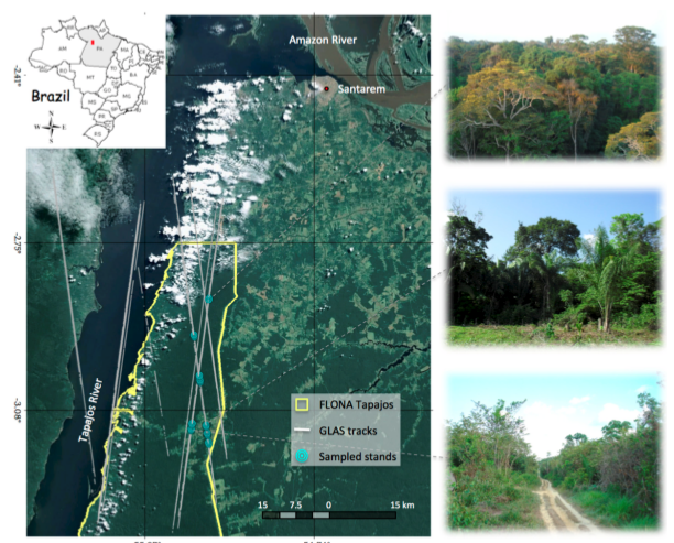
LBA-ECO TG-07 Forest Structure Measurements for GLAS Validation: Santarem 2004
National Aeronautics and Space Administration —
This data set provides the results of a GLAS (the Geoscience Laser Altimeter System) forest structure validation survey conducted in Santarem and Sao Jorge, Para... -
Federal
LBA-ECO ND-02 Cation Leaching from Forest and Pasture Soils, Para, Brazil
National Aeronautics and Space Administration —
This data set provides a time series of calcium, magnesium, and potassium concentrations extracted from soil samples from a laboratory column extraction study... -
Federal
LBA-ECO ND-30 Fractional Cover of Mixed Land Use Ranches, Para and Rondonia, Brazil
National Aeronautics and Space Administration —
This data set contains images of fractional cover estimates of photosynthetic vegetation (PV) canopy, nonphotosynthetic vegetation (NPV), and exposed soils (S)... -
Federal
Classification of Global Forests for IPCC Aboveground Biomass Tier 1 Estimates, 2020
National Aeronautics and Space Administration —
This dataset provides classes of global forests delineated by status/condition in 2020 at approximately 30-m resolution. The data support generating Tier 1 estimates... -
Federal
LBA-ECO ND-04 Termite Mound and Soil Characterization, Amazonas, Brazil: 1999-2001
National Aeronautics and Space Administration —
This data set reports the results of a comprehensive study of mound building termites at the Embrapa research station in the Distrito Agropecuario da SUFRAMA, located... -
Federal
NPP Multi-Biome: PIK Data for Northern Eurasia, 1940-1988 (Based on Bazilevich), R1
National Aeronautics and Space Administration —
There is one comma-separated (.csv) data file and one text (.txt) file (bibliographic information) with this data set. This data set provides above-ground net primary... -
Federal
Forest Structure and Biomass Data, La Selva, Costa Rica: 2006
National Aeronautics and Space Administration —
This data set provides field measurements of diameter, tree height, and crown dimensions for 1,513 trees in 30 plots at the La Selva Biological Station in Costa Rica....

Official websites use .gov
A
.gov website belongs to an official government
organization in the United States.
Secure .gov websites use HTTPS
A
lock (
) or https:// means you’ve safely connected to
the .gov website. Share sensitive information only on official,
secure websites.