
-
Federal
A Global Database of Gas Fluxes from Soils after Rewetting or Thawing, Version 1.0
National Aeronautics and Space Administration —
This database contains information compiled from published studies on gas flux from soil following rewetting or thawing. The resulting database includes 222 field and... -
Federal
Pantropical Forest Height and Biomass from GEDI and TanDEM-X Data Fusion
National Aeronautics and Space Administration —
This dataset includes maps of canopy height and aboveground biomass at spatial resolutions of 25 m and 100 m for Mexico, Gabon, French Guiana, and the Amazon Basin.... -
Federal
Delta-X: Digital Elevation Model, MRD, LA, USA, 2021
National Aeronautics and Space Administration —
This dataset provides an updated digital elevation model (DEM) for the Atchafalaya and Terrebonne basins in coastal Louisiana, USA. The DEM is updated from the Pre-... -
Federal
ABoVE: Wetland Vegetation Classification for Peace-Athabasca Delta, Canada, 2019
National Aeronautics and Space Administration —
This dataset contains land cover classification focused on water and wetland vegetation communities over the Peace-Athabasca Delta, Canada. Four classification maps... -
Federal
ABoVE: Passive Microwave-derived Annual Snowpack Main Melt Onset Date Maps, 1988-2023
National Aeronautics and Space Administration —
This dataset provides the annual date of snowpack seasonal beginning melt (i.e., main melt onset date, MMOD) across northwest Canada, Alaska, US, and parts of far... -
Federal
MASTER: FireSense, California and Southern US, Spring 2025
National Aeronautics and Space Administration —
This dataset includes Level 1B (L1B) and Level 2 (L2) data products from the MODIS/ASTER Airborne Simulator (MASTER) instrument. The spectral data were collected as... -
Federal
MASTER: Wildfire and farmland mapping, California, July, 2004
National Aeronautics and Space Administration —
This dataset includes Level 1B (L1B) and Level 2 (L2) data products from the MODIS/ASTER Airborne Simulator (MASTER) instrument. The spectral data were collected... -
Federal
Water Quality and Spectral Reflectance, Peace-Athabasca Delta, Canada, 2010-2011
National Aeronautics and Space Administration —
The Peace-Athabasca Delta (PAD) is a hydrologically complex and ecologically diverse freshwater delta formed by the confluence of the Peace, Athabasca, and Birch... -
Federal
PhenoCam Dataset v3.0: Vegetation Phenology from Digital Camera Imagery, 2000-2023
National Aeronautics and Space Administration —
This dataset provides vegetation phenological observations for 738 sites across diverse ecosystems of the world (mostly North America) from 2000 to 2023. The... -
Federal
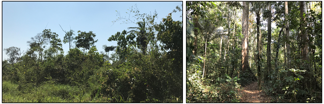
Forest Inventories and DBH at Burned and Unburned Forest Sites, Acre, Brazil, 2017
National Aeronautics and Space Administration —
This data set provides measurements of diameter at breast height (DBH) and species identification at four forest sites in the eastern side of Acre, Brazil including... -
Federal
Global Soil Types, 0.5-Degree Grid (Modified Zobler)
National Aeronautics and Space Administration —
A global data set of soil types is available at 0.5-degree latitude by 0.5-degree longitude resolution. There are 106 soil units, based on Zobler?s (1986) assessment... -
Federal
Gridded GEDI Vegetation Structure Metrics and Biomass Density at Multiple Resolutions
National Aeronautics and Space Administration —
This dataset consists of near-global, analysis-ready, multi-resolution gridded vegetation structure metrics derived from NASA Global Ecosystem Dynamics Investigation... -
Federal
Delta-X: AVIRIS-NG BRDF-Adjusted Surface Reflectance and Mosaics, MRD, LA, 2021, V3
National Aeronautics and Space Administration —
This data provides AVIRIS-NG Bidirectional Reflectance Distribution Function (BRDF) and sunglint-corrected surface spectral reflectance images over the Atchafalaya... -
Federal
ABoVE: Vegetation Composition across Fire History Gradients on the Y-K Delta, Alaska
National Aeronautics and Space Administration —
This dataset provides ecological field data that were collected during July 2017 and July 2018 from 43 plots spanning gradients of fire history in the upland tundra... -
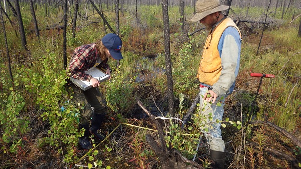
Federal
ABoVE: Post-Fire and Unburned Vegetation Community and Field Data, NWT, Canada, 2018
National Aeronautics and Space Administration —
This dataset provides vegetation community characteristics and biophysical data collected in 2018 from areas that were burned by wildfire in 2014 and 2015, and from... -
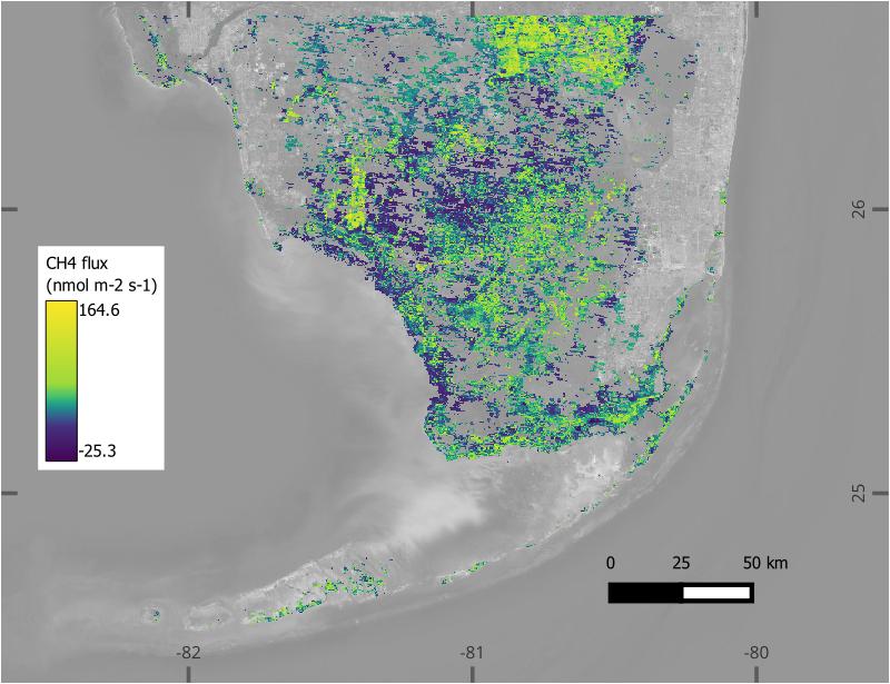
Federal
BlueFlux: Modeled Daily CO2 and CH4 Wetland Fluxes, Southern Florida, 2000-2024
National Aeronautics and Space Administration —
This dataset contains gridded estimates of carbon dioxide (CO2) and methane (CH4) fluxes at daily resolution covering the Southern Florida region from 2000 to 2024.... -
Federal
COMEX: Flight Information for AJAX Airborne In Situ CO2 and CH4, 2014-2015, USA
National Aeronautics and Space Administration —
This dataset provides information to access NASA Earthdata published flight data and flight information collected by the Alpha Jet Atmospheric eXperiment (AJAX) and... -
Federal
Annual Land Use and Urban Land Cover: Ethiopia, Nigeria, and South Africa, 2016-2020
National Aeronautics and Space Administration —
This dataset provides a two-tier annual Land Use (LU) and Urban Land Cover (LC) product suite over three African countries, Ethiopia, Nigeria, and South Africa,... -
Federal
NACP: Urban Greenhouse Gases across the CO2 Urban Synthesis and Analysis Network, V2
National Aeronautics and Space Administration —
This dataset provides hourly urban greenhouse gas measurements for cities in the CO2 Urban Synthesis and Analysis (CO2-USA) Data Synthesis Network for 2000 to 2019.... -
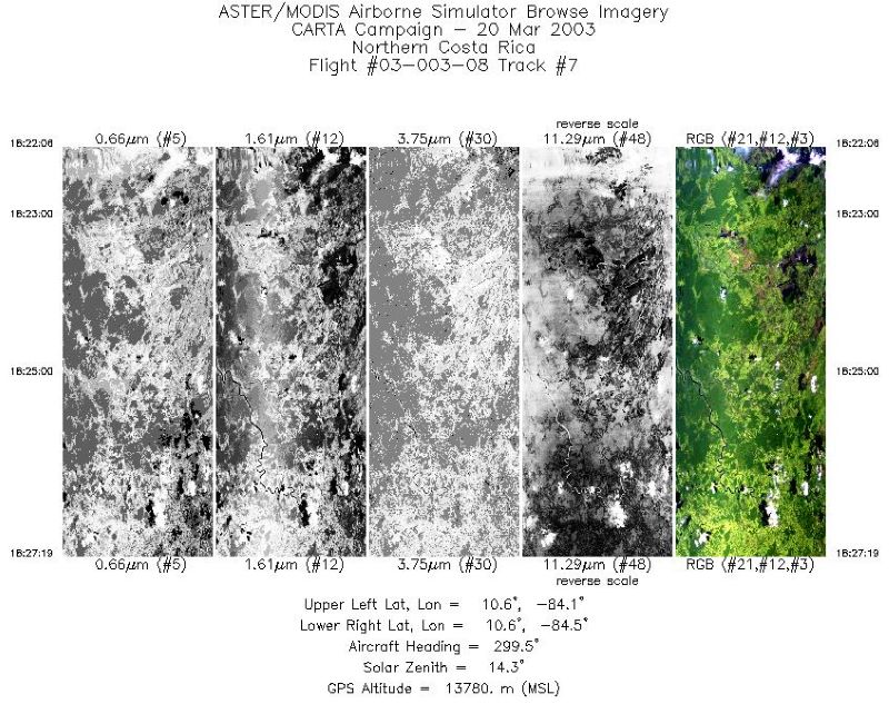
Federal
MASTER: Costa Rica Airborne Research and Technology Applications, March, 2003
National Aeronautics and Space Administration —
This dataset includes Level 1B (L1B) data products from the MODIS/ASTER Airborne Simulator (MASTER) instrument. The spectral data were collected during 14 flights...

Official websites use .gov
A
.gov website belongs to an official government
organization in the United States.
Secure .gov websites use HTTPS
A
lock (
) or https:// means you’ve safely connected to
the .gov website. Share sensitive information only on official,
secure websites.