

4 datasets found for "National Sediment Inventory"
-
Federal
GEDI-FIA Fusion: Training Lidar Models to Estimate Forest Attributes
National Aeronautics and Space Administration —
This dataset includes interpolated cumulative waveforms, with uncertainties, over national forest inventory (FIA) field plots across the contiguous United States. The... -
Federal
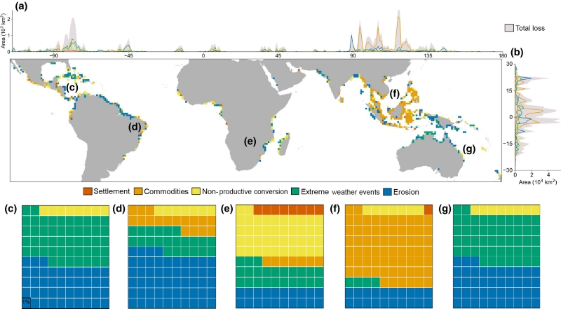
Global Mangrove Loss Extent, Land Cover Change, and Loss Drivers, 2000-2016
National Aeronautics and Space Administration —
This dataset provides estimates of the extent of mangrove loss, land cover change, and its anthropogenic or climatic drivers in three time periods: 2000-2005,... -
Federal
LBA-ECO LC-14 Biophysical Measurements, Rainfall Exclusion, Tapajos National Forest
National Aeronautics and Space Administration —
This data set reports forest biophysical measurements from a rainfall exclusion experiment conducted at the km 67 Seca Floresta site, Tapajos National Forest, Brazil... -
Federal
Classification of Global Forests for IPCC Aboveground Biomass Tier 1 Estimates, 2020
National Aeronautics and Space Administration —
This dataset provides classes of global forests delineated by status/condition in 2020 at approximately 30-m resolution. The data support generating Tier 1 estimates...
4 datasets found for "National Sediment Inventory"