
-
Federal
Delta-X: Delft3D Sediment Model, Site 322, Terrebonne Basin, MRD, Louisiana, USA
National Aeronautics and Space Administration —
This dataset contains the Delft3D model of the intensive site 322 in the Terrebonne Basin along the Mississippi River Delta (MRD) in coastal Louisiana. Simulations... -
Federal
Delta-X: NUMAR Soil Accretion Modeled to 2100, MRD, Louisiana, USA
National Aeronautics and Space Administration —
This dataset holds modeled estimates of soil accretion for the Atchafalaya and Terrebonne basins in the Mississippi River Delta of coastal Louisiana, U.S. Soil... -
Federal
Delta-X: UAVSAR L1 Single Look Complex (SLC) Stack Products, MRD, Louisiana, 2021
National Aeronautics and Space Administration —
This dataset contains UAVSAR Level 1 (L1) Single Look Complex (SLC) stack products for Delta-X flight lines acquired during 2021-03-27 to 2021-04-18 (spring) and... -
Federal
LBA-ECO LC-09 Soil Composition and Structure in the Brazilian Amazon: 1992-1995
National Aeronautics and Space Administration —
This data set reports basic soil structure and composition information for five Amazonian research sites: Altamira, Bragantina, Tome-Acu, and Ponta de Pedras, all... -
Federal
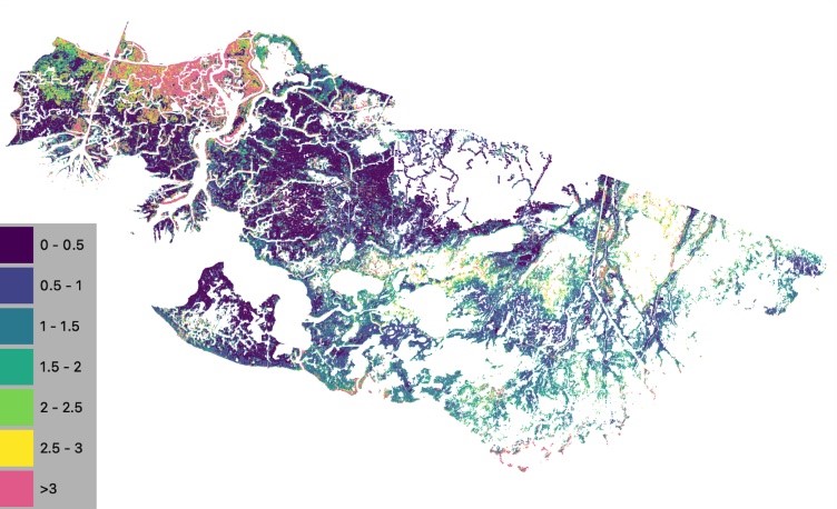
Wetland Salinity Maps of Select Estuary Sites in the United States, 2020
National Aeronautics and Space Administration —
This dataset provides gridded average annual wetland salinity concentrations in practical salinity units (PSU) at 30-meter resolution within 24 coastal estuary sites... -
Federal
Tidal Wetlands Soil Organic Carbon and Estuarine Characteristics, USA, 1972-2015
National Aeronautics and Space Administration —
This dataset provides a synthesis of soil organic carbon (SOC) estimates and a variety of other environmental information from tidal wetlands within estuaries in the... -
Federal
SHIFT: Wetland Spectra, Salinity, and Fractional Cover, Devereux Slough, CA, 2022
National Aeronautics and Space Administration —
This dataset includes field data, analysis code, and corresponding airborne imagery collected and generated during the 2022 NASA Surface Biology Geology (SBG) High... -
Federal
Global N Cycle: Fluxes and N2O Mixing Ratios Originating from Human Activity
National Aeronautics and Space Administration —
Nitrogen is a major nutrient in terrestrial ecosystems and an important catalyst in tropospheric photochemistry. Over the last century human activities have... -
Federal
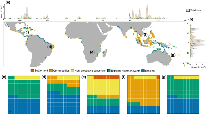
Global Mangrove Loss Extent, Land Cover Change, and Loss Drivers, 2000-2016
National Aeronautics and Space Administration —
This dataset provides estimates of the extent of mangrove loss, land cover change, and its anthropogenic or climatic drivers in three time periods: 2000-2005,... -
Federal
Delta-X: Delft3D Broad-Scale Sediment Model, Terrebonne Basin, MRD, Louisiana, USA
National Aeronautics and Space Administration —
This dataset contains the Delft3D model of the Terrebonne Basin along the Mississippi River Delta (MRD) in coastal Louisiana. Simulations cover the Delta-X Spring and... -
Federal
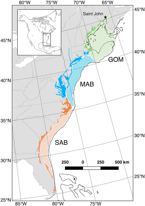
Mean Annual Fluxes of Carbon in Coastal Ecosystems of Eastern North America
National Aeronautics and Space Administration —
This dataset contains best estimates and uncertainties for mean annual fluxes of inorganic, organic, and total (organic + inorganic) carbon in tidal wetlands,... -
Federal
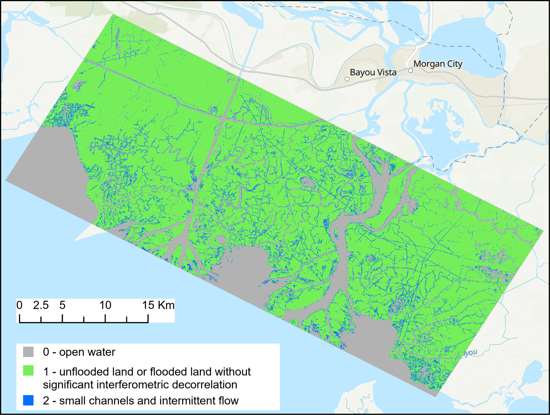
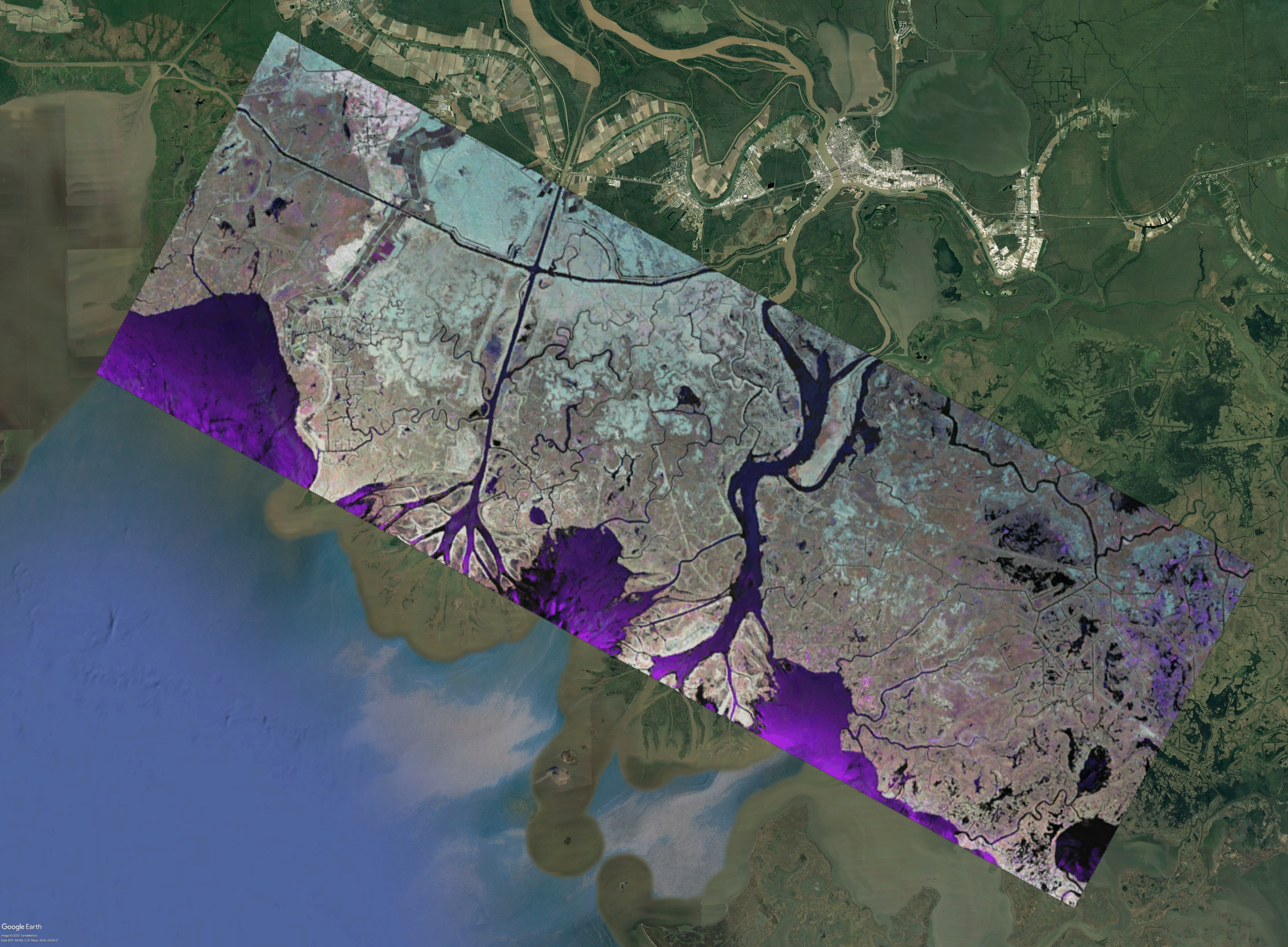
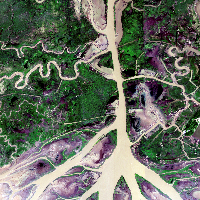
Pre-Delta-X: UAVSAR Georeferenced Channel Maps, Atchafalaya Basin, LA, USA, 2016, V2
National Aeronautics and Space Administration —
This dataset provides spatial data on water channels in the estuary of the Atchafalaya Basin of the Mississippi River Delta of coastal Louisiana. These Level-3 (L3)... -
Federal
Pre-Delta-X: L1 UAVSAR Single Look Complex and Interferograms, MRD, LA, USA, 2016
National Aeronautics and Space Administration —
This Level 1 (L1) dataset includes single look complex (SLC) stack products and co-registered interferograms in the HH (horizontal transmit and horizontal receive)... -
Federal
Greenness Trends and Carbon Stocks of Mangrove Forests Across Mexico, 2001-2015
National Aeronautics and Space Administration —
This dataset provides estimates of greenness trends, above- and belowground carbon stocks, and climate variables of the persistent mangrove forests on the coasts of... -
Federal
Delta-X: AVIRIS-NG L1B Spectral Radiance Products, MRD, Louisiana, 2021
National Aeronautics and Space Administration —
This dataset provides Level 1B (L1B) radiance products from NASA's Airborne Visible Infrared Imaging Spectrometer- Next Generation (AVIRIS-NG) instrument acquired... -
Federal
Delta-X: Delft3D Broad-Scale Sediment Model, Atchafalaya Basin, MRD, Louisiana, USA
National Aeronautics and Space Administration —
This dataset contains the Delft3D model of the Atchafalaya Basin along the Mississippi River Delta (MRD) in coastal Louisiana. Simulations cover the Delta-X Spring... -
Federal
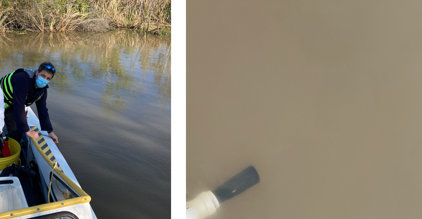
Delta-X: In Situ Water Quality Indicators across MRD, LA, USA, 2021, Version 2
National Aeronautics and Space Administration —
This dataset provides in situ measurements of water temperature (degrees C), salinity (PSU), turbidity (FNU), and chlorophyll-a fluorescence (RFU) in surface of the... -
Federal
Delta-X: UAVSAR L3 Water Level Changes, MRD, Louisiana, 2021
National Aeronautics and Space Administration —
This dataset contains georeferenced InSAR-derived water level change maps for Delta-X flight lines acquired during the spring (2021-03-27 to 2021-04-18) and fall... -
Federal
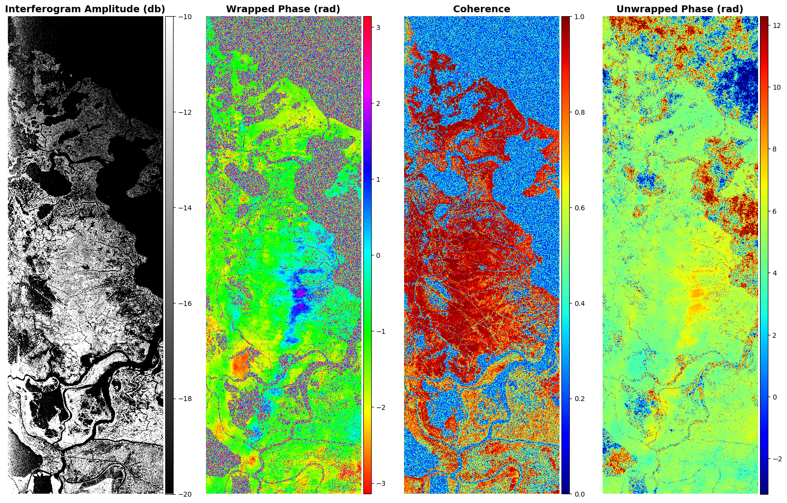
Delta-X: UAVSAR L1B Interferometric Products, MRD, Louisiana, 2021
National Aeronautics and Space Administration —
This dataset contains UAVSAR Level 1B (L1B) interferometric products for Delta-X flight lines acquired during the 2021 Spring (2021-03-27 to 2021-04-18) and Fall...

Official websites use .gov
A
.gov website belongs to an official government
organization in the United States.
Secure .gov websites use HTTPS
A
lock (
) or https:// means you’ve safely connected to
the .gov website. Share sensitive information only on official,
secure websites.