
-
Federal
LiDAR Surveys over Selected Forest Research Sites, Brazilian Amazon, 2008-2018
National Aeronautics and Space Administration —
This dataset provides the complete catalog of point cloud data collected during LiDAR surveys over selected forest research sites across the Amazon rainforest in... -
Federal
AfriSAR: Aboveground Biomass for Lope, Mabounie, Mondah, and Rabi Sites, Gabon
National Aeronautics and Space Administration —
This dataset provides gridded estimates of aboveground biomass (AGB) for four sites in Gabon at 0.25 ha (50 m) resolution derived with field measurements and airborne... -
Federal
CMS: LiDAR Data for Mangrove Forests in the Zambezi River Delta, Mozambique, 2014
National Aeronautics and Space Administration —
This data set provides high-resolution LiDAR point cloud data collected during surveys over mangrove forests in the Zambezi River Delta in Mozambique in May 2014. The... -
Federal
CMS: LiDAR-derived Canopy Height, Elevation for Sites in Kalimantan, Indonesia, 2014
National Aeronautics and Space Administration —
This dataset provides canopy height and elevation data products derived from airborne LiDAR data collected over 90 sites on the island of Borneo in late 2014. The... -
Federal
Maps of Vegetation Types and Physiographic Features, Imnavait Creek, Alaska
National Aeronautics and Space Administration —
This dataset provides the spatial distribution of vegetation types, soil carbon, and physiographic features in the Imnavait Creek area, Alaska. Specific attributes... -
Federal
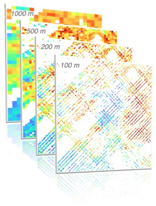
Global 1-km Gridded Thickness of Soil, Regolith, and Sedimentary Deposit Layers
National Aeronautics and Space Administration —
This data set provides high-resolution estimates of the thickness of the permeable layers above bedrock (soil, regolith, and sedimentary deposits) within a global... -
Federal
Global Vegetation Height Metrics from GEDI and ICESat2
National Aeronautics and Space Administration —
This dataset provides global rasters of relative height metrics for vegetation from Global Ecosystem Dynamics Investigation (GEDI) L2A data and Ice, Cloud, and Land... -
Federal
NPP Tropical Forest: Gunung Mulu, Malaysia, 1977-1978, R1
National Aeronautics and Space Administration —
This data set contains seven ASCII data files (.txt format). Four files provide NPP data for contrasting lowland rainforests within Gunung Mulu National Park on the... -
Federal
LBA-ECO LC-01 SRTM 90-Meter Digital Elevation Model, Northern Ecuadorian Amazon
National Aeronautics and Space Administration —
This data set provides 90-meter resolution Digital Elevation Model data used in the University of North Carolina's Carolina Population Center (CPC) Ecuador Projects.... -
Federal
LBA-ECO CD-06 Biogeochemistry of Ji-Parana River and Tributaries, Brazil: 1999-2003
National Aeronautics and Space Administration —
This data set provides spatially extensive and temporally intensive surveys of the river biogeochemistry of the Ji-Parana River Basin in Western Amazonia, Rondonia,... -
Federal
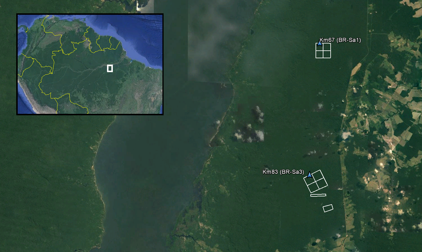
LiDAR and DTM Data from Tapajos National Forest in Para, Brazil, 2008
National Aeronautics and Space Administration —
This data set provides LiDAR point clouds and digital terrain models (DTM) from surveys over the Tapajos National Forest in Belterra municipality, Para, Brazil during... -
Federal
LBA-ECO CD-06 Physical, Political, and Hydrologic Maps, Ji-Parana River Basin, Brazil
National Aeronautics and Space Administration —
This data set contains physical, hydrologic, political, demographic, and societal maps for the Ji-Parana River Basin, in the state of Rondonia, Brazil. These data... -
Federal
Gridded GEDI Vegetation Structure Metrics and Biomass Density at Multiple Resolutions
National Aeronautics and Space Administration —
This dataset consists of near-global, analysis-ready, multi-resolution gridded vegetation structure metrics derived from NASA Global Ecosystem Dynamics Investigation... -
Federal
Global Forest Ecosystem Structure and Function Data For Carbon Balance Research
National Aeronautics and Space Administration —
A comprehensive global database has been assembled to quantify CO2 fluxes and pathways across different levels of integration (from photosynthesis up to net ecosystem... -
Federal
Delta-X: UAVSAR L3 Water Level Changes, MRD, Louisiana, 2021
National Aeronautics and Space Administration —
This dataset contains georeferenced InSAR-derived water level change maps for Delta-X flight lines acquired during the spring (2021-03-27 to 2021-04-18) and fall... -
Federal
CMS: Mangrove Canopy Height Estimates from Remote Imagery, Zambezi Delta, Mozambique
National Aeronautics and Space Administration —
This data set provides high resolution canopy height estimates for mangrove forests in the Zambezi Delta, Mozambique, Africa. The estimates were derived from three... -
Federal
ABoVE: AirSWOT Ka-band Radar over Surface Waters of Alaska and Canada, 2017
National Aeronautics and Space Administration —
This dataset provides AirSWOT (Surface Water and Ocean Topography) Ka-band (35.75 GHz) radar data products collected from an airborne platform over parts of Alaska... -
Federal
NPP Grassland: Central Plains Experimental Range (SGS), USA, 1939-1990, R1
National Aeronautics and Space Administration —
This data set records the productivity of a semiarid shortgrass prairie steppe located in the Central Plains Experimental Reserve (CPER)/Pawnee National Grassland in... -
Federal
VEMAP 2: Annual Ecosystem Model Responses to U.S. Climate Change, 1994-2100
National Aeronautics and Space Administration —
The Vegetation-Ecosystem Modeling and Analysis Project (VEMAP) was a large, collaborative, multi-institutional, international effort whose goal was to evaluate the... -
Federal
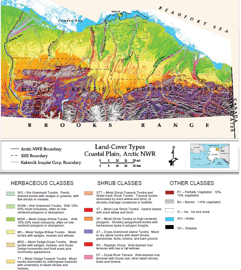
Land Cover and Vegetation Map, Arctic National Wildlife Refuge
National Aeronautics and Space Administration —
This data set provides a landcover map with 16 landcover classes for the northern coastal plain of the the Arctic National Wildlife Refuge (ANWR) on the North Slope...

Official websites use .gov
A
.gov website belongs to an official government
organization in the United States.
Secure .gov websites use HTTPS
A
lock (
) or https:// means you’ve safely connected to
the .gov website. Share sensitive information only on official,
secure websites.