
-
Federal
NACP North American Forest Dynamics Project: Forest Disturbance and Regrowth Data
National Aeronautics and Space Administration —
This data set provides the results of time-series analyses of Landsat imagery for 55 selected forested sites across the conterminous U.S.A. The output is a pair of... -
Federal
Daily Rainfall Data (FIFE)
National Aeronautics and Space Administration —
The FIFE Daily Rainfall Data Set contains daily precipitation values for 42 rain gauge stations within the Konza LTER portion of the FIFE site (i.e., Northwest... -
Federal
ABoVE: Thaw Depth at Selected Unburned and Burned Sites Across Alaska
National Aeronautics and Space Administration —
This dataset provides thaw depth measurements made at seven locations across Alaska, during August 2016, June and September 2017, and July-August 2018. Three of the... -
Federal
MASTER: Costa Rica Airborne Research and Technology Applications (CARTA), 2005
National Aeronautics and Space Administration —
This dataset includes Level 1B (L1B) data products from the MODIS/ASTER Airborne Simulator (MASTER) instrument. The spectral data were collected during 23 flights... -
Federal
BOREAS TGB-09 Above-canopy NMHC at SSA-OBS, SSA-OJP and SSA-OA Sites
National Aeronautics and Space Administration —
THE BOREAS TGB-09 team collected data in order to inventory and quantify the anthropogenic and biogenic NMHC's over the BOREAS study areas. This data set contains... -
Federal
MASTER: California Fires, California, November 2007
National Aeronautics and Space Administration —
This dataset includes Level 1B (L1B) data products from the MODIS/ASTER Airborne Simulator (MASTER) instrument. The spectral data were collected during six flights... -
Federal
SAFARI 2000 Stem and Canopy Characterization, Kalahari Transect, 1995-2000
National Aeronautics and Space Administration —
This data set provides species distribution, basal area, height, and crown cover of woody stems at 10 sites along the Kalahari Transect where a large gradient in both... -
Federal
BOREAS HYD-03 Snow Temperature Profiles
National Aeronautics and Space Administration —
The BOREAS HYD-03 team collected several data sets related to the hydrology of forested areas. This data set contains measurements of snow depth, snow density in 3-cm... -
Federal
Regridded Harmonized World Soil Database v1.2
National Aeronautics and Space Administration —
This data set describes select global soil parameters from the Harmonized World Soil Database (HWSD) v1.2, including additional calculated parameters such as area... -
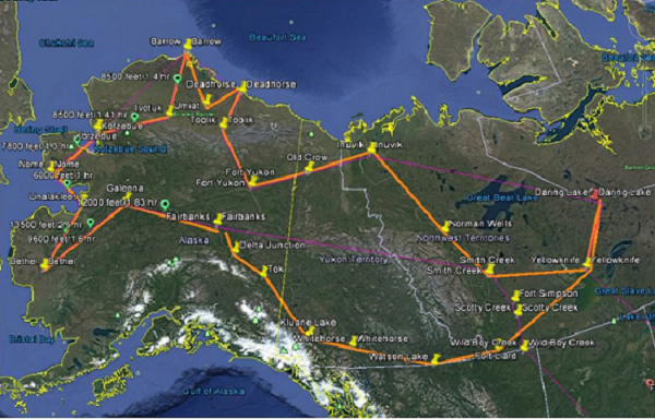
Federal
Ground-based Observations of XCO2, XCH4, and XCO, Fairbanks, AK, 2016-2019
National Aeronautics and Space Administration —
This dataset provides ground-based column-averaged dry mole fractions (DMFs) of CO2 (xco2), CO (xco), CH4 (xch4), and N2O (xn2o) to supplement satellite-based... -
Federal
CMS: Forest Inventory and Biophysical Measurements, Para, Brazil, 2012-2014
National Aeronautics and Space Administration —
This data set provides measurements for diameter at breast height (DBH), commercial tree height, and total tree height for forest inventories taken at the Fazenda... -
Federal
LBA-ECO CD-06 Biogeochemistry of Ji-Parana River and Tributaries, Brazil: 1999-2003
National Aeronautics and Space Administration —
This data set provides spatially extensive and temporally intensive surveys of the river biogeochemistry of the Ji-Parana River Basin in Western Amazonia, Rondonia,... -
Federal
BOREAS TE-20 Soils Data over the NSA-MSA and Tower Sites in Raster Format
National Aeronautics and Space Administration —
This data set was gridded from vector layers of soil maps that were received from Dr. Hugo Veldhuis, who did the original mapping in the field during 1994. The vector... -
Federal
BOREAS TGB-10 Volatile Organic Carbon Data over the SSA
National Aeronautics and Space Administration —
The BOREAS TGB-10 team collected several trace gas data sets in their efforts to determine the role of biogenic hydrocarbon emissions with respect to boreal forest... -
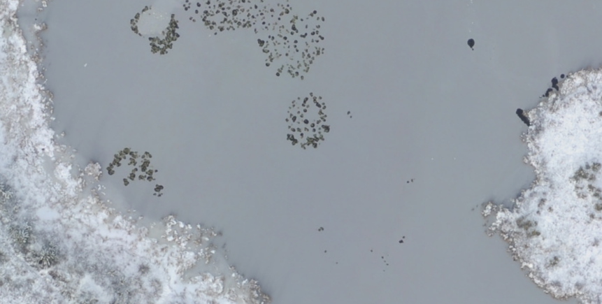
Federal
ABoVE: Aerial Photographs of Frozen Lakes near Fairbanks, Alaska, October 2014
National Aeronautics and Space Administration —
This dataset includes high resolution orthophotographs of 21 lakes in the region of Fairbanks, Alaska, USA. Aerial photographs were taken on October 8, 2014, three... -
Federal
ABoVE: Atmospheric Gas Concentrations from Airborne Flasks, Arctic-CAP, 2017
National Aeronautics and Space Administration —
This dataset provides atmospheric carbon dioxide (CO2), methane (CH4), carbon monoxide (CO), molecular hydrogen (H2), nitrous oxide (N2O), sulfur hexafluoride (SF6),... -
Federal
Delta-X: UAVSAR L3 Water Level Changes, MRD, Louisiana, 2021
National Aeronautics and Space Administration —
This dataset contains georeferenced InSAR-derived water level change maps for Delta-X flight lines acquired during the spring (2021-03-27 to 2021-04-18) and fall... -
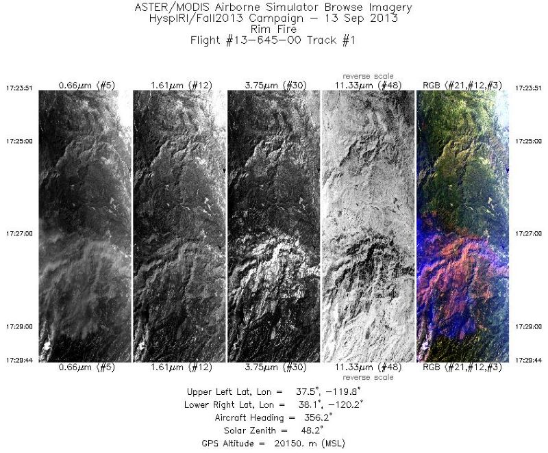
Federal
MASTER: HyspIRI Airborne Campaign, California, Fall 2013
National Aeronautics and Space Administration —
This dataset includes Level 1B (L1B) and Level 2 (L2) data products from the MODIS/ASTER Airborne Simulator (MASTER) instrument. The raw data were collected as part... -
Federal
NPP Tropical Forest: Gunung Mulu, Malaysia, 1977-1978, R1
National Aeronautics and Space Administration —
This data set contains seven ASCII data files (.txt format). Four files provide NPP data for contrasting lowland rainforests within Gunung Mulu National Park on the... -
Federal
LBA-ECO ND-02 Soil Gas Flux, Rainfall Exclusion, km 67, Tapajos National Forest
National Aeronautics and Space Administration —
Moist tropical forests in Amazonia and elsewhere are subjected to increasingly severe drought episodes through the El Nino-Southern Oscillation (ENSO) and possibly...

Official websites use .gov
A
.gov website belongs to an official government
organization in the United States.
Secure .gov websites use HTTPS
A
lock (
) or https:// means you’ve safely connected to
the .gov website. Share sensitive information only on official,
secure websites.