

13 datasets found for "2016年支付宝免签约即时到账接口财付通免签约到账接口程序适合网络赚钱单页包教✅项目合作 二开均可 TG:saolei44✅.SEQglGflepc"
-
Federal
Pre-Delta-X: Total Suspended Solids of Surface Water across MRD, LA, USA, 2015-2016
National Aeronautics and Space Administration —
This dataset contains the total suspended solids (TSS) concentration of in situ water samples collected at selected sites across the Atchafalaya and Terrebonne Basins... -
Federal
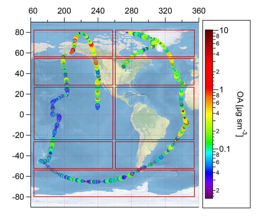
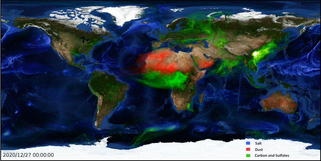
ATom: Observed and Modeled Organic Aerosol Mass Concentrations, 2016-2017
National Aeronautics and Space Administration —
This dataset provides airborne in situ observations of submicron organic aerosol (OA) mass concentrations during the first (mid-2016) and second (early-2017) global... -
Federal
Digital Elevation Models for the Global Change Research Wetland, Maryland, USA, 2016
National Aeronautics and Space Administration —
This dataset contains four alternative digital elevation models (DEMs) at 1 m resolution and model performance statistical metrics for the Global Change Research... -
Federal
Pre-Delta-X: Water Levels across Wax Lake Outlet, Atchafalaya Basin, LA, USA, 2016
National Aeronautics and Space Administration —
This dataset provides absolute water level elevations derived for 10 locations across the Wax Lake Delta, Atchafalaya Basin, in Southern Louisiana, USA, within the... -
Federal
Pre-Delta-X: Spectral Reflectance of Water Surface, Atchafalaya Basin, LA, USA, 2016
National Aeronautics and Space Administration —
This dataset provides measurements of in situ remote-sensing reflectance (Rrs; per steradian) of surface water across Atchafalaya Basin, southern coastal Louisiana,... -
Federal
AfriSAR: Canopy Structure Derived from PolInSAR and Coherence TomoSAR NISAR tools
National Aeronautics and Space Administration —
This dataset contains forest vertical structure and associated uncertainty products derived by applying multi-baseline Polarimetric Interferometric Synthetic Aperture... -
Federal
ABoVE: Active Layer Soil Characteristics at Selected Sites Across Alaska
National Aeronautics and Space Administration —
This dataset provides soil active layer characteristics from nine locations across Alaska. Soil samples were collected in 2016 except for one site which was sampled... -
Federal
ABoVE: Soil Temperature and VWC at Unburned and Burned Sites Across Alaska, 2016-2023
National Aeronautics and Space Administration —
This dataset provides soil temperature and volumetric water content (VWC) measurements at 15 cm depth collected at 12 selected boreal and tundra sites located across... -
Federal
ABoVE: Last Day of Spring Snow, Alaska, USA, and Yukon Territory, Canada, 2000-2016
National Aeronautics and Space Administration —
This dataset provides the last day of spring snow cover for most of Alaska and the Yukon Territory for 2000 through 2016. The data are based on the MODIS daily snow... -
Federal
ACT-America: L2 Remotely Sensed Column-average CO2 by Airborne Lidar, Eastern USA
National Aeronautics and Space Administration —
This dataset provides Level 2 (L2) remotely sensed column-average carbon dioxide (CO2) concentrations measured during airborne campaigns in Summer 2016, Winter 2017,... -
Federal
ATom: GEOS-5 Derived Meteorological Conditions and Tagged Tracers Along Flight Tracks
National Aeronautics and Space Administration —
This dataset provides modeled meteorological conditions and tagged-CO tracer concentrations along ATom flight paths derived from the Goddard Earth Observing System... -
Federal
ATom: L2 In Situ Peroxyacetyl Nitrate (PAN) Measurements from Georgia Tech CIMS
National Aeronautics and Space Administration —
This dataset provides measurements of two important components of photochemical smog - peroxyacetyl nitrate (PAN) and peroxyl propionyl nitrate (PPN)- measured by the...
13 datasets found for "2016年支付宝免签约即时到账接口财付通免签约到账接口程序适合网络赚钱单页包教✅项目合作 二开均可 TG:saolei44✅.SEQglGflepc"