

14 datasets found for ""Sample Sites""
-
Federal
Pre-Delta-X: Total Suspended Solids of Surface Water across MRD, LA, USA, 2015-2016
National Aeronautics and Space Administration —
This dataset contains the total suspended solids (TSS) concentration of in situ water samples collected at selected sites across the Atchafalaya and Terrebonne Basins... -
Federal
PROVE Surface albedo of Jornada Experimental Range, New Mexico, 1997
National Aeronautics and Space Administration —
The objective of this study was to determine the spatial variations in field measurements of broadband albedo as related to the ground cover and under a range of... -
Federal
A Compilation of Global Soil Microbial Biomass Carbon, Nitrogen, and Phosphorus Data
National Aeronautics and Space Administration —
This data set provides the concentrations of soil microbial biomass carbon (C), nitrogen (N) and phosphorus (P), soil organic carbon, total nitrogen, and total... -
Federal
CMS: LiDAR-derived Aboveground Biomass, Canopy Height and Cover for Maryland, 2011
National Aeronautics and Space Administration —
This data set provides 30-meter gridded estimates of aboveground biomass (AGB), canopy height, and canopy coverage for the state of Maryland in 2011. Leaf-off LiDAR... -
Federal
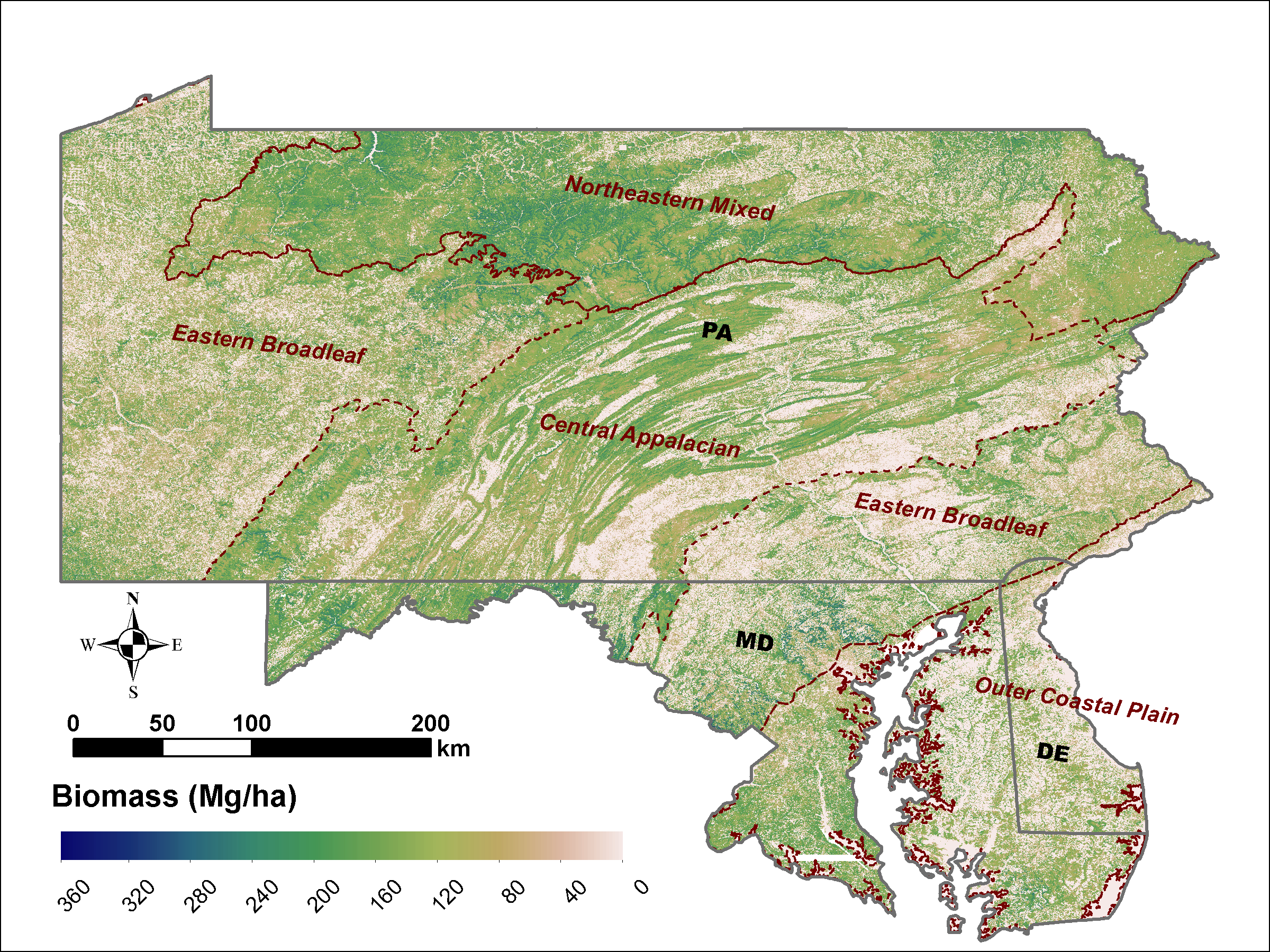
LiDAR Derived Biomass, Canopy Height and Cover for Tri-State (MD, PA, DE) Region, V2
National Aeronautics and Space Administration —
This dataset provides 30-meter gridded estimates of aboveground biomass (AGB), forest canopy height, and canopy coverage for Maryland, Pennsylvania, and Delaware in... -
Federal
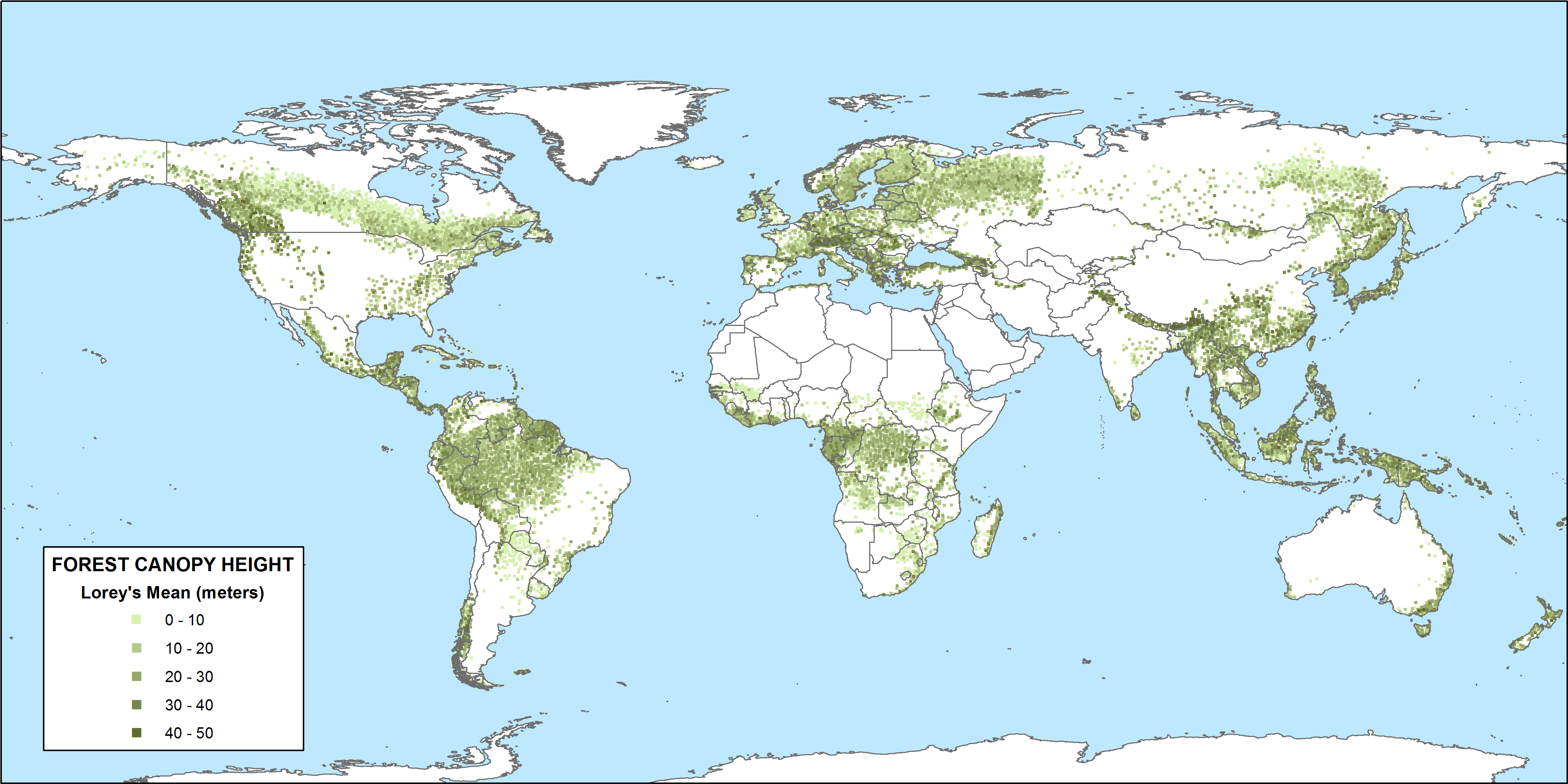
CMS: GLAS LiDAR-derived Global Estimates of Forest Canopy Height, 2004-2008
National Aeronautics and Space Administration —
This data set provides estimates of forest canopy height derived from the Geoscience Laser Altimeter System (GLAS) LiDAR instrument that was aboard the NASA Ice,... -
Federal
NACP Peatland Land Cover Map of Upper Peninsula, Michigan, 2007-2011
National Aeronautics and Space Administration —
This dataset provides a land cover map focused on peatland ecosystems in the upper peninsula of Michigan. The map was produced at 12.5-m resolution using a multi-... -
Federal
Synthesis of Winter In Situ Soil CO2 Flux in pan-Arctic and Boreal Regions, 1989-2017
National Aeronautics and Space Administration —
This dataset provides a synthesis of winter ( September-April) in situ soil CO2 flux measurement data from locations across pan-Arctic and Boreal permafrost regions.... -
Federal
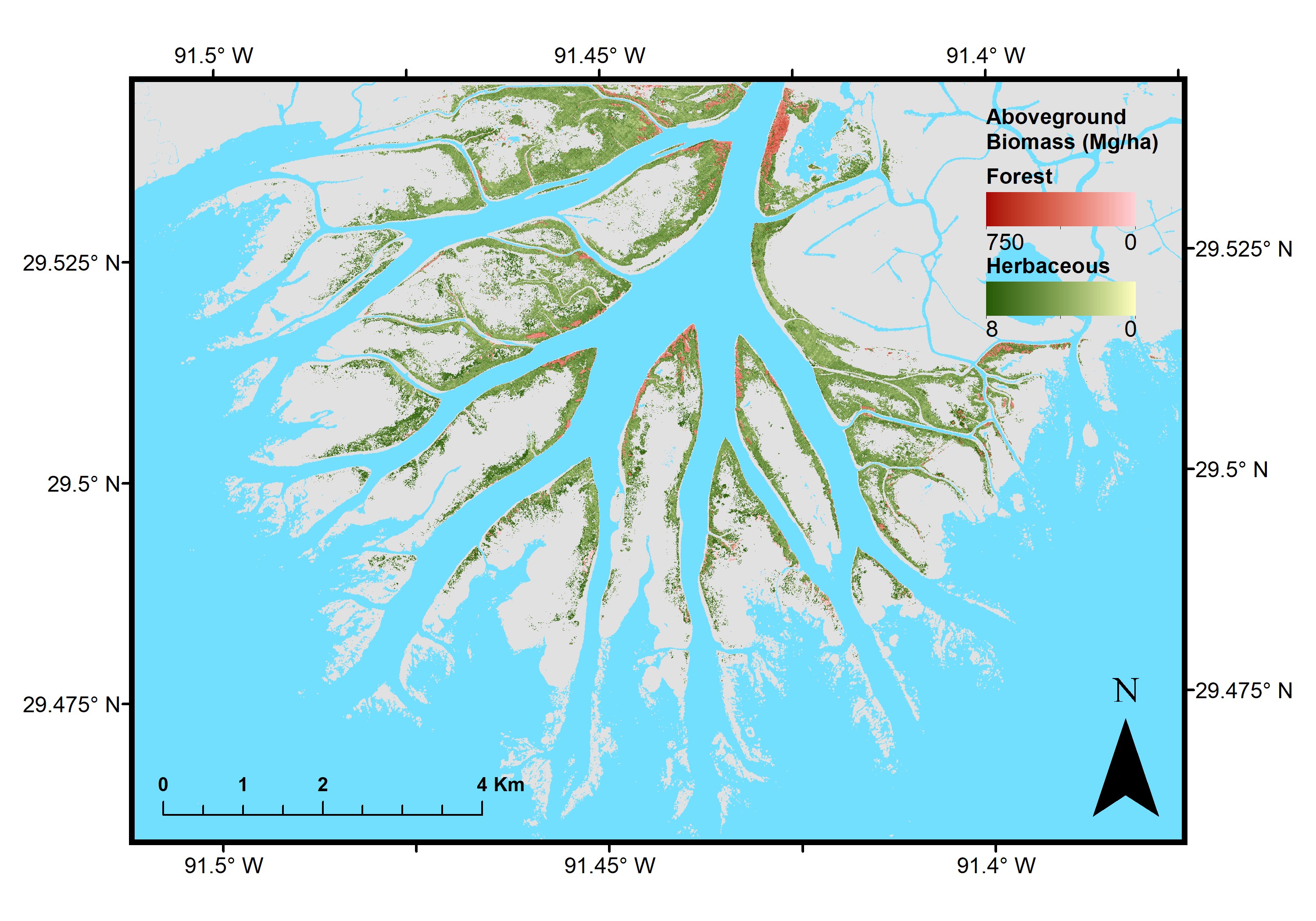
Pre-Delta-X: Aboveground Biomass and Vegetation Maps, Wax Lake Delta, LA, USA, 2016
National Aeronautics and Space Administration —
This dataset includes aboveground biomass (AGB) and vegetation of herbaceous and forest wetland at 5.4 m resolution across the Wax Lake Delta (WLD) in Southern... -
Federal
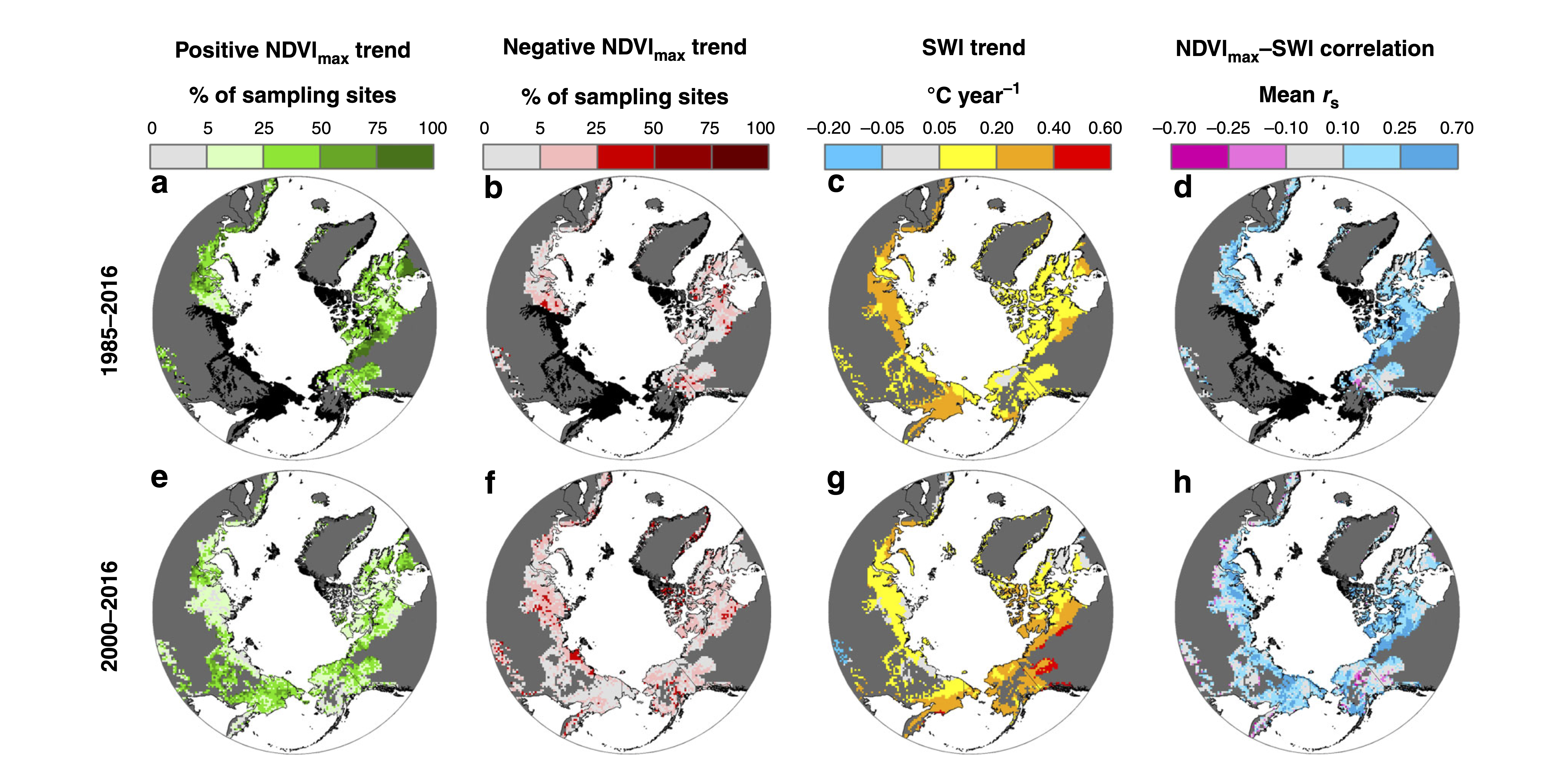
ABoVE: Landsat Tundra Greenness and Summer Air Temperatures, Arctic Tundra, 1985-2016
National Aeronautics and Space Administration —
This dataset provides annual tundra greenness and summer air temperatures at a resolution of 50 km over the pan-Arctic tundra biome above 31.5 degrees over the time... -
Federal
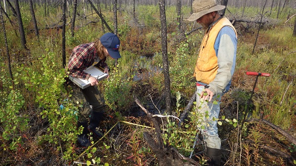
ABoVE: Post-Fire and Unburned Vegetation Community and Field Data, NWT, Canada, 2017
National Aeronautics and Space Administration —
This dataset provides vegetation community characteristics, soil moisture, and biophysical data collected in 2017 from 11 study sites in the ABoVE Study area. The 11... -
Federal
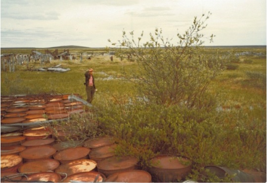
Arctic Vegetation Plots at Oumalik, AK, 1983-1985
National Aeronautics and Space Administration —
This data set provides environmental, soil, and vegetation data collected between 1983 and 1985 from 87 study plots near an abandoned test oil well in Oumalik,... -
Federal
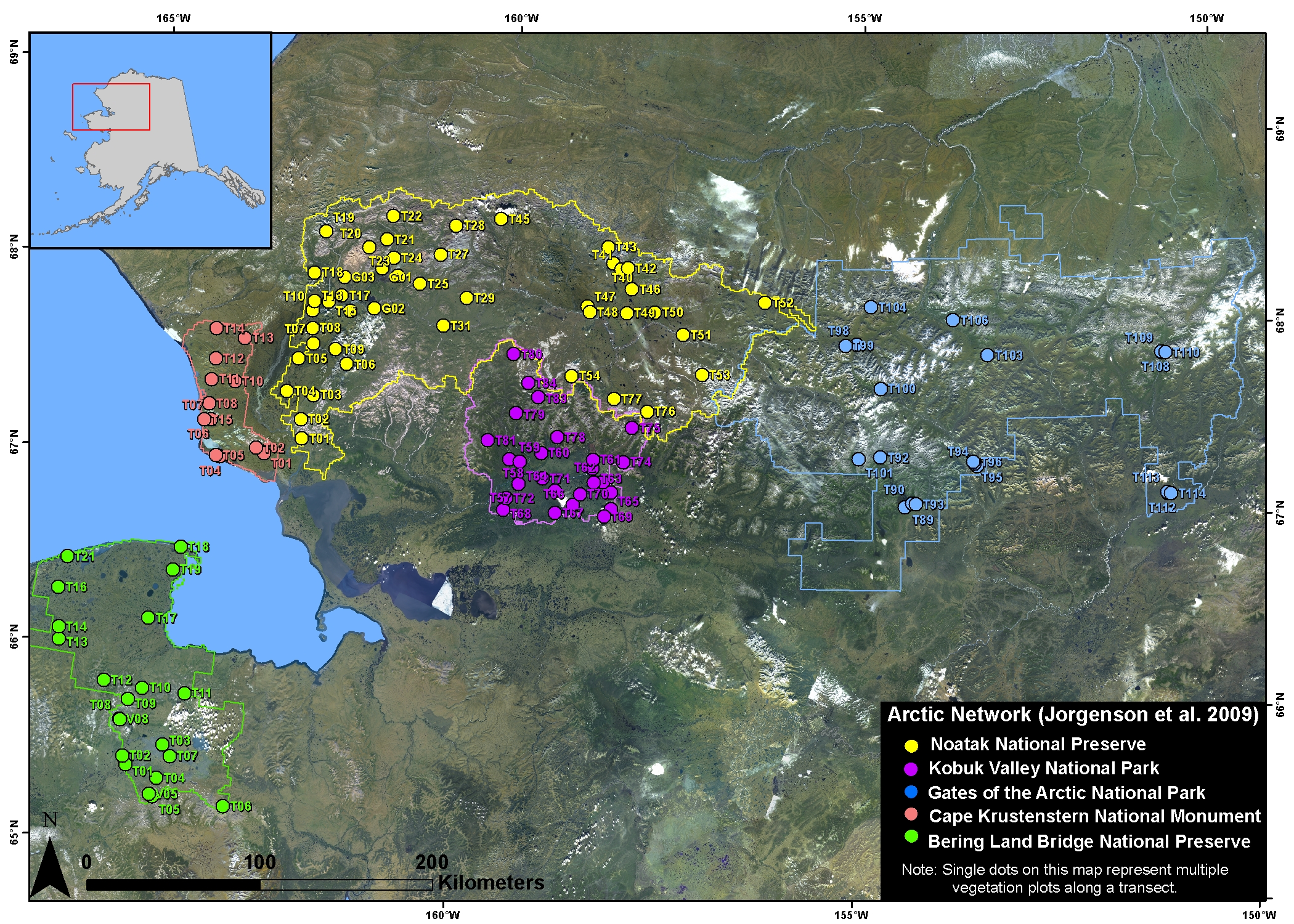
Arctic Vegetation Plots in NPS Arctic Network Parks, Alaska, 2002-2008
National Aeronautics and Space Administration —
This dataset provides environmental, soil, and vegetation data collected at selected locations in the parks and preserves of the National Park Service (NPS) Arctic... -
Federal
BOREAS TGB-12 Soil Carbon Site Information
National Aeronautics and Space Administration —
During 1993 and 1994, the BOReal Ecosystem-Atmosphere Study (BOREAS) Trace Gas and Biogeochemistry team #12 (TGB-12) collected several data sets to support their...
14 datasets found for ""Sample Sites""