

3 datasets found for ""Reference Grids""
-
Federal
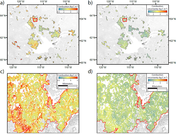
ABoVE: Wildfire Carbon Emissions and Burned Plot Characteristics, NWT, CA, 2014-2016
National Aeronautics and Space Administration —
This dataset provides estimates of wildfire carbon emissions and uncertainties at 30-m resolution, and measurements collected at burned and unburned field plots from... -
Federal
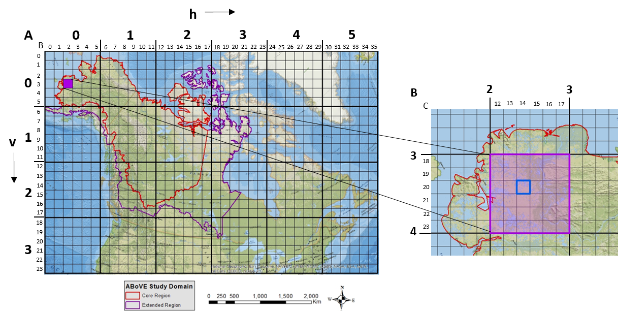
ABoVE: Study Domain and Standard Reference Grids, Version 2
National Aeronautics and Space Administration —
The Arctic - Boreal Vulnerability Experiment (ABoVE) has developed two standardized spatial data products to expedite coordination of research activities and to... -
Federal
Lake Bathymetry Maps derived from Landsat and Random Forest Modeling, North Slope, AK
National Aeronautics and Space Administration —
This dataset provides lake bathymetry maps derived from Landsat surface reflectance products for a portion of the North Slope area of Alaska. A random forest...
3 datasets found for ""Reference Grids""