
-
Federal
MISR L2 TOA/Cloud Classifier Product subset for the RICO region V003
National Aeronautics and Space Administration —
RICMITCL_003 is the Multi-angle Imaging SpectroRadiometer (MISR) Level 2 TOA/Cloud Classifier Product subset for the RICO region, version 2 data product. It contains... -
Federal
MISR Level 3 Component Global Land Product covering a day subset for the UAE region V004
National Aeronautics and Space Administration —
UAEMRDLS_004 is the Multi-angle Imaging SpectroRadiometer (MISR) Level 3 Component Global Land Product covering a day subset for the UAE region version 4. It contains... -
Federal
MISR Level 3 Component Global Land Regional public Product covering a day V002
National Aeronautics and Space Administration —
MI3DLSR_2 is the Multi-angle Imaging SpectroRadiometer (MISR) Level 3 Component Global Land Regional public Product covering a dayversion 2. It contains a daily... -
Federal
MISR L2 Geometric Parameters subset for the C-MARE Region V002
National Aeronautics and Space Administration —
CMRMIGEO_2 is the Multi-angle Imaging SpectroRadiometer (MISR) Level 2 Geometric Parameters subset for the C-MARE Region version 2. It contains the geometric... -
Federal
MISR L2 Aerosol Product subset for the SAMUM region V002
National Aeronautics and Space Administration —
SAMMI2AE_002 is the Multi-angle Imaging SpectroRadiometer (MISR) Level 2 Aerosol Product subset for the SAMUM region Version 2. It contains Aerosol optical depth and... -
Federal
MISR Level 3 Component Global Radiance Regional public Product covering a day V002
National Aeronautics and Space Administration —
MI3DRDR_2 is the Multi-angle Imaging SpectroRadiometer (MISR) Level 3 Component Global Radiance Regional public Product covering a day version 2. It contains a global... -
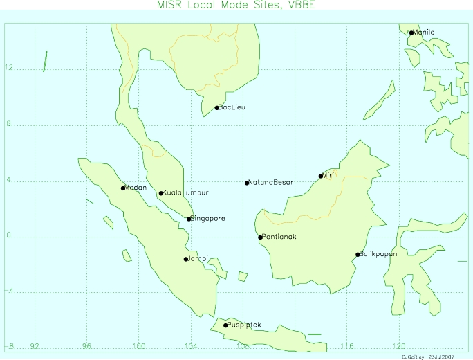
Federal
MISR Level 2 TOA/Cloud Stereo Product subset for the VBBE region V002
National Aeronautics and Space Administration —
VBEMI2ST_002 is the Multi-angle Imaging SpectroRadiometer (MISR) Level 2 TOA/Cloud Stereo Product subset for the VBBE region version 2. It contains the... -
Federal
MISR L2 Land Surface Product subset for the INTEX-B region V002
National Aeronautics and Space Administration —
IXBMI2LS_002 is the Multi-angle Imaging SpectroRadiometer (MISR) Level 2 Land Surface Product subset for the INTEX-B region. It contains information on land... -
Federal
MISR Level 1B2 Terrain Data subset for the UAE region V003
National Aeronautics and Space Administration —
UAEMIB2T_003 is the Multi-angle Imaging SpectroRadiometer (MISR) Level 1B2 Terrain Data subset for the UAE region version 3 data product. It contains Terrain-... -
Federal
MISR L2 Surface Product subset for the SAMUM region V002
National Aeronautics and Space Administration —
SAMMI2LS_2 is the Multi-angle Imaging SpectroRadiometer (MISR) Level 2 Surface Product subset for the SAMUM region version 2. It contains information about land... -
Federal
MISR Level 2 Land Surface Product subset for the VBBE region V002
National Aeronautics and Space Administration —
VBEMI2LS_002 is the Multi-angle Imaging SpectroRadiometer (MISR) Level 2 Land Surface Product subset for the VBBE region version 2. It contains information on land... -
Federal
MISR Level 2 Land Surface parameters subset for the UAE region V002
National Aeronautics and Space Administration —
UAEMIALS_002 is the Multi-angle Imaging SpectroRadiometer (MISR) Level 2 Land Surface parameters subset for the UAE region version 2. It contains information on land... -
Federal
MISR L1B2 Terrain Product subset for the INTEX-B region V003
National Aeronautics and Space Administration —
IXBMIB2T_3 is the Multi-angle Imaging SpectroRadiometer (MISR) Level 1B2 Terrain Product subset for the INTEX-B region version 3. It contains Terrain-projected TOA... -
Federal
MISR Level 1B2 Terrain Product subset for the VBBE region V003
National Aeronautics and Space Administration —
VBEMIB2T_003 is the Multi-angle Imaging SpectroRadiometer (MISR) Level 1B2 Terrain Product subset for the VBBE region version 3. It contains Terrain-projected TOA... -
Federal
MISR Level 2 Aerosol parameters subset for the UAE region V002
National Aeronautics and Space Administration —
UAEMIAAE_002 is the Multi-angle Imaging spectro-radiometer (MISR). It contains aerosol optical depth, particle type, and associated atmospheric data. The MISR... -
Federal
MISR Level 3 Component Global Aerosol Product covering a day subset for the UAE region V004
National Aeronautics and Space Administration —
UAEMRDAE_004 is the Multi-angle Imaging SpecrtroRadiometer (MISR) Level 3 Component Global Aerosol Product covering a day subset for the UAE region version 4. It... -
Federal
MISR Geometric Parameters subset for the VBBE region V002
National Aeronautics and Space Administration —
VBEMIGEO_002 is the Multi-angle Imaging SpectroRadiometer (MISR) Geometric Parameters subset for the VBBE region version 2. It contains the Geometric Parameters that... -
Federal
MISR L2 FIRSTLOOK Land Surface Product subset for the ARCTAS region V001
National Aeronautics and Space Administration —
ATSM2LSF_001 is the Multi-angle Imaging SpectroRadiometer (MISR) Level 2 FIRSTLOOK Land Surface Product subset for the ARCTAS region version 1. It contains... -
Federal
MISR Level 3 Component Global Land Regional public Product covering a month V002
National Aeronautics and Space Administration —
MI3MLSR_2 is the Multi-angle Imaging SpectroRadiometer (MISR) Level 3 Component Global Land Regional public Product covering a month version 2. It contains a daily... -
Federal
MISR Level 2 TOA/Cloud Classifier parameters subset for the UAE region V003
National Aeronautics and Space Administration —
UAEMITCL_003 is the Multi-angle Imaging SpectroRadiometer (MISR) Level 2 TOA/Cloud Classifier parameters subset for the UAE region version 3. It contains the Angular...

Official websites use .gov
A
.gov website belongs to an official government
organization in the United States.
Secure .gov websites use HTTPS
A
lock (
) or https:// means you’ve safely connected to
the .gov website. Share sensitive information only on official,
secure websites.