
-
Federal
GLDAS Noah Land Surface Model L4 3 hourly 0.25 x 0.25 degree V2.0 (GLDAS_NOAH025_3H) at GES DISC
National Aeronautics and Space Administration —
NASA Global Land Data Assimilation System Version 2 (GLDAS-2) has three components: GLDAS-2.0, GLDAS-2.1, and GLDAS-2.2. GLDAS-2.0 is forced entirely with the... -
Federal
GLDAS Catchment Land Surface Model L4 monthly 1.0 x 1.0 degree V2.0 (GLDAS_CLSM10_M) at GES DISC
National Aeronautics and Space Administration —
NASA Global Land Data Assimilation System Version 2 (GLDAS-2) has three components: GLDAS-2.0, GLDAS-2.1, and GLDAS-2.2. GLDAS-2.0 is forced entirely with the... -
Federal
GLDAS Noah Land Surface Model L4 monthly 0.25 x 0.25 degree V2.1 (GLDAS_NOAH025_M) at GES DISC
National Aeronautics and Space Administration —
NASA Global Land Data Assimilation System Version 2 (GLDAS-2) has three components: GLDAS-2.0, GLDAS-2.1, and GLDAS-2.2. GLDAS-2.0 is forced entirely with the... -
Federal
Monthly Frequency of Dust Storm over Land for Varying Intensities, Based on MODIS Aqua Deep Blue Level 2 Aerosol Products MYD04_L2 Collection 6.1, on a Global 0.1 by 0.1 Degree Grid, Level 3 Version 1 (MYDFDS_MON_GLB_L3) at GES DISC
National Aeronautics and Space Administration —
Version 1 is the current version of the dataset.This collection MYDFDS_MON_GLB_L3 provides level 3 monthly frequency of dust storms (FDS) over land from 175°W to... -
Federal
TROPESS CrIS-SNPP L2 Deuterated Water Vapor for Reanalysis Stream, Summary Product V1 (TRPSYL2HDOCRSRS) at GES DISC
National Aeronautics and Space Administration —
The TROPESS CrIS-SNPP L2 Deuterated Water Vapor for Reanalysis Stream, Summary Product contains the vertical distribution of the retrieved atmospheric state of semi-... -
Federal
GPM MHS on METOP-B (GPROF) Climate-based Radiometer Precipitation Profiling L3 1 day 0.25 degree x 0.25 degree V07 (GPM_3GPROFMETOPBMHS_DAY_CLIM) at GES DISC
National Aeronautics and Space Administration —
Version 07 is the current version of the data set. Older versions are no longer available and have been superseded by Version 07. The "CLIM" products differ from... -
Federal
NLDAS Secondary Forcing Data L4 Monthly 0.125 x 0.125 degree V2.0 (NLDAS_FORB0125_M) at GES DISC
National Aeronautics and Space Administration —
This data set contains the monthly secondary forcing data "File B" for Phase 2 of the North American Land Data Assimilation System (NLDAS-2). The data are in 1/8th... -
Federal
GLDAS Catchment Land Surface Model L4 3 hourly 1.0 x 1.0 degree V2.1 (GLDAS_CLSM10_3H) at GES DISC
National Aeronautics and Space Administration —
NASA Global Land Data Assimilation System Version 2 (GLDAS-2) has three components: GLDAS-2.0, GLDAS-2.1, and GLDAS-2.2. GLDAS-2.0 is forced entirely with the... -
Federal
GLDAS Noah Land Surface Model L4 monthly 1.0 x 1.0 degree V2.0 (GLDAS_NOAH10_M) at GES DISC
National Aeronautics and Space Administration —
NASA Global Land Data Assimilation System Version 2 (GLDAS-2) has three components: GLDAS-2.0, GLDAS-2.1, and GLDAS-2.2. GLDAS-2.0 is forced entirely with the... -
Federal
GLDAS Catchment Land Surface Model L4 daily 0.25 x 0.25 degree V2.0 (GLDAS_CLSM025_D) at GES DISC
National Aeronautics and Space Administration —
NASA Global Land Data Assimilation System Version 2 (GLDAS-2) has three components: GLDAS-2.0, GLDAS-2.1, and GLDAS-2.2. GLDAS-2.0 is forced entirely with the... -
Federal
OMPS-NPP L2 LP Aerosol Extinction Vertical Profile swath daily 3slit V2.5 (OMPS_NPP_LP_L2_AER_DAILY) at GES DISC
National Aeronautics and Space Administration —
The OMPS-NPP L2 LP Aerosol Extinction Vertical Profile swath daily 3slit (AER) product contains the retrieved aerosol extinction coefficients measured by the Ozone... -
Federal
GLDAS Noah Land Surface Model L4 monthly 0.25 x 0.25 degree V2.0 (GLDAS_NOAH025_M) at GES DISC
National Aeronautics and Space Administration —
NASA Global Land Data Assimilation System Version 2 (GLDAS-2) has three components: GLDAS-2.0, GLDAS-2.1, and GLDAS-2.2. GLDAS-2.0 is forced entirely with the... -
Federal
GLDAS Catchment Land Surface Model L4 monthly 1.0 x 1.0 degree V2.1 (GLDAS_CLSM10_M) at GES DISC
National Aeronautics and Space Administration —
NASA Global Land Data Assimilation System Version 2 (GLDAS-2) has three components: GLDAS-2.0, GLDAS-2.1, and GLDAS-2.2. GLDAS-2.0 is forced entirely with the... -
Federal
SBUV2/NOAA-11 Ozone (O3) Profile and Total Column Ozone 1 Month Zonal Mean L3 Global 5.0 degree Latitude Zones V1 (SBUV2N11L3zm) at GES DISC
National Aeronautics and Space Administration —
The Solar Backscattered Ultraviolet (SBUV) from NOAA-11 Level-3 monthly zonal mean (MZM) product (SBUV2N11L3zm) is derived from the Level-2 retrieved ozone profiles.... -
Federal
HIRS/Nimbus-6 Level 1 Calibrated Radiances for the Global Atmospheric Research Program (GARP) V001 (HIRSN6L1GARP) at GES DISC
National Aeronautics and Space Administration —
The Nimbus-6 High Resolution Infrared Radiometer (HIRS) Level 1 Calibrated Radiances for the Global Atmospheric Research Program (GARP) data product contains daily... -
Federal
HIRS/Nimbus-6 Images of Brightness Temperature on 70 mm Film V001 (HIRSN6IM) at GES DISC
National Aeronautics and Space Administration —
The HIRSN6IM data product consists of images of brightness temperatures on 70 mm film strips from the Nimbus-6 High Resolution Infrared Radiation Sounder. Each... -
Federal
HRIR/Nimbus-2 Images of Nighttime Brightness Temperature on 70 mm Film V001 (HRIRN2IM) at GES DISC
National Aeronautics and Space Administration —
HRIRN2IM is the Nimbus-2 High-Resolution Infrared Radiometer (HRIR) data product containing scanned negatives of photofacsimile 70mm film strips. The images contain... -
Federal
HRIR/Nimbus-1 Images of Nighttime Brightness Temperature on 70 mm Film V001 (HRIRN1IM) at GES DISC
National Aeronautics and Space Administration —
HRIRN1IM is the Nimbus-1 High-Resolution Infrared Radiometer (HRIR) data product containing scanned negatives of photofacsimile 70mm film strips. The images contain... -
Federal
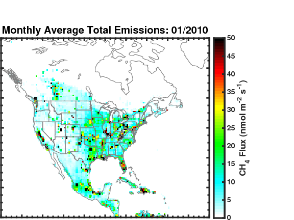
Methane (CH4) Flux for North America L4 Daily V1 (CMS_CH4_FLX_NAD) at GES DISC
National Aeronautics and Space Administration —
The CMS Methane (CH4) Flux for North America data set contains estimates of methane emission in North America based on an inversion of the GEOS-Chem chemical... -
Federal
GPM MHS on METOP-C (GPROF) Climate-based Radiometer Precipitation Profiling L2A 1.5 hours 17 km V07 (GPM_2AGPROFMETOPCMHS_CLIM) at GES DISC
National Aeronautics and Space Administration —
Version 07 is the current version of the data set. Older versions are no longer available and have been superseded by Version 07. The "CLIM" products differ from...

Official websites use .gov
A
.gov website belongs to an official government
organization in the United States.
Secure .gov websites use HTTPS
A
lock (
) or https:// means you’ve safely connected to
the .gov website. Share sensitive information only on official,
secure websites.