
-
Federal
GPM IMERG Final Precipitation L3 1 day 0.1 degree x 0.1 degree V07 (GPM_3IMERGDF) at GES DISC
National Aeronautics and Space Administration —
Version 07 is the current version of the data set. Older versions will no longer be available and have been superseded by Version 07.The Integrated Multi-satellitE... -
Federal
GLDAS Noah Land Surface Model L4 3 hourly 0.25 x 0.25 degree V2.0 (GLDAS_NOAH025_3H) at GES DISC
National Aeronautics and Space Administration —
NASA Global Land Data Assimilation System Version 2 (GLDAS-2) has three components: GLDAS-2.0, GLDAS-2.1, and GLDAS-2.2. GLDAS-2.0 is forced entirely with the... -
Federal
Daily FluxSat GPP of biomass over Land, Based on MODIS Terra and Aqua adjusted reflectance Collection 6.1, on a Global 0.5 by 0.625 Degree Grid, Level 3 Version 2.2
National Aeronautics and Space Administration —
This dataset provides global gridded daily estimates of gross primary production (GPP) and uncertainties at 0.5 deg latitude by 0.625 deg longitude resolution for the... -
Federal
NLDAS Noah Land Surface Model L4 Hourly 0.125 x 0.125 degree V2.0 (NLDAS_NOAH0125_H) at GES DISC
National Aeronautics and Space Administration —
This data set contains fifty-three fields simulated from the Noah land-surface model (LSM) for Phase 2 of the North American Land Data Assimilation System (NLDAS-2).... -
Federal
GPM IMERG Late Precipitation L3 1 day 0.1 degree x 0.1 degree V07 (GPM_3IMERGDL) at GES DISC
National Aeronautics and Space Administration —
Version 07 is the current version of the data set. Older versions will no longer be available and have been superseded by Version 07.The Integrated Multi-satellitE... -
Federal
TROPESS Chemical Reanalysis Specific Humidity 6-Hourly 3-dimensional Product V1 (TRPSCRQ6H3D) at GES DISC
National Aeronautics and Space Administration —
The TROPESS Chemical Reanalysis Specific Humidity 6-Hourly 3-dimensional Product contains vertical specific humidity values, a meteorological field. The data are part... -
Federal
TSIS SIM Level 3 Solar Spectral Irradiance 12-Hour Means V13 (TSIS_SSI_L3_12HR) at GES DISC
National Aeronautics and Space Administration —
Version 13 is the current release of this data product, and supercedes all previous versions.The TSIS SIM Level 3 Solar Spectral Irradiance (SSI) 12-Hour Means data... -
Federal
SCAMS/Nimbus-6 Images of Brightness Temperatures, Water Vapor and Temperature on 70-mm Film V001 (SCAMSN6IM) at GES DISC
National Aeronautics and Space Administration —
The SCAMSN6IM data product consists of images of brightness temperatures, water vapor and temperature on 70 mm film strips from the Nimbus-6 Scanning Microwave... -
Federal
SIRS/Nimbus-3 Level 1 Radiance Data V001 (SIRSN3L1) at GES DISC
National Aeronautics and Space Administration —
SIRSN3L1 is the Nimbus-3 Satellite Infrared Spectrometer (SIRS) Level 1 Radiance Data product. SIRS measured infrared radiation (11 to 36 micrometers) emitted from... -
Federal
OMI/Aura Sulfur Dioxide (SO2) Total Column Daily L3 1 day Best Pixel in 0.25 degree x 0.25 degree V3 (OMSO2e) at GES DISC
National Aeronautics and Space Administration —
The OMI science team produces this Level-3 Aura/OMI Global OMSO2e Data Products (0.25 degree Latitude/Longitude grids). In this Level-3 daily global SO2 data product,... -
Federal
MLS/Aura Level 3 Monthly Binned Hydroxyl (OH) Mixing Ratio on Assorted Grids V005 (ML3MBOH) at GES DISC
National Aeronautics and Space Administration —
ML3MBOH is the EOS Aura Microwave Limb Sounder (MLS) monthly binned on various vertical grids product for hydroxyl (OH) derived from radiances measured by the THz... -
Federal
Sounder SIPS: Suomi NPP CrIMSS Level 2 CLIMCAPS Normal Spectral Resolution: Atmospheric state at Standard Pressure Levels derived from CLIMCAPS V2.1 (SNDRSNIML2PLEVCPSN) at GES DISC
National Aeronautics and Space Administration —
The CLIMCAPS (Community Long-term Infrared Microwave Coupled Product System) algorithm is used to analyze data from the Cross-track Infrared Sounder/Advanced... -
Federal
GLDAS Noah Land Surface Model L4 3 hourly 0.25 x 0.25 degree Early Product V2.1 (GLDAS_NOAH025_3H_EP) at GES DISC
National Aeronautics and Space Administration —
NASA Global Land Data Assimilation System Version 2 (GLDAS-2) has three components: GLDAS-2.0, GLDAS-2.1, and GLDAS-2.2. GLDAS-2.0 is forced entirely with the... -
Federal
GLDAS Catchment Land Surface Model L4 3 hourly 1.0 x 1.0 degree V2.1 (GLDAS_CLSM10_3H) at GES DISC
National Aeronautics and Space Administration —
NASA Global Land Data Assimilation System Version 2 (GLDAS-2) has three components: GLDAS-2.0, GLDAS-2.1, and GLDAS-2.2. GLDAS-2.0 is forced entirely with the... -
Federal
M2-SCREAM: 3d,3-Hourly,Instantaneous,Model-Level,Assimilation,Assimilated Constituent Fields,Replayed MERRA-2 Meteorological Fields
National Aeronautics and Space Administration —
The MERRA-2 Stratospheric Composition Reanalysis of Aura MLS (M2-SCREAM) products produced at NASA’s Global Modeling and Assimilation Office (GMAO) are generated by... -
Federal
LIMS/Nimbus-7 Level 2 Vertical Profiles of O3, NO2, H2O, HNO3, Geopotential Height, and Temperature V006 (LIMSN7L2) at GES DISC
National Aeronautics and Space Administration —
The Limb Infrared Monitor of the Stratosphere (LIMS) version 6 Level-2 data product consists of daily, geolocated, vertical profiles of temperature, geopotential... -
Federal
TROPESS CrIS-SNPP L2 Deuterated Water Vapor for Reanalysis Stream, Summary Product V1 (TRPSYL2HDOCRSRS) at GES DISC
National Aeronautics and Space Administration —
The TROPESS CrIS-SNPP L2 Deuterated Water Vapor for Reanalysis Stream, Summary Product contains the vertical distribution of the retrieved atmospheric state of semi-... -
Federal
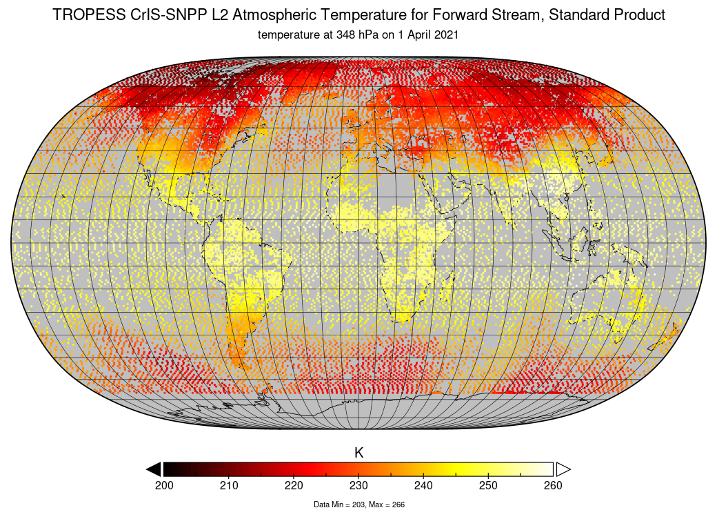
TROPESS CrIS-SNPP L2 Atmospheric Temperature for Forward Stream, Standard Product V1 (TRPSDL2TATMCRSFS) at GES DISC
National Aeronautics and Space Administration —
The TROPESS CrIS-SNPP L2 Atmospheric Temperature for Forward Stream, Standard Product contains the vertical distribution of the retrieved atmospheric state of... -
Federal
FLDAS Noah Land Surface Model L4 Global Monthly 0.1 x 0.1 degree (MERRA-2 and CHIRPS) V001 (FLDAS_NOAH01_C_GL_M) at GES DISC
National Aeronautics and Space Administration —
This dataset contains a series of land surface parameters simulated from the Noah 3.6.1 model in the Famine Early Warning Systems Network (FEWS NET) Land Data... -
Federal
MLS/Aura Level 2 Nitric Acid (HNO3) Mixing Ratio V005 (ML2HNO3) at GES DISC
National Aeronautics and Space Administration —
ML2HNO3 is the EOS Aura Microwave Limb Sounder (MLS) standard product for nitric acid derived from radiances measured by the 240 GHz radiometer at and below 10 hPa,...

Official websites use .gov
A
.gov website belongs to an official government
organization in the United States.
Secure .gov websites use HTTPS
A
lock (
) or https:// means you’ve safely connected to
the .gov website. Share sensitive information only on official,
secure websites.