

5 datasets found for "Countries"
-
Federal
CMS GOSAT and ObsPack L4 Top-down yearly methane emissions for individual sectors at 0.5x0.625 degrees for North America V1 (CMS_GO_CH4_SEC_TDYC_NA)
National Aeronautics and Space Administration —
Methane emissions are provided by sector in the contiguous United States (CONUS), Canada, and Mexico by inverse analysis of in situ (GLOBALVIEWplus CH4ObsPack) and... -
Federal
Multi-Satellite Air Quality Sulfur Dioxide (SO2) Database Long-Term L4 Global V2 (MSAQSO2L4) at GES DISC
National Aeronautics and Space Administration —
These data are a part of Multi-Decadal Sulfur Dioxide (SO2) Climatology from Satellite Instruments (MEaSUREs-12-0022 project). Version 2 of the global catalogue of... -
Federal
High Resolution Altitude Corrected Precipitation based on TMPA and other sources L4 Monthly 1 km x 1 km V1 (HRAC_Precip) at GES DISC
National Aeronautics and Space Administration —
This is a dataset that enhances the TMPA monthly product (3B43) in its accuracy and spatial resolution, in hydrometeorological applications. About 9,200 gauge... -
Federal
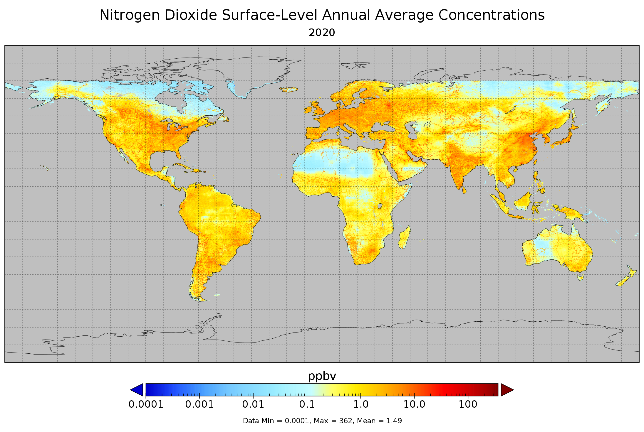
Nitrogen Dioxide Surface-Level Annual Average Concentrations V1 (SFC_NITROGEN_DIOXIDE_CONC) at GES DISC
National Aeronautics and Space Administration —
The Nitrogen Dioxide Surface-Level Annual Average Concentrations Product (SFC_NITROGEN_DIOXIDE_CONC) contains estimated global NO2 surface values derived using a Land... -
Federal
Global Inventory of Methane Emissions from Fuel Exploitation V1 (GFEI_CH4)
National Aeronautics and Space Administration —
This is a global inventory of methane emissions from fuel exploitation (GFEI) created for the NASA Carbon Monitoring System (CMS). The emission sources represented in...
5 datasets found for "Countries"