
-
Federal
OCO-2 Level 2 geolocated XCO2 retrievals results, physical model, Retrospective Processing V11r (OCO2_L2_Standard) at GES DISC
National Aeronautics and Space Administration —
Version 11r is the current version of the data set. Older versions will no longer be available and are superseded by Version 11r.The Orbiting Carbon Observatory is... -
Federal
Global Landslide Nowcast from LHASA L4 1 day 1 km x 1 km version 1.1 (Global_Landslide_Nowcast) at GES DISC
National Aeronautics and Space Administration —
The Landslide Hazard Assessment for Situational Awareness (LHASA) model identifies locations with high potential for landslide occurrence at a daily temporal... -
Federal
Monthly Frequency of Dust Storm over Land for Varying Intensities, Based on MODIS Terra Deep Blue Level 2 Aerosol Products MOD04_L2 Collection 6.1, on a Global 0.1 by 0.1 Degree Grid, Level 3 Version 1 (MODFDS_MON_GLB_L3) at GES DISC
National Aeronautics and Space Administration —
Version 1 is the current version of the dataset.This collection MODFDS_MON_GLB_L3 provides level 3 monthly frequency of dust storms (FDS) over land from 175°W to... -
Federal
MERRA-2 tavgM_2d_aer_Nx: 2d,Monthly mean,Time-averaged,Single-Level,Assimilation,Aerosol Diagnostics 0.625 x 0.5 degree V5.12.4 (M2TMNXAER) at GES DISC
National Aeronautics and Space Administration —
M2TMNXAER (or tavgM_2d_aer_Nx) is a time-averaged 2-dimensional monthly mean data collection in Modern-Era Retrospective analysis for Research and Applications... -
Federal
HAQAST Sentinel-5P TROPOMI Nitrogen Dioxide (NO2) GLOBAL Monthly Level 3 0.1 x 0.1 Degree Gridded Data Version 2.4 (HAQ_TROPOMI_NO2_GLOBAL_M_L3) at GES DISC
National Aeronautics and Space Administration —
This product provides level 3 monthly averages of tropospheric Nitrogen dioxide (NO2) vertical column density derived from the level 2 Tropospheric Monitoring... -
Federal
GPM SSMIS on F16 (GPROF) Climate-based Radiometer Precipitation Profiling L3 1 month 0.25 degree x 0.25 degree V07 (GPM_3GPROFF16SSMIS_CLIM) at GES DISC
National Aeronautics and Space Administration —
Version 07 is the current version of the data set. Older versions will no longer be available and have been superseded by Version 07. The "CLIM" products differ from... -
Federal
MERRA-2 tavgU_2d_aer_Nx: 2d,diurnal,Time-averaged,Single-Level,Assimilation,Aerosol Diagnostics 0.625 x 0.5 degree V5.12.4 (M2TUNXAER) at GES DISC
National Aeronautics and Space Administration —
M2TUNXAER (or tavgU_2d_aer_Nx) is a time-averaged 2-dimensional monthly diurnal means data collection in Modern-Era Retrospective analysis for Research and... -
Federal
GEOS-Carb CASA-GFED Daily Fire and Fuel Emissions 0.5 degree x 0.5 degree V3 (GEOS_CASAGFED_D_FIRE) at GES DISC
National Aeronautics and Space Administration —
This product provides Daily average wildfire emissions (FIRE) andfuel wood burning emissions (FUEL) derived from the Carnegie-Ames-Stanford-Approach – Global Fire... -
Federal
CAR ARMCAS Arctic Cloud Radiation Measurements L1 V1 (CAR_ARMCAS_L1C) at GES DISC
National Aeronautics and Space Administration —
The Arctic Radiation Measurement in Column Atmosphere-surface System (ARMCAS) was a collaborative research effort between the Cloud and Aerosol Research (CAR) Group,... -
Federal
GPM SSMI on F08 (GPROF) Climate-based Radiometer Precipitation Profiling L3 1 day 0.25 degree x 0.25 degree V07 (GPM_3GPROFF08SSMI_DAY_CLIM) at GES DISC
National Aeronautics and Space Administration —
Version 7 is the current version of the data set. Older versions will no longer be available and have been superseded by the current version. The "CLIM" products... -
Federal
GPM SSMI on F14 (GPROF) Climate-based Radiometer Precipitation Profiling L3 1 month 0.25 degree x 0.25 degree V07 (GPM_3GPROFF14SSMI_CLIM) at GES DISC
National Aeronautics and Space Administration —
Version 07 is the current version of the data set. Older versions will no longer be available and have been superseded by Version 07. The "CLIM" products differ from... -
Federal
Carbon Monitoring System Lake Superior Primary Production Yearly V1 (CMSLakeSuperiorPPY) at GES DISC
National Aeronautics and Space Administration —
Yearly Average primary production/carbon fixation data for Lake Superior. The primary production data is derived using MODIS imagery with model data.The NASA Carbon... -
Federal
GPM SSMIS on F17 (GPROF) Radiometer Precipitation Profiling L2 1.5 hours 12 km V07 (GPM_2AGPROFF17SSMIS) at GES DISC
National Aeronautics and Space Administration —
Version 07 is the current version of the data set. Older versions will no longer be available and have been superseded by Version 07.The 2AGPROF (Goddard Profiling)... -
Federal
GPM MHS on NOAA18 (GPROF) Radiometer Precipitation Profiling L3 1 month 0.25 degree x 0.25 degree V07 (GPM_3GPROFNOAA18MHS_CLIM) at GES DISC
National Aeronautics and Space Administration —
Version 07 is the current version of the data set. Older versions are no longer available and have been superseded by Version 07. The "CLIM" products differ from... -
Federal
GPM SSM/I on F14 (GPROF) Climate-based Radiometer Precipitation Profiling L2 1.5 hours 12 km V07 (GPM_2AGPROFF14SSMI_CLIM) at GES DISC
National Aeronautics and Space Administration —
Version 07 is the current version of the data set. Older versions will no longer be available and have been superseded by Version 07.The 'CLIM' products differ from... -
Federal
Sounder SIPS: Suomi NPP CrIMSS Level 3 Specific Quality Control Gridded Daily CHART Normal Spectral Resolution V1
National Aeronautics and Space Administration —
The objective of this limited edition data collection is to examine products generated by the Climate Heritage AIRS Retrieval Technique (CHART) algorithm to analyze... -
Federal
Aqua AIRS Level 3 Spectral Outgoing Longwave Radiation (OLR) Monthly
National Aeronautics and Space Administration —
This L3 Spectral Outgoing Longwave Radiation (OLR) is derived using the AIRS radiances to compute spectral fluxes based on an algorithm developed by Xianglei Huang at... -
Federal
GPM SSMIS on F16 (GPROF) Climate-based Radiometer Precipitation Profiling 1.5 hours 12 km V07 (GPM_2AGPROFF16SSMIS_CLIM) at GES DISC
National Aeronautics and Space Administration —
Version 07 is the current version of the data set. Older versions will no longer be available and have been superseded by Version 07.The 'CLIM' products differ from... -
Federal
Carbon Monitoring System Carbon Flux Total Prior L4 V3 (CMSFluxTotalPrior)
National Aeronautics and Space Administration —
This dataset provides the Prior for Total Carbon Flux.The NASA Carbon Monitoring System (CMS) is designed to make significant contributions in characterizing,... -
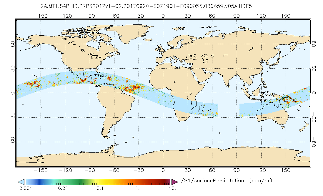
Federal
GPM SAPHIR on MT1 (PRPS) Climate-based Radiometer Precipitation Profiling L2 1.5 hours 10 km V06 (GPM_2APRPSMT1SAPHIR_CLIM) at GES DISC
National Aeronautics and Space Administration —
Version 6 is the current version of this dataset. Older versions are no longer available and have been superseded by Version 6.The Precipitation Retrieval and...

Official websites use .gov
A
.gov website belongs to an official government
organization in the United States.
Secure .gov websites use HTTPS
A
lock (
) or https:// means you’ve safely connected to
the .gov website. Share sensitive information only on official,
secure websites.