
-
Federal
HIRS/Nimbus-6 Images of Brightness Temperature on 70 mm Film V001 (HIRSN6IM) at GES DISC
National Aeronautics and Space Administration —
The HIRSN6IM data product consists of images of brightness temperatures on 70 mm film strips from the Nimbus-6 High Resolution Infrared Radiation Sounder. Each... -
Federal
CAR CLAMS BRDF Measurements V2 (CAR_CLAMS_BRDF) at GES DISC
National Aeronautics and Space Administration —
CLAMS is the Chesapeake Lighthouse and Aircraft Measurements for Satellites field campaign sponsored by CERES, MISR, MODIS-Atmospheres and the NASA/GEWEX Global... -
Federal
OMPS-NPP L2 NP Ozone (O3) Vertical Profile swath orbital
National Aeronautics and Space Administration —
The OMPS-NPP L2 NP Ozone (O3) Total Column swath orbital product provides ozone profile retrievals from the Ozone Mapping and Profiling Suite (OMPS) Nadir-Profiler... -
Federal
MLS/Aura L1 Radiances from Filter Banks for THz V004 (ML1RADT) at GES DISC
National Aeronautics and Space Administration —
ML1RADT is the EOS Aura Microwave Limb Sounder (MLS) product containing the level 1 radiances from the filter banks for the GHz radiometers. The data version is 4.2.... -
Federal
OMPS-NPP L2 NM Ozone (O3) Total Column swath orbital
National Aeronautics and Space Administration —
The OMPS-NPP L2 NM Ozone (O3) Total Column swath orbital product provides total ozone measurements from the Ozone Mapping and Profiling Suite (OMPS) Nadir-Mapper (NM)... -
Federal
Sounder SIPS: Suomi NPP CrIMSS Level 3 Specific Quality Control Gridded Daily SiFSAP V2 (SNDRSNIML3SDSFSP) at GES DISC
National Aeronautics and Space Administration —
The SIFSAP (Single Field-of-View Sounder Atmospheric Products) algorithm provides retrieval for each sounder Field of View (FOV), therefore, it has 3-times higher... -
Federal
Climatological Monthly Frequency of Dust Storm over Land for Varying Intensities, Based on MODIS Terra Deep Blue Level 2 Aerosol Products MOD04_L2 Collection 6.1, on a Global 0.1 by 0.1 Degree Grid, Level 3 Version 1 (MODFDS_CLM_GLB_L3) at GES DISC
National Aeronautics and Space Administration —
Version 1 is the current version of the dataset.This collection MODFDS_CLM_GLB_L3 provides level 3 climatological monthly frequency of dust storms (FDS) over land... -
Federal
SCAMS/Nimbus-6 Images of Brightness Temperatures, Water Vapor and Temperature on 70-mm Film V001 (SCAMSN6IM) at GES DISC
National Aeronautics and Space Administration —
The SCAMSN6IM data product consists of images of brightness temperatures, water vapor and temperature on 70 mm film strips from the Nimbus-6 Scanning Microwave... -
Federal
MLS/Aura L1 Radiances from Digital Autocorrelators V005 (ML1RADD) at GES DISC
National Aeronautics and Space Administration —
ML1RADD is the EOS Aura Microwave Limb Sounder (MLS) product containing the level 1 radiances from the digital autocorrelators. The data version is 5.0. Data coverage... -
Federal
MiCASA Daily NPP Rh ATMC NEE FIRE FUEL Fluxes 0.1 degree x 0.1 degree
National Aeronautics and Space Administration —
MiCASA is an extensive revision of CASA-GFED3. CASA-GFED3 derives from Potter et al. (1993), diverging in development since Randerson et al. (1996). CASA is a light... -
Federal
Sounder SIPS: Suomi NPP CrIMSS Level 3 Specific Quality Control Gridded Monthly SiFSAP V2 (SNDRSNIML3SMSFSP) at GES DISC
National Aeronautics and Space Administration —
The SIFSAP (Single Field-of-View Sounder Atmospheric Products) algorithm provides retrieval for each sounder Field of View (FOV), therefore, it has 3-times higher... -
Federal
OMPS-NPP L2 NM Sulfur Dioxide (SO2) Total and Tropospheric Column swath orbital V2 (OMPS_NPP_NMSO2_L2) at GES DISC
National Aeronautics and Space Administration —
The OMPS-NPP L2 NM Sulfur Dioxide (SO2) Total and Tropospheric Column swath orbital collection 2 version 2.0 product contains the retrieved sulfur dioxide (SO2)... -
Federal
OMPS-NPP L2 LP Ozone (O3) Vertical Profile swath daily 3slit V2.5 (OMPS_NPP_LP_L2_O3_DAILY) at GES DISC
National Aeronautics and Space Administration —
The OMPS-NPP L2 LP Ozone (O3) Vertical Profile swath daily 3slit collection contains ozone measured by the Ozone Mapping and Profiling Suite (OMPS) Limb-Profiler (LP)... -
Federal
CAR Discover AQ BRDF Measurements V2 (CAR_DISCOVERAQ_BRDF_2)
National Aeronautics and Space Administration —
DISCOVER-AQ, a NASA Earth Venture program funded mission, stands for Deriving Information on Surface Conditions from Column and Vertically Resolved Observations... -
Federal
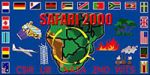
CAR Safari South African Biogeophysics and Biogeochemistry L1 V1 (CAR_SAFARI_L1C) at GES DISC
National Aeronautics and Space Administration —
The Southern African Regional Science Initiative (SAFARI) 2000 is an international science field campaign aimed at developing a better understanding of the southern... -
Federal
OMPS-NPP L2 NM Formaldehyde (HCHO) Total Column swath orbital
National Aeronautics and Space Administration —
The OMPS-NPP L2 NM Formaldehyde (HCHO) Total Column swath orbital product provides formaldehyde measurements from the Ozone Mapping and Profiling Suite (OMPS) Nadir-... -
Federal
Monthly Frequency of Dust Storm over Land for Varying Intensities, Based on MODIS Terra Deep Blue Level 2 Aerosol Products MOD04_L2 Collection 6.1, on a Global 0.1 by 0.1 Degree Grid, Level 3 Version 1 (MODFDS_MON_GLB_L3) at GES DISC
National Aeronautics and Space Administration —
Version 1 is the current version of the dataset.This collection MODFDS_MON_GLB_L3 provides level 3 monthly frequency of dust storms (FDS) over land from 175°W to... -
Federal
SMMR/Nimbus-7 Color Images V001 (SMMRN7IM) at GES DISC
National Aeronautics and Space Administration —
SMMRN7IM is the Nimbus-7 Scanning Multichannel Microwave Radiometer (SMMR) Color Image data product scanned from 17" x 15" color prints and saved as JPEG-2000 files.... -
Federal
Monthly Frequency of Dust Storm over Land for Varying Intensities, Based on MODIS Aqua Deep Blue Level 2 Aerosol Products MYD04_L2 Collection 6.1, on a Global 0.1 by 0.1 Degree Grid, Level 3 Version 1 (MYDFDS_MON_GLB_L3) at GES DISC
National Aeronautics and Space Administration —
Version 1 is the current version of the dataset.This collection MYDFDS_MON_GLB_L3 provides level 3 monthly frequency of dust storms (FDS) over land from 175°W to...

Official websites use .gov
A
.gov website belongs to an official government
organization in the United States.
Secure .gov websites use HTTPS
A
lock (
) or https:// means you’ve safely connected to
the .gov website. Share sensitive information only on official,
secure websites.