
-
Federal
Sentinel-6A GNSS-POD Level 1B Daily RINEX V1 (S6A_GN_1B_RNXD_AX_) at GES DISC
National Aeronautics and Space Administration —
This dataset provides the L1B Global Navigation Satellite System (GNSS) Precise Orbit Determination (POD) data generated by European Organisation for the Exploitation... -
Federal
TERRA MODIS High Resolution Level 3 daily aerosol data, 0.1x0.1 degree grid Version 001 (AER_DBDT_D10KM_L3_MODIS_TERRA) at GES DISC
National Aeronautics and Space Administration —
This High-Resolution (0.1 x 0.1 degree) Level 3 daily Aerosol Optical Depth (AOD) product is generated by combining two Moderate Resolution Imaging Spectroradiometer... -
Federal
Sounder SIPS: JPSS-1 CrIS Level 3 Specific Quality Control Gridded Daily CLIMCAPS V2 (SNDRJ1IML3SDCCP) at GES DISC
National Aeronautics and Space Administration —
WARNING: To users of the derived product “co_mmr_midtrop” (carbon monoxide mass mixing ratio to dry air [kg/kg] at ~500 hPa). This variable has a significant bias due... -
Federal
Sentinel-6A Level 2 GNSS Radio Occultation Near-Real-Time V1 (S6A_RO_2__NRT_NC__) at GES DISC
National Aeronautics and Space Administration —
This dataset provides the L2 Global Navigation Satellite System (GNSS) Radio-Occultation (RO) Near-Real-Time (NRT) retrieval generated by NASA's Jet Propulsion... -
Federal
Sounder SIPS: Suomi NPP CrIMSS Level 3 Specific Quality Control Gridded Daily CHART Normal Spectral Resolution V1
National Aeronautics and Space Administration —
The objective of this limited edition data collection is to examine products generated by the Climate Heritage AIRS Retrieval Technique (CHART) algorithm to analyze... -
Federal
MLS/Aura Level 3 Daily Binned Relative Humidity With Respect To Ice (RHI) on Zonal and Similar Grids V005 (ML3DZRHI) at GES DISC
National Aeronautics and Space Administration —
ML3DZRHI is the EOS Aura Microwave Limb Sounder (MLS) daily binned on zonal and assorted vertical grids product for relative humidity with respect to ice (RHI)... -
Federal
MLS/Aura Level 3 Daily Binned Nitric Acid (HNO3) Mixing Ratio on Zonal and Similar Grids V004 (ML3DZHNO3) at GES DISC
National Aeronautics and Space Administration —
ML3DZHNO3 is the EOS Aura Microwave Limb Sounder (MLS) daily binned on zonal and assorted vertical grids product for nitric acid (HNO3) derived from radiances... -
Federal
TROPESS CrIS-JPSS1 L2 Methane for Forward Stream, Summary Product V1 (TRPSYL2CH4CRS1FS) at GES DISC
National Aeronautics and Space Administration —
The TROPESS CrIS-JPSS1 L2 Methane for Forward Stream, Summary Product contains the vertical distribution of the retrieved atmospheric state of methane (CH4), and... -
Federal
Sentinel-6A Level 1B GNSS Radio Occultation Daily RINEX V1 (S6A_RO_1B_POD_RNX_) at GES DISC
National Aeronautics and Space Administration —
This dataset provides the L1B Global Navigation Satellite System (GNSS) Radio Occultation (RO) Precise Orbit Determination (POD) data generated by NASA JPL from... -
Federal
GPM MHS on METOP-B Common Calibrated Brightness Temperature L1C 1.5 hours 17 km V07 (GPM_1CMETOPBMHS) at GES DISC
National Aeronautics and Space Administration —
Version 07 is the current version of the data set. Older versions will no longer be available and have been superseded by Version 07.1CAMSR2 contains common... -
Federal
Sounder SIPS: Suomi NPP CrIMSS Level 3 Comprehensive Quality Control Gridded Daily CHART Normal Spectral Resolution V1
National Aeronautics and Space Administration —
The objective of this limited edition data collection is to examine products generated by the Climate Heritage AIRS Retrieval Technique (CHART) algorithm to analyze... -
Federal
Sounder SIPS: Suomi NPP CrIMSS Level 3 Comprehensive Quality Control Gridded Monthly CHART Normal Spectral Resolution V1
National Aeronautics and Space Administration —
The objective of this limited edition data collection is to examine products generated by the Climate Heritage AIRS Retrieval Technique (CHART) algorithm to analyze... -
Federal
Sentinel-5P TROPOMI Ozone Profile 1-Orbit L2 30km x 30km V2 (S5P_L2__O3__PR_HiR) at GES DISC
National Aeronautics and Space Administration —
Starting from August 6th in 2019, Sentinel-5P TROPOMI along-track high spatial resolution (~5.5km at nadir) has been implemented. S5P_L2__O3__PR_HiR data collection... -
Federal
GPM ATMS on NOAA-21 Common Calibrated Brightness Temperatures L1C 1.5 hours 17 km V07 (GPM_1CNOAA21ATMS) at GES DISC
National Aeronautics and Space Administration —
Version 07 is the current version of the data set. Older versions will no longer be available and have been superseded by Version 07.1CATMS contains common calibrated... -
Federal
NOAA20 VIIRS High Resolution Level 3 daily aerosol data, 0.1x0.1 degree grid Version 001 (AER_DBDT_D10KM_L3_VIIRS_NOAA20) at GES DISC
National Aeronautics and Space Administration —
This High-Resolution (0.1 x 0.1 degree) Level 3 daily Aerosol Optical Depth (AOD) product is generated by combining two Visible Infrared Imaging Radiometer Suite... -
Federal
HIRDLS-MLS/Aura Level 3 Monthly 10 x 20 deg Ice Water Content V002 (HIRMLS3IWC) at GES DISC
National Aeronautics and Space Administration —
HIRMLS3IWC is the Joint EOS High Resolution Dynamics Limb Sounder (HIRDLS) and Microwave Limb Sounder (MLS) monthly 10 degreee lat x 20 degreee lon gridded product... -
Federal
TROPESS CrIS-SNPP L2 Methane for Reanalysis Stream, Summary Product V1 (TRPSYL2CH4CRSRS) at GES DISC
National Aeronautics and Space Administration —
The TROPESS CrIS-SNPP L2 Methane for Reanalysis Stream, Summary Product contains the vertical distribution of the retrieved atmospheric state of methane (CH4), and... -
Federal
CMS (Carbon Monitoring System) Methane (CH4) Flux for North America 0.5 degree x 0.667 degree V1 (CMS_CH4_FLX_NA) at GES DISC
National Aeronautics and Space Administration —
An error was found in this product; therefore, it has been deleted. Please use the CMS Methane (CH4) Flux for North America Daily product (CMS_CH4_FLX_NAD, DOI:... -
Federal
CAR Discover AQ BRDF Measurements V2 (CAR_DISCOVERAQ_BRDF_2)
National Aeronautics and Space Administration —
DISCOVER-AQ, a NASA Earth Venture program funded mission, stands for Deriving Information on Surface Conditions from Column and Vertically Resolved Observations... -
Federal
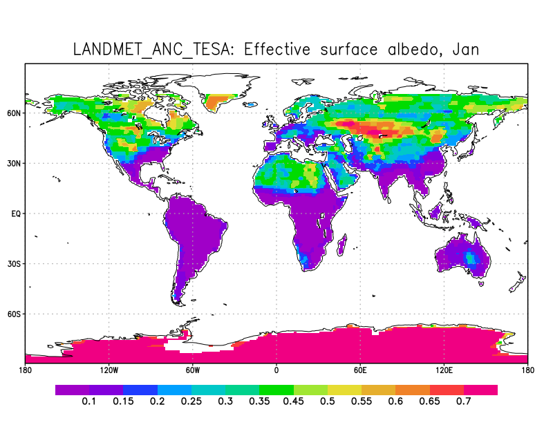
LANDMET Ancillary Monthly Mean Effective and Spectral Albedo Data L3 V1 (LANDMET_ANC_TESA) at GES DISC
National Aeronautics and Space Administration —
This is an ancillary product containing the total effective surface albedo at solar wavelengths originated from the ISCCP FD radiative fluxes product, and the...

Official websites use .gov
A
.gov website belongs to an official government
organization in the United States.
Secure .gov websites use HTTPS
A
lock (
) or https:// means you’ve safely connected to
the .gov website. Share sensitive information only on official,
secure websites.