
-
Federal
LIMS/Nimbus-7 Level 1 Radiance Data V001 (LIMSN7L1PROFILER) at GES DISC
National Aeronautics and Space Administration —
LIMSN7L1PROFILER is the Nimbus-7 Limb Infrared Monitor of the Stratosphere (LIMS) Level-1 Profiles of Radiance Data product and contains selected daily vertical... -
Federal
GPM DPR Ku-band Received Power L1B 1.5 hours 5 km V07 (GPM_PRL1KU) at GES DISC
National Aeronautics and Space Administration —
Version 07 is the current version of the data set. Older versions are no longer available and have been superseded by Version 07. This product contains the calibrated... -
Federal
TRMM Precipitation Radar Rainfall Rate and Profile L2 1.5 hours V7 (TRMM_2A25) at GES DISC
National Aeronautics and Space Administration —
The new version of these data is in GPM-like format (consistent with the GPM Dual-frequency Radar data format), and can be found under the name GPM_2APR. The TRMM... -
Federal
BUV/Nimbus-4 Level 2 High-Density Ozone Data V005 (BUVN4L2HDBUV) at GES DISC
National Aeronautics and Space Administration —
The Nimbus-4 BUV Level 2 High-Density Ozone Data collection contains the vertical distribtuion and total column amount of ozone, as well as the full set of ancillary... -
Federal
TRMM Precipitation Radar Rain Characteristics L2 1.5 hours V7 (TRMM_2A23) at GES DISC
National Aeronautics and Space Administration —
The new version of these data is in GPM-like format (consistent with the GPM Dual-frequency Radar data format), and can be found under the name GPM_2APR. The TRMM... -
Federal
MLS/Aura Near-Real-Time L2 Nitrous Oxide (N2O) Mixing Ratio V005 (ML2N2O_NRT) at GES DISC
National Aeronautics and Space Administration —
ML2N2O_NRT is the EOS Aura Microwave Limb Sounder (MLS) Near-Real-Time (NRT) product for nitrous oxide (N2O). This product contains N2O profiles derived from the 190... -
Federal
UARS Wind Imaging Interferometer (WINDII) Level 3AT V011 (UARWI3AT) at GES DISC
National Aeronautics and Space Administration —
The Wind Imaging Interferometer (WINDII) Level 3AT data product consists of daily, 65.536 second interval time-ordered vertical profiles of meridional and zonal wind... -
Federal
TRMM Ground Validation Calibrated QC Radar Reflectivity Full Volume Scan L1C 1 hour V7 (TRMM_1C51UW) at GES DISC
National Aeronautics and Space Administration —
This dataset is part of the University of Washington TRMM Ground Validation products. Files are in "Universal Format", described in BAMS, Vol 61, No 11, November... -
Federal
THIR/Nimbus-7 Images of Daytime and Nighttime Brightness Temperature on 70 mm Film V001 (THIRN7IM) at GES DISC
National Aeronautics and Space Administration —
THIRN7IM is the Nimbus-7 Temperature-Humidity Infrared Radiometer (THIR) data product consisting of daily montages of brightness temperatures measured at 6.7 and 11.5... -
Federal
TRMM Microwave Imager Hydrometeor Profile L2 1.5 hours V7 (TRMM_2A12) at GES DISC
National Aeronautics and Space Administration —
The new version of these data is in GPM-like format and can be found under the name GPM_2AGPROFTRMMTMI_CLIM. This dataset, 2A12, ”TMI Profiling”, generates surface... -
Federal
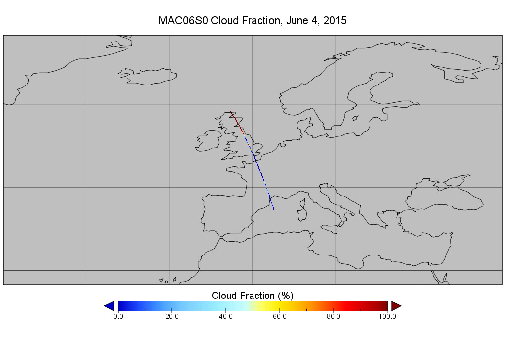
MODIS/Aqua Clouds 1km and 5km 5-Min L2 Narrow Swath Subset along CloudSat V002 (MAC06S0) at GES DISC NGDA
National Aeronautics and Space Administration —
This is the narrow-swath MODIS/Aqua subset along CloudSat field of view track. The goal of the narrow-swath subset is to select and return MODIS data that are within... -
Federal
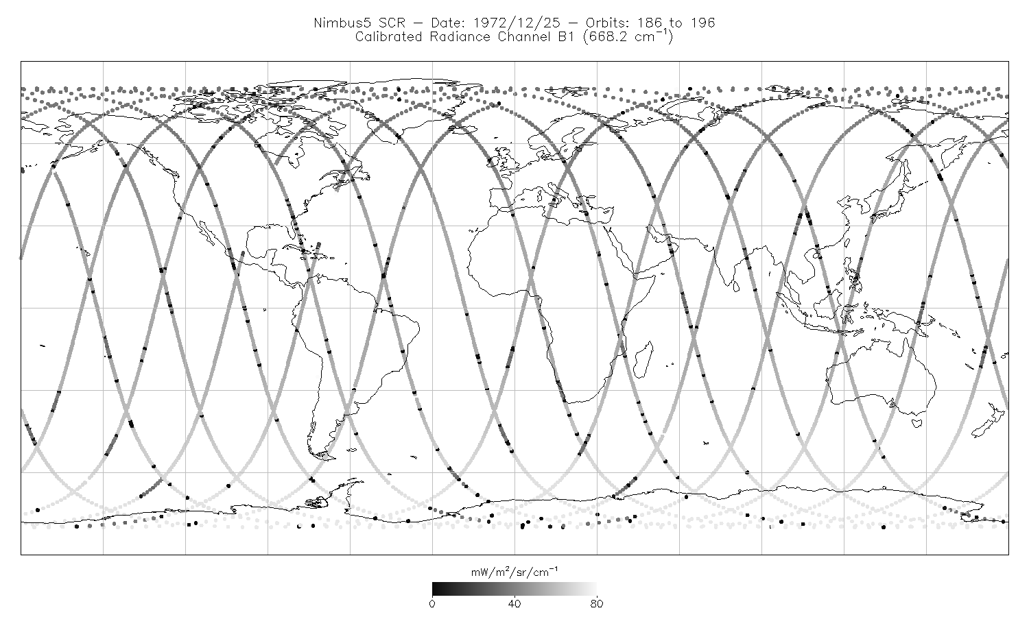
SCR/Nimbus-5 Level 1 Calibrated Radiances V001 (SCRN5L1RAD) at GES DISC
National Aeronautics and Space Administration —
SCRN5L1RAD is the Nimbus-5 Selective Chopper Radiometer (SCR) Level 1 Calibrated Radiances data product. The calibrated radiances are measured at 16 channels from 2.3... -
Federal
UARS Improved Stratospheric and Mesospheric Sounder (ISAMS) Level 3AL V010 (UARIS3AL) at GES DISC
National Aeronautics and Space Administration —
The Improved Stratospheric and Mesospheric Sounder (ISAMS) Level 3AL data product consists of daily, 4 degree increment latitude-ordered vertical profiles of... -
Federal
OCO-2 Level 1A collated, parsed, science or calibration data V11.2 (OCO2_L1aIn_Sample) at GES DISC
National Aeronautics and Space Administration —
Version 11.2 is the current version of the data set. Older versions will no longer be available and are superseded by Version 11.2. The Orbiting Carbon Observatory is... -
Federal
UARS Cryogenic Limb Array Etalon Spectrometer (CLAES) Level 3AL V009 (UARCL3AL) at GES DISC
National Aeronautics and Space Administration —
The Cryogenic Limb Array Etalon Spectrometer (CLAES) Level 3AL data product consists of daily, 4 degree increment latitude-ordered vertical profiles of temperature... -
Federal
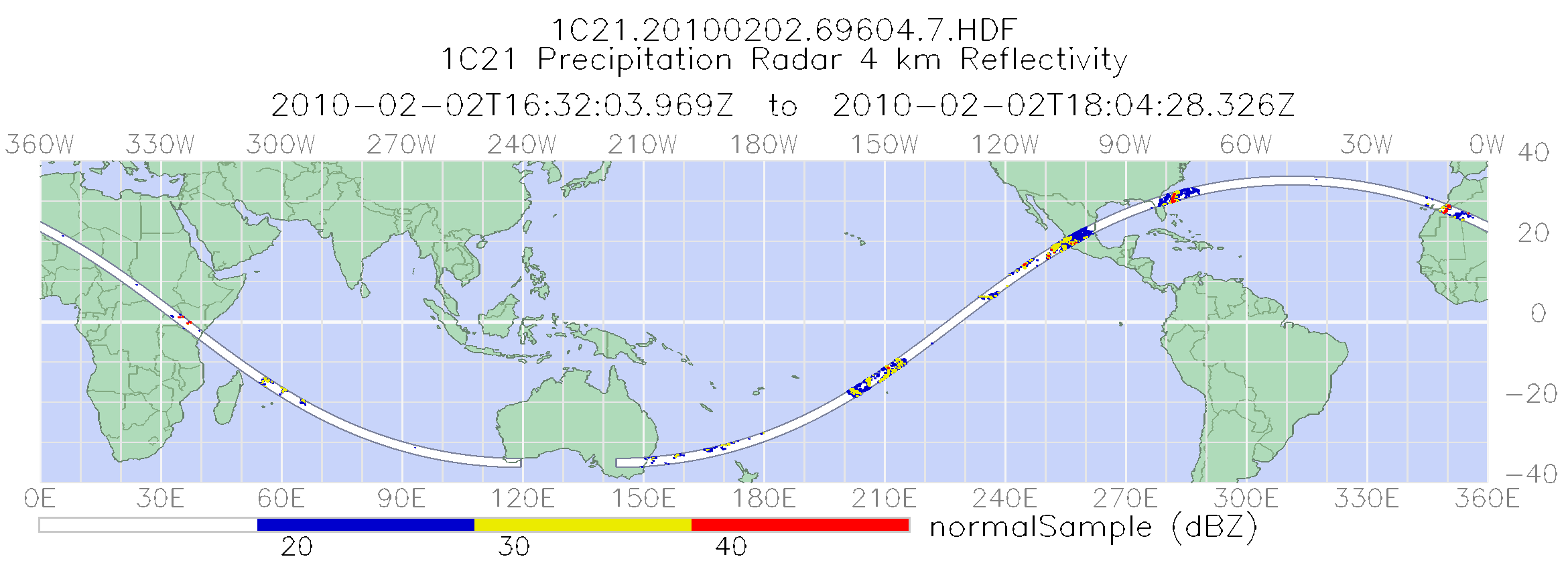
TRMM Precipitation Radar Power and Reflectivity L1C 1.5 hours V7 (TRMM_1C21) at GES DISC
National Aeronautics and Space Administration —
The TRMM Precipitation Radar (PR), the first of its kind in space, is an electronically scanning radar, operating at 13.8 GHz that measures the 3-D rainfall... -
Federal
OCO-3 Level 2 CO2 prior based on CO2 monthly flask record, global meteorology, and age of air, Forward Processing V11 (OCO3_L2_CO2Prior) at GES DISC
National Aeronautics and Space Administration —
Version 11 is the current version of the data set. Older versions will no longer be available and are superseded by Version 11. The Orbiting Carbon Observatory -3... -
Federal
MLS/Aura Near-Real-Time L2 Temperature V005 (ML2T_NRT) at GES DISC
National Aeronautics and Space Administration —
ML2T_NRT is the EOS Aura Microwave Limb Sounder (MLS) Near-Real-Time (NRT) product for temperature. This product contains temperature profiles derived from the 118... -
Federal
HIRDLS/Aura Level 3 Nitrogen Dioxide (NO2) 1deg Lat Zonal Fourier Coefficients V007 (H3ZFCNO2) at GES DISC
National Aeronautics and Space Administration —
The "HIRDLS/Aura Level 3 Nitrogen Dioxide (NO2) Zonal Fourier Coefficients" version 7 data product (H3ZFCNO2) contains the entire mission (~3 years) of HIRDLS data... -
Federal
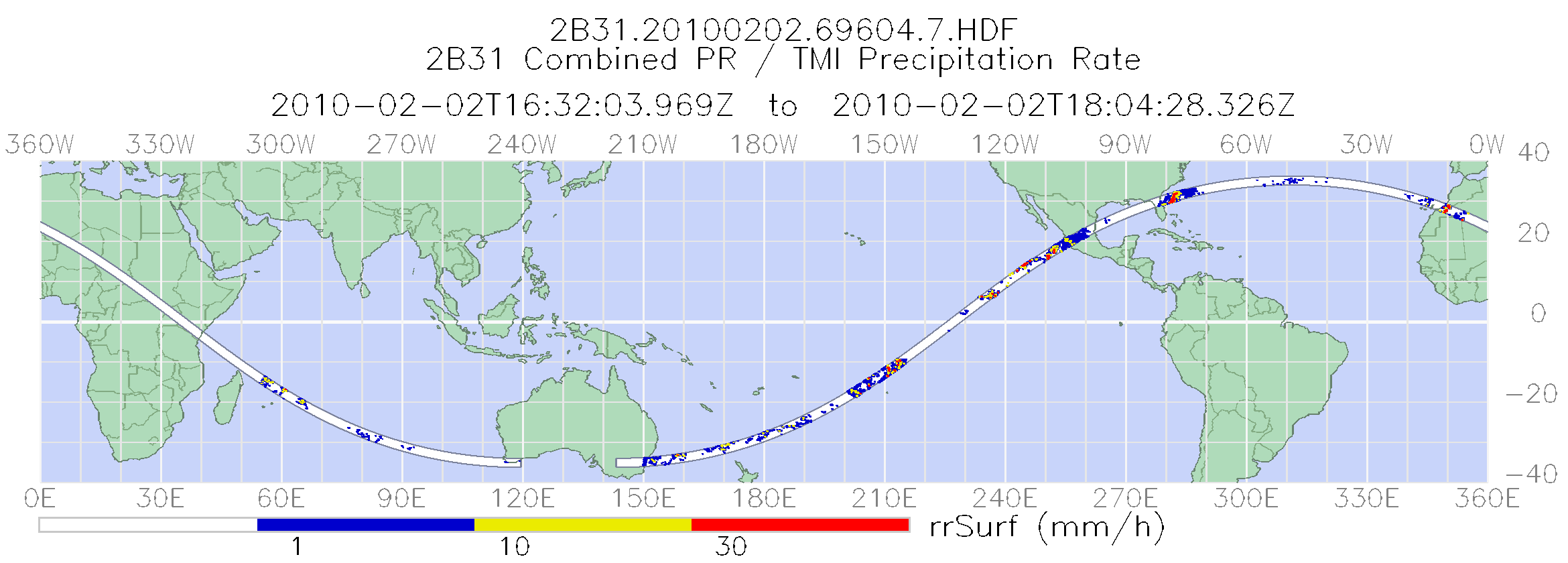
TRMM Combined Precipitation Radar and Microwave Imager Rainfall Profile L2 1.5 hours V7 (TRMM_2B31) at GES DISC
National Aeronautics and Space Administration —
The TRMM combined algorithm (2B31) combines data from the TMI and PR to produce the best rain estimate for TRMM. This combined rainfall product is derived from...

Official websites use .gov
A
.gov website belongs to an official government
organization in the United States.
Secure .gov websites use HTTPS
A
lock (
) or https:// means you’ve safely connected to
the .gov website. Share sensitive information only on official,
secure websites.