
-
Federal
OPERA Radiometric Terrain Corrected SAR Backscatter from Sentinel-1 validated product (Version 1) recent views
National Aeronautics and Space Administration —
The Observational Products for End-Users from Remote Sensing Analysis (OPERA) Radiometric Terrain Corrected (RTC) SAR Backscatter from Sentinel-1 (S1) validated... -
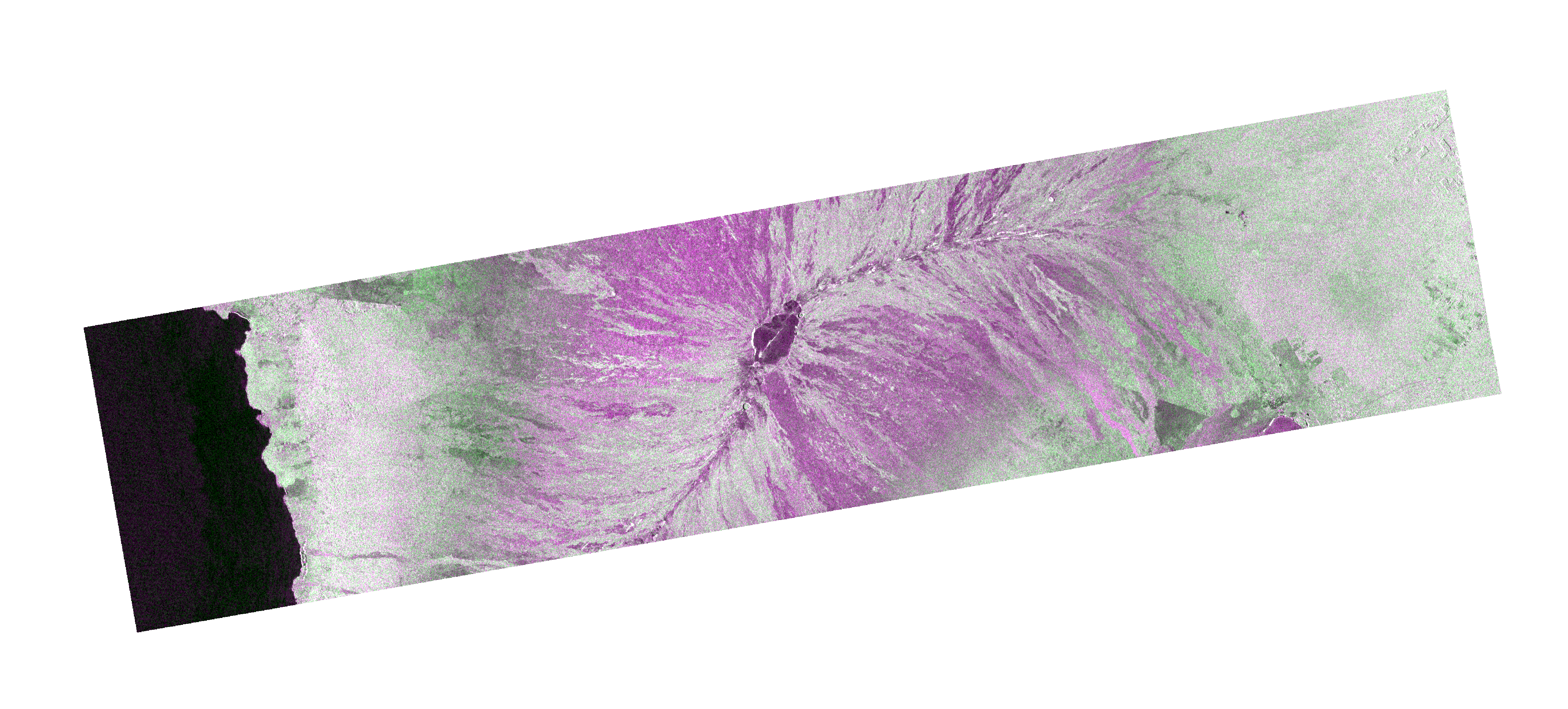
Federal
ALOS_PALSAR_RTC_HIGH_RES recent views
National Aeronautics and Space Administration —
PALSAR_Radiometric_Terrain_Corrected_high_res -
Federal
SENTINEL-1B_SINGLE_POL_GRD_HIGH_RES recent views
National Aeronautics and Space Administration —
Sentinel-1B Single-pol ground projected high and full resolution images -
Federal
Global Sentinel-1 Burst ID Map recent views
National Aeronautics and Space Administration —
Sentinel-1 performs systematic acquisition of bursts in both IW and EW modes. The bursts overlap almost perfectly between different passes and are always located at... -
Federal
SEASAT_SAR_LEVEL1_GEOTIFF recent views
National Aeronautics and Space Administration —
SEASAT Image GeoTIFF -
Federal
SENTINEL-1A_SINGLE_POL_GRD_FULL_RES recent views
National Aeronautics and Space Administration —
Sentinel-1A Single-pol ground range detected full resolution images -
Federal
RADARSAT-1_LEVEL0 recent views
National Aeronautics and Space Administration —
RADARSAT-1 Level 0 -
Federal
SENTINEL-1B_DUAL_POL_GRD_MEDIUM_RES recent views
National Aeronautics and Space Administration —
Sentinel-1B Dual-pol ground projected medium resolution images -
Federal
ERS-2_LEVEL0 recent views
National Aeronautics and Space Administration —
ERS-2 Standard Beam Data Level 0 -
Federal
AIRSAR_POLSAR_SYNOPTIC_3_FREQ_POLARIMETRY recent views
National Aeronautics and Space Administration —
AIRSAR three-frequency polarimetric synoptic product -
Federal
ALOS_PALSAR_LEVEL2.2 recent views
National Aeronautics and Space Administration —
ALOS PALSAR Level 2.2 -
Federal
RADARSAT-1_LEVEL1 recent views
National Aeronautics and Space Administration —
RADARSAT-1 Level 1 Amplitude Images -
Federal
SMAP_L1B_SIGMA_NAUGHT_LOW_RES_METADATA_V001 recent views
National Aeronautics and Space Administration —
SMAP Level 1B Sigma Naught Low Res Product Metadata -
Federal
SENTINEL-1A_SINGLE_POL_GRD_MEDIUM_RES recent views
National Aeronautics and Space Administration —
Sentinel-1A Single-pol ground projected medium resolution images -
Federal
SENTINEL-1B_DUAL_POL_GRD_HIGH_RES recent views
National Aeronautics and Space Administration —
Sentinel-1B Dual-pol ground projected high and full resolution images -
Federal
SMAP_L1A_RADAR_QA_V001 recent views
National Aeronautics and Space Administration —
SMAP Level 1A Radar Data Quality Information -
Federal
SMAP_L1B_SIGMA_NAUGHT_LOW_RES_V001 recent views
National Aeronautics and Space Administration —
SMAP Level 1B Sigma Naught Low Res Product -
Federal
SMAP_L1C_SIGMA_NAUGHT_HIGH_RES_V001 recent views
National Aeronautics and Space Administration —
SMAP Level 1C Sigma Naught High Res Product -
Federal
SENTINEL-1B_RAW recent views
National Aeronautics and Space Administration —
Sentinel-1B level zero product -
Federal
SENTINEL-1B_METADATA_RAW recent views
National Aeronautics and Space Administration —
Metadata for Sentinel-1B level zero product

Official websites use .gov
A
.gov website belongs to an official government
organization in the United States.
Secure .gov websites use HTTPS
A
lock (
) or https:// means you’ve safely connected to
the .gov website. Share sensitive information only on official,
secure websites.