

240 datasets found
-
Federal
West Flank Coso FORGE: Indian Wells Valley Aeromagnetic Data
Department of Energy —
Aeromagnetic data was collected over the Indian Wells Valley, CA in November 1994. It consisted of 9,033 line-kilometers covering ~4,150 square kilometers, flown at a... -
Federal
Geospatial and model dataset for flood-Inundation maps in a 10-mile reach of the Sabinal River and a 7-mile reach of the West Sabinal River near Utopia, Texas, 2021
Department of the Interior —
This data release documents the digital data used to produce flood-inundation maps for a range of gage heights (stages) for the Sabinal River near Utopia, Tex. The... -
Federal
Hawthorne Nevada Deep Direct-Use Feasibility Study - Shallow Temperature Survey
Department of Energy —
The objective of this project is to use a multi-disciplinary, three-tiered approach to assess the geothermal resource and determine the feasibility of implementing a... -
Federal
Snake River Plain Play Fairway Analysis: Phase 1 Report
Department of Energy —
This presents the results of Phase 1 of the Snake River Plain Play Fairway Analysis project, along with a proposed work for Phase 2. No new data were collected, but... -
Federal
Hydrothermal mineral alterations in the Brady and Desert Peak geothermal fields
Department of Energy —
Results of the analysis of HyMap's spectra against know hydrothermally altered minerals in the Brady-Desert Peak Geothermal Areas. The analysis was performed using... -
Federal
Hot Pot Fault Summary
Department of Energy —
Compilation of faults interpreted from seismic reflection survey and from field observations. -
Federal
Penrose Well Temperatures
Department of Energy —
Penrose Well Temperatures Geothermal waters have been encountered in several wells near Penrose in Fremont County, Colorado. Most of the wells were drilled for oil... -
Federal
West Flank Coso FORGE: MT Station Locations
Department of Energy —
This data includes the locations of the MT data collected in and around the Coso Geothermal field that covered the West Flank area. These are the data that the 3D MT... -
Federal
Areas of Anomalous Surface Temperature in Archuleta County, Colorado, as Identified from ASTER Thermal Data
Department of Energy —
This layer contains areas of anomalous surface temperature in Archuleta County identified from ASTER thermal data and spatial based insolation model. The temperature... -
Federal
Hot Pot Field Observations
Department of Energy —
Map of field observations including depressions, springs, evidence of former springs, travertine terraces and vegetation patterns. Map also contains interpretation of... -
Federal
Oregon Cascades Play Fairway Analysis: Faults and Heat Flow Maps
Department of Energy —
This submission includes a fault map of the Oregon Cascades and backarc, a probability map of heat flow, and a fault density probability layer. More extensive... -
Federal
Utah FORGE: Milford Gravity Data Shapefile
Department of Energy —
This is a zipped GIS compatible shapefile of gravity data points used in the Milford, Utah FORGE project as of March 21st, 2016. The shapefile is native to ArcGIS,... -
Federal
Tularosa Basin Play Fairway Analysis: Weights of Evidence; Mineralogy, and Temperature Anomaly Maps
Department of Energy —
This submission has two shapefiles and a tiff image. The weights of evidence analysis was applied to data representing heat of the earth and fracture permeability... -
Federal
Areas of Weakly Anomalous to Anomalous Surface Temperature in Garfield County, Colorado, as Identified from ASTER Thermal Data
Department of Energy —
Note: This "Weakly Anomalous to Anomalous Surface Temperature" dataset differs from the "Anomalous Surface Temperature" dataset for this county (another remotely... -
Federal
Exploration Gap Assessment (FY13 Update)
Department of Energy —
This submission contains an update to the previous Exploration Gap Assessment funded in 2012, which identify high potential hydrothermal areas where critical data are... -
Federal
Regional Slip Tendency Analysis of the Great Basin Region
Department of Energy —
Slip and dilation tendency on the Great Basin fault surfaces (from the USGS Quaternary Fault Database) were calculated using 3DStress (software produced by Southwest... -
Federal
Granite Springs Valley, Nevada Play Fairway Analysis - Well data and Temperature Survey
Department of Energy —
This data is associated with the Nevada Play Fairway project and includes excel files containing raw 2-meter temperature data and corrections. GIS shapefiles and... -
Federal
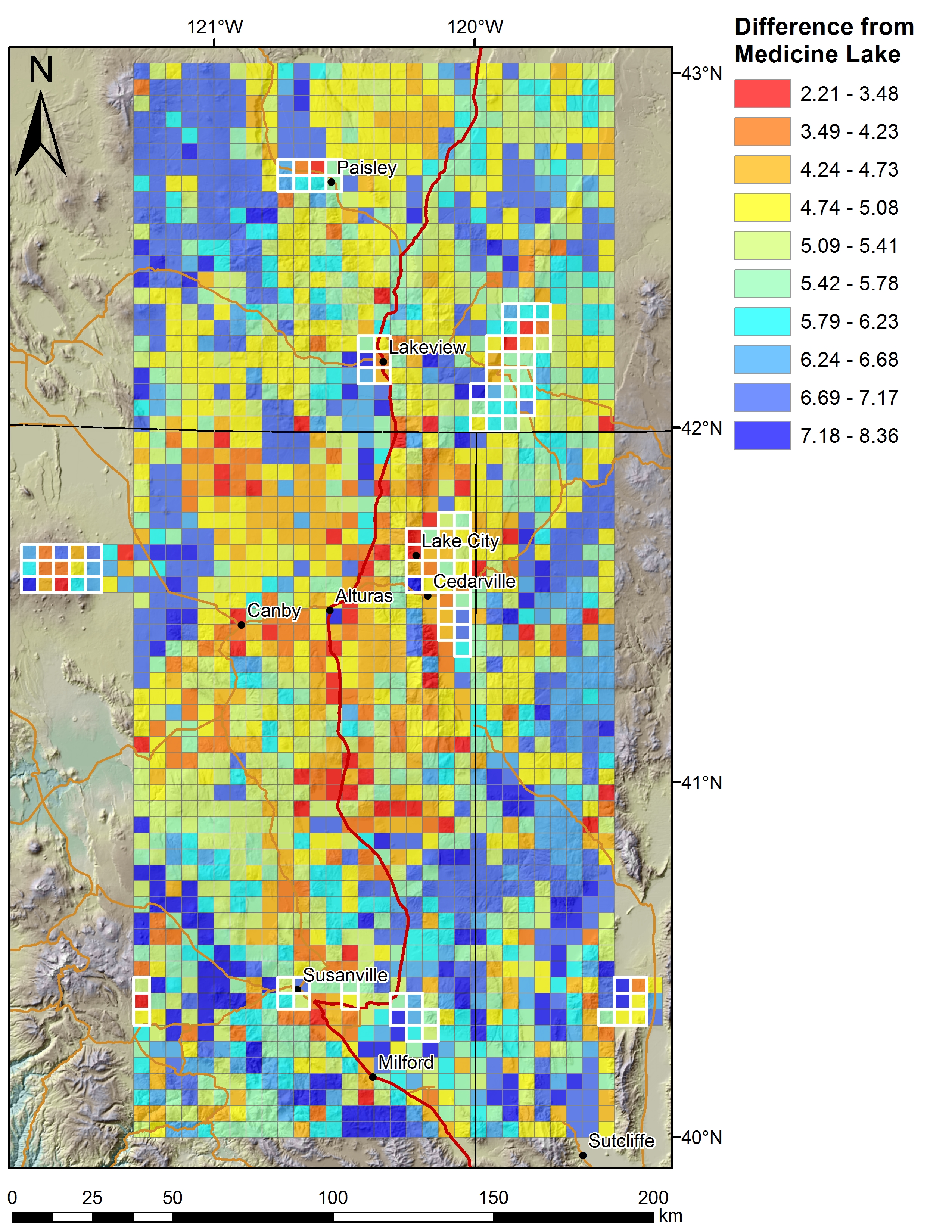
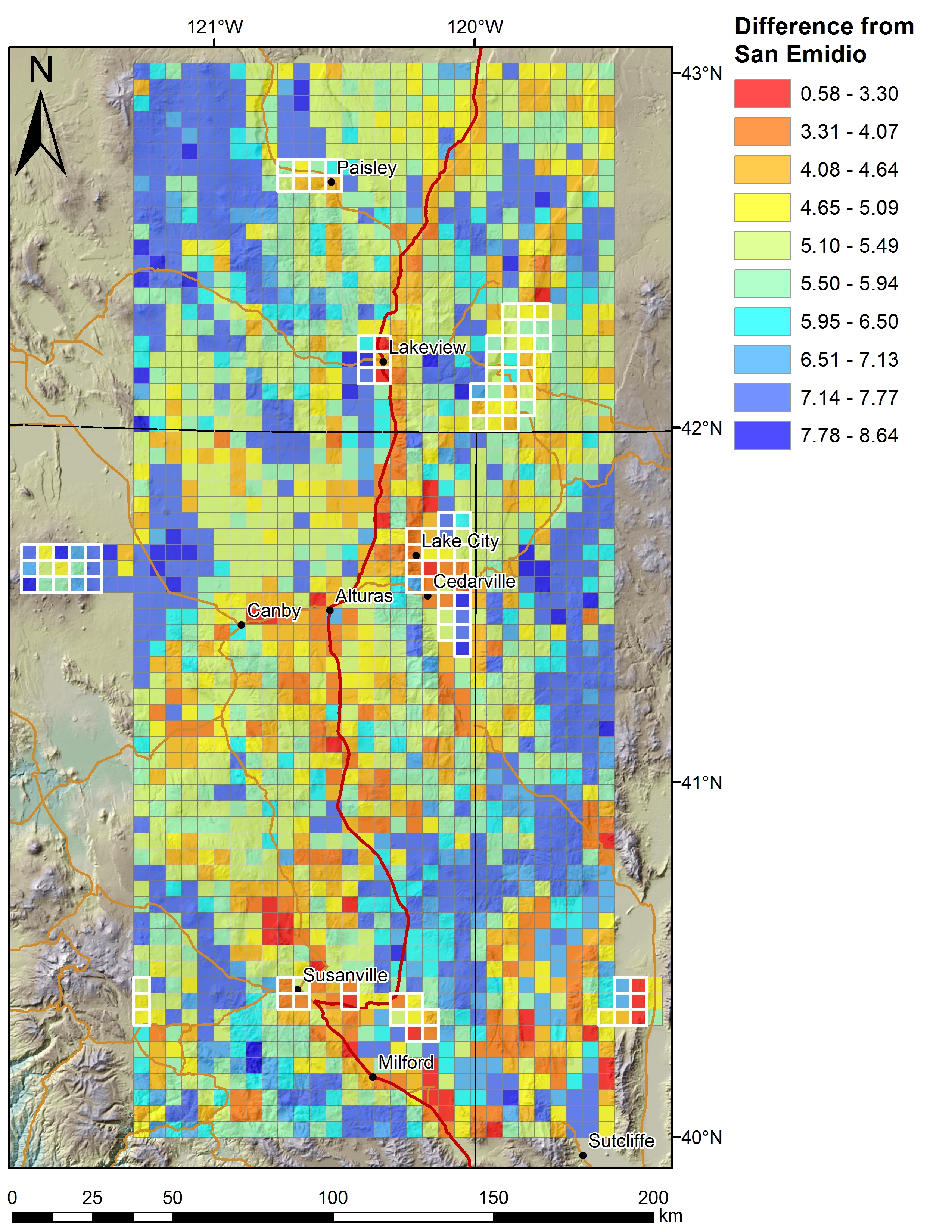
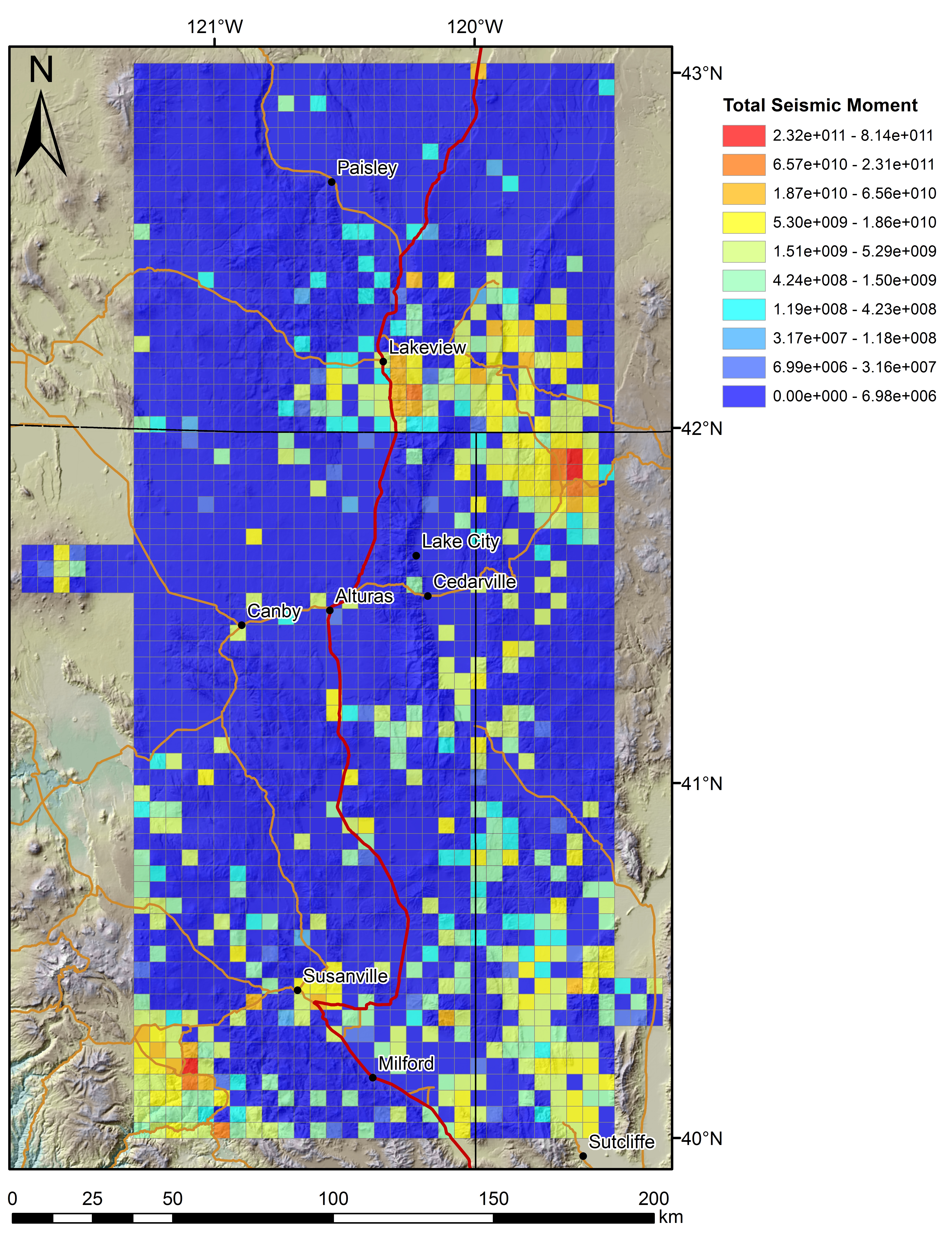
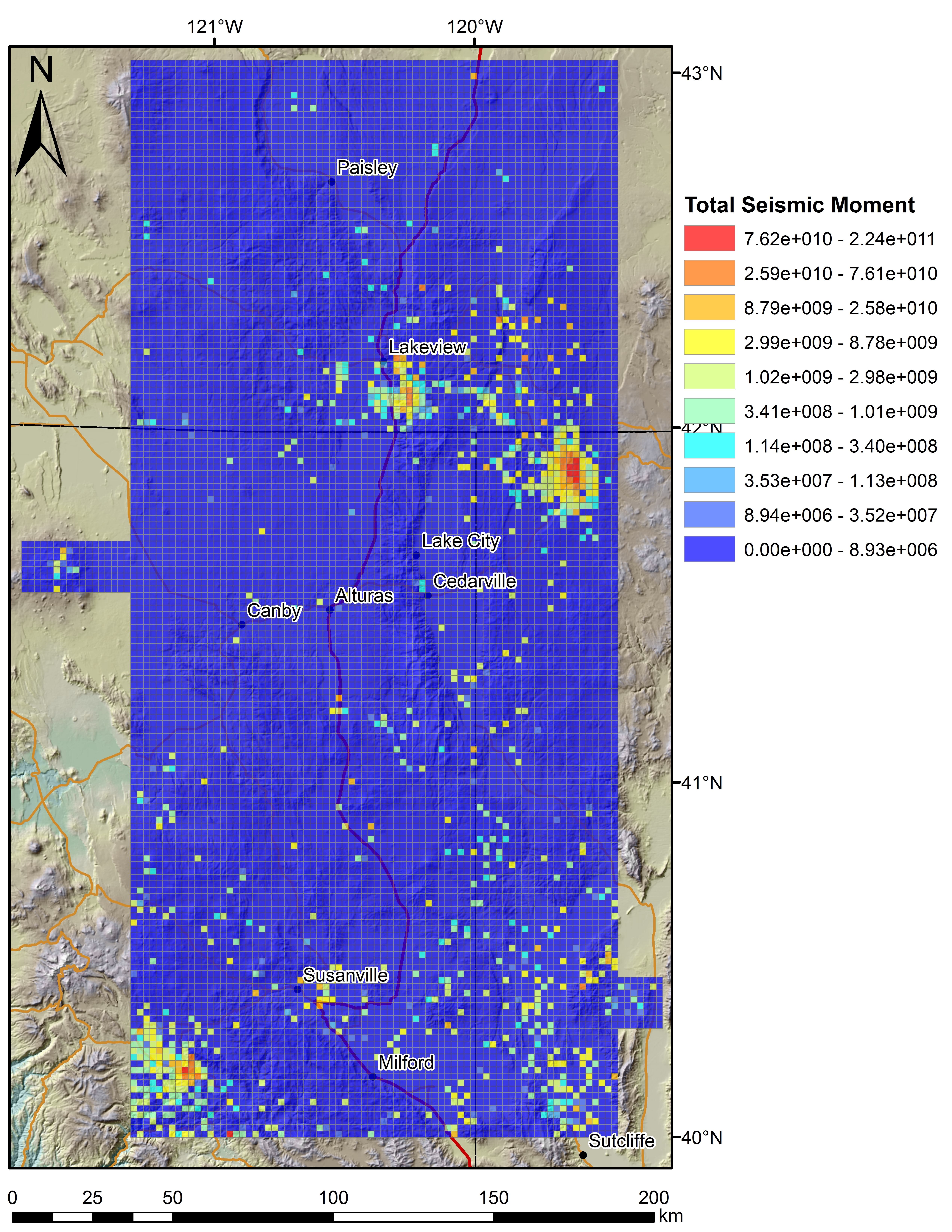
Play Fairway Analysis CA-NV-OR: Figures on 2km Grids
Department of Energy —
Various data sets displayed on a 2km grid for the Play Fairway Analysis CA-NV-OR area. -
Federal
Appalachian Basin Play Fairway Analysis Thermal Risk Factor and Quality Analyses
Department of Energy —
This submission revises the analysis and products for Thermal Quality Analysis for the northern half of the Appalachian Basin...
240 datasets found