
-
Federal
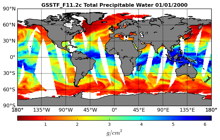
SAFARI 2000 MODIS Water and Heat Fluxes, Maun, Botswana, Dry Season 2001
National Aeronautics and Space Administration —
A physically-based model, Energy: Surface Towards Atmosphere (ESTA), was used to model and map the energy and water balances of a heterogeneous land surface in a... -
Federal
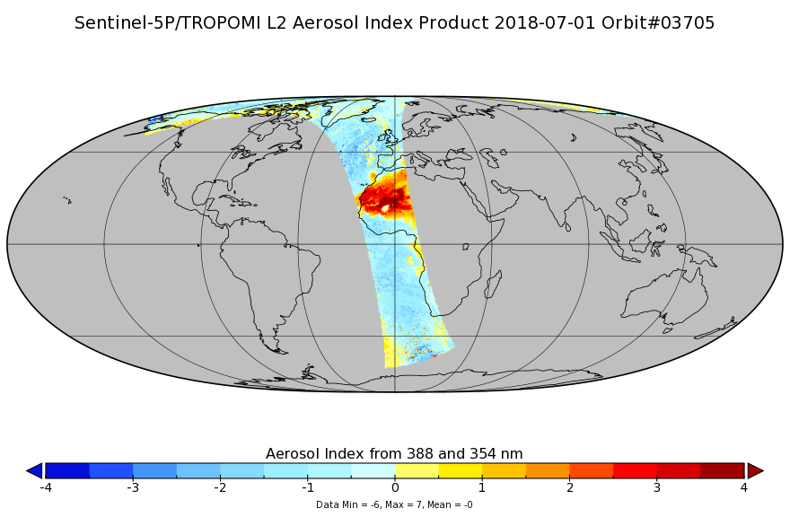
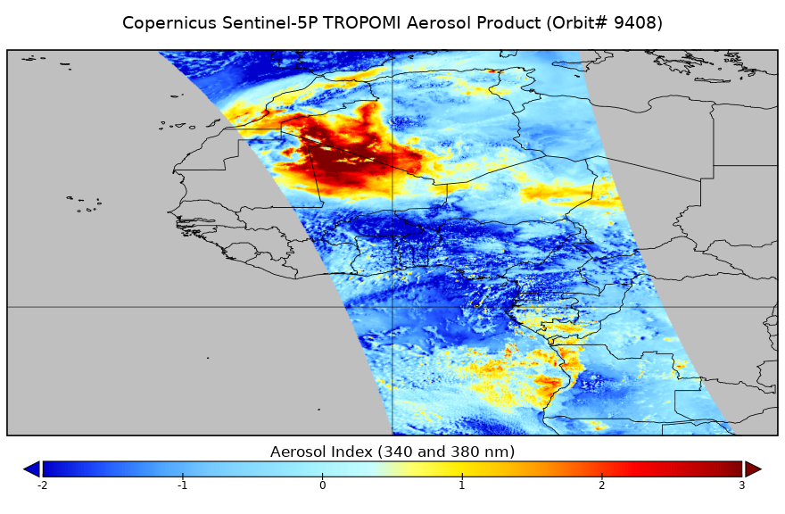
Sentinel-5P TROPOMI Aerosol Index 1-Orbit L2 7km x 3.5km V1 (S5P_L2__AER_AI) at GES DISC
National Aeronautics and Space Administration —
Starting from August 6th in 2019, Sentinel-5P TROPOMI along-track high spatial resolution (~5.5km at nadir) has been implemented. For data after August 6th of 2019,... -
Federal
CERES and GEO-Enhanced TOA, Within-Atmosphere and Surface Fluxes, Clouds and Aerosols Monthly-Averaged 1-Hourly Terra-NPP Edition1A
National Aeronautics and Space Administration —
CER_SYN1deg-MHour_Terra-NPP_Edition1A is the Clouds and the Earth's Radiant Energy System (CERES) and geostationary (GEO)-Enhanced Top-of-Atmosphere (TOA), Within-... -
Federal
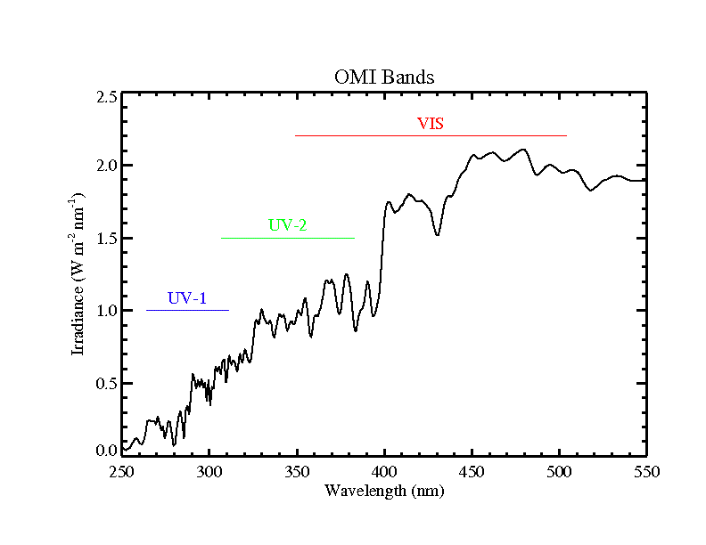
OMI/Aura Level 1B Averaged Solar Irradiances V004 (OML1BIRR) at GES DISC
National Aeronautics and Space Administration —
The Aura Ozone Monitoring Instrument (OMI) Level 1B (L1B) UV Averaged Solar Irradiances product (shortname OML1BIRR) contains the averaged radiometrically calibrated... -
Federal
OMI/Aura Level 1B VIS Global Geolocated Earthshine Radiances V004 (OML1BRVG) at GES DISC
National Aeronautics and Space Administration —
The Aura Ozone Monitoring Instrument (OMI) Level 1B (L1B) Geolocated Earthshine VIS Radiance, Global-mode (shortname OML1BRVG) Version 4 product contains geolocated... -
Federal
SatCORPS CERES GEO Edition 4 MTSAT-2R Northern Hemisphere Version 1.0
National Aeronautics and Space Administration —
CER_GEO_Ed4_MTS02_NH_V01 is the Satellite Cloud and Radiation Property retrieval System (SatCORPS) Clouds and the Earth's Radiant Energy System (CERES) Geostationary... -
Federal
LBA-ECO CD-03 Cloud Base-Backscatter Data, km 67 Tower Site, Tapajos National Forest
National Aeronautics and Space Administration —
A Vaisala CT-25K ceilometer was installed at an old-growth forest site located at the km 67 Eddy Flux Tower site in the Tapajos National Forest, Para, Brazil, off... -
Federal
CALIPSO Wide Field Camera Level 1B 125m Native Science data, Validated Stage 1 V3-02
National Aeronautics and Space Administration —
CAL_WFC_L1_125m-ValStage1-V3-02 data are Cloud-Aerosol Lidar and Infrared Pathfinder Satellite Observation (CALIPSO) Wide Field Camera (WFC) Level 1B 125 m Native... -
Federal
Global Gas Flare Survey by Infrared Imaging, VIIRS Nightfire, 2012-2019
National Aeronautics and Space Administration —
This dataset contains annual global flare site surveys from 2012-2019 derived from Visible Infrared Imaging Radiometer Suite (VIIRS) on the Suomi National Polar... -
Federal
GPM GROUND VALIDATION DC-8 CAMERA NADIR GCPEX V1
National Aeronautics and Space Administration —
The GPM Ground Validation DC-8 Camera Nadir GCPEx dataset contains geo-located, visible-wavelength imagery of the ground obtained from the nadir camera aboard the... -
Federal
SatCORPS CERES GEO Edition 4 Meteosat-5 Full Disk Version 2
National Aeronautics and Space Administration —
CER_GEO_Ed4_MET05_FD_V02 is the Satellite Cloud and Radiation Property retrieval System (SatCORPS) Clouds and the Earth's Radiant Energy System (CERES) Geostationary... -
Federal
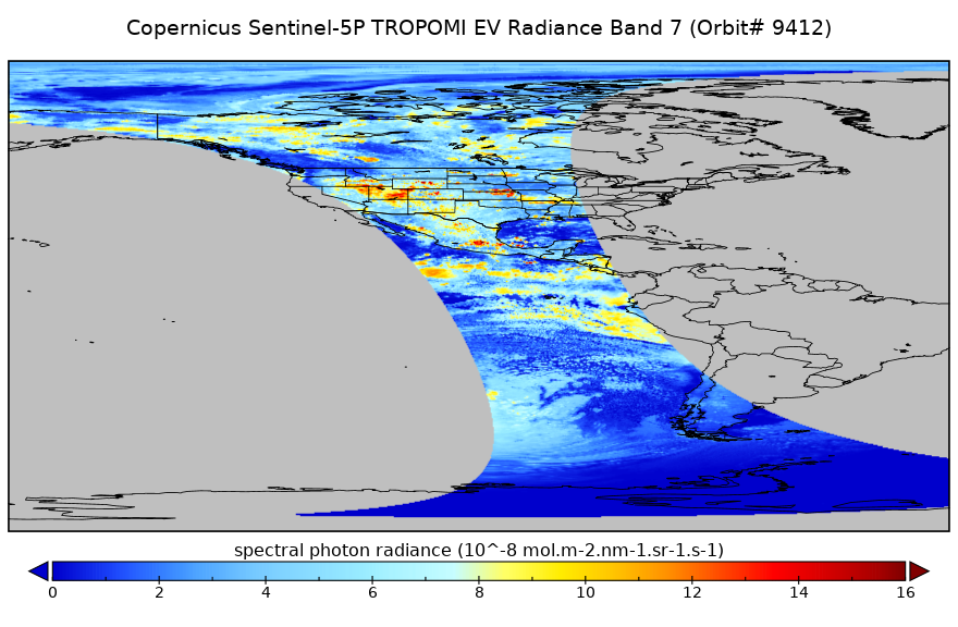
Sentinel-5P TROPOMI Radiance product band 7 (SWIR detector) L1B 5.5km x 7km V2 (S5P_L1B_RA_BD7_HiR) at GES DISC
National Aeronautics and Space Administration —
Starting from August 6th in 2019, Sentinel-5P TROPOMI along-track high spatial resolution (~5.5km at nadir) has been implemented. For data before August 6th of 2019,... -
Federal
CERES Single Scanner Footprint (SSF) TOA/Surface Fluxes, Clouds and Aerosols NPP-FM5 Edition2A
National Aeronautics and Space Administration —
CER_SSF_NPP-FM5_Edition2A data have CERES observed TOA fluxes, MODIS clouds and aerosols, and parameterized surface fluxes. The Single Scanner Footprint TOA/Surface... -
Federal
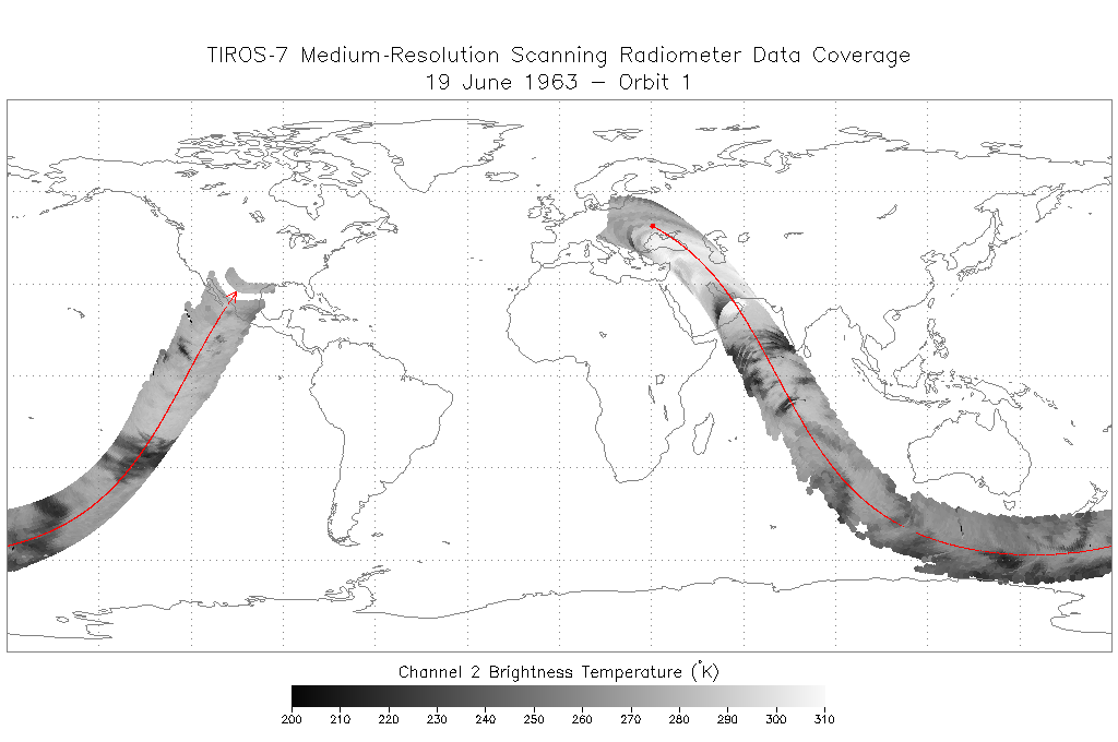
TIROS-7 Medium-Resolution Scanning Radiometer Level 1 Final Meteorological Radiation Data V001 (TIROS7L1FMRT) at GES DISC
National Aeronautics and Space Administration —
TIROS-7 Medium-Resolution Scanning Radiometer Level 1 Final Meteorological Radiation Data (FMRT) product contains radiances expressed in five infrared/visible... -
Federal
Sentinel-5P TROPOMI Near-Real-Time (NRT) Radiance product band 4 (UVIS detector) L1B 5.5km x 3.5km V2 (S5P_L1B_RA_BD4_HiR_NRT) at GES DISC
National Aeronautics and Space Administration —
The Sentinel-5P TROPOMI Near Real Time (NRT) Radiance product band 4 (UVIS detector) L1B 5.5km x 21km V2 (S5P_L1B_RA_BD4_HiR_NRT) product at GES DISC is the near real... -
Federal
GOES IMPACTS
National Aeronautics and Space Administration —
The GOES IMPACTS dataset consists of single reflective band radiance products from the Advanced Baseline Imager (ABI) onboard the GOES-16 geostationary satellite.... -
Federal
BOREAS RSS-19 1994 Seasonal Understory Reflectance Data
National Aeronautics and Space Administration —
One objective of BOREAS is to further the understanding of the spectral bi-directional reflectance of typical boreal ecosystem stands in the visible/near-infrared... -
Federal
SatCORPS CERES GEO Edition 4 MTSAT-1R Northern Hemisphere Version 1.0
National Aeronautics and Space Administration —
CER_GEO_Ed4_MTS01_NH_V01 is the Satellite Cloud and Radiation Property retrieval System (SatCORPS) Clouds and the Earth's Radiant Energy System (CERES) Geostationary... -
Federal
Sentinel-5P TROPOMI Near-Real-Time (NRT) Aerosol Index 1-Orbit L2 5.5km x 3.5km V2 (S5P_L2__AER_AI_HiR_NRT) at GES DISC
National Aeronautics and Space Administration —
The Sentinel-5P TROPOMI Near Real Time (NRT) Aerosol Index 1-Orbit L2 5.5km x 3.5km V2 (S5P_L2__AER_AI_HiR_NRT) at GES DISC is the near real time version of the...

Official websites use .gov
A
.gov website belongs to an official government
organization in the United States.
Secure .gov websites use HTTPS
A
lock (
) or https:// means you’ve safely connected to
the .gov website. Share sensitive information only on official,
secure websites.