

173 datasets found for ""Soil Moisture""
-
Federal
ABoVE: Synthesis of Burned and Unburned Forest Site Data, AK and Canada, 1983-2016
National Aeronautics and Space Administration —
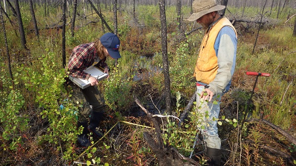
This dataset is a synthesis of field plot characterization data, derived above-ground and below-ground combusted carbon, and acquired Fire Weather Index (FWI) System... -
Federal
ABoVE: Characterization of Burned and Unburned Spruce Forest Sites, Tanana, AK, 2017
National Aeronautics and Space Administration —
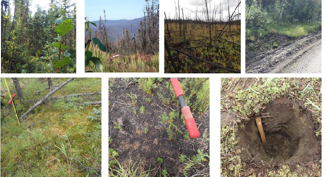
This dataset provides the results of field observations of soil characteristics and depth to permafrost, survey results for Composite Burn Index (CBI) determination,... -
Federal
ABoVE: Post-Fire and Unburned Vegetation Community and Field Data, NWT, Canada, 2017
National Aeronautics and Space Administration —
This dataset provides vegetation community characteristics, soil moisture, and biophysical data collected in 2017 from 11 study sites in the ABoVE Study area. The 11... -
Federal
Arctic Vegetation Plots at Umiat, North Slope, Alaska, 1951
National Aeronautics and Space Administration —
This data set provides vegetation cover and plot data collected during the periods of July and August, 1951, from 51 stands (areas of homogeneous vegetation... -
Federal
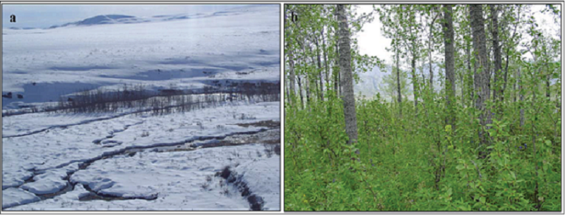
Arctic Tundra Flux Study in the Kuparuk River Basin (Alaska), 1994-1996
National Aeronautics and Space Administration —
CO2 and water vapor fluxes and ecosystem characteristics were measured at 24 sites along a 317-km transect from the Arctic coast to the latitudinal treeline in Alaska... -
Federal
BOREAS RSS-08 BIOME-BGC Model Simulations at Tower Flux Sites in 1994
National Aeronautics and Space Administration —
BIOME-BGC is a general ecosystem process model designed to simulate biogeochemical and hydrologic processes across multiple scales (Running and Hunt, 1993). In this... -
Federal
BOREAS HYD-06 Moss/Humus Moisture Data
National Aeronautics and Space Administration —
This data set contains water content measurements of the moss/humus layer, where it existed. These data were collected along various flight lines in the Southern and... -
Federal
Arctic Vegetation Plots Legacy Project Barter Island and Point Barrow, Alaska, 1994
National Aeronautics and Space Administration —
This dataset provides vegetation cover and environmental plot and soil data collected at two U.S. Air Force sites at Barter Island (BI) and Point Barrow (B), on the... -
Federal
Arctic Vegetation Plots, Poplars, Arctic and Interior AK and YT, Canada, 2003-2005
National Aeronautics and Space Administration —
This data set provides vegetation cover and environmental plot data collected from 32 balsam poplar (Populus balsamifera L., Salicaceae) vegetation plots located on... -
Federal
RSS SMAP Level 3 Sea Surface Salinity Standard Mapped Image 8-Day Running Mean V6.0 Validated Dataset
National Aeronautics and Space Administration —
The RSS SMAP Level 3 Sea Surface Salinity Standard Mapped Image 8-Day Running Mean V6.0 Validated Dataset produced by the Remote Sensing Systems (RSS) and sponsored... -
Federal
SOLVE I DC-8 Aircraft In-situ Trace Gas Data
National Aeronautics and Space Administration —
SOLVE1_TraceGas_AircraftInSItu_DC8_Data is the in-situ trace gas data for the DC-8 aircraft collected during the SAGE III Ozone Loss and Validation Experiment... -
Federal
Site Averaged Neutron Soil Moisture: 1987 (Betts)
National Aeronautics and Space Administration —
The Site Averaged Neutron Soil Moisture Data: 1987 (Betts) Data Set contains the site averaged product data of the neutron probe soil moisture collected during the...
173 datasets found for ""Soil Moisture""