
-
Federal
Paraguay Synoptic Digital Image Records
National Oceanic and Atmospheric Administration, Department of Commerce —
This dataset consists of images of records containing meteorological surface observations in synoptic format for various stations in the country of Paraguay. It has a... -
Federal
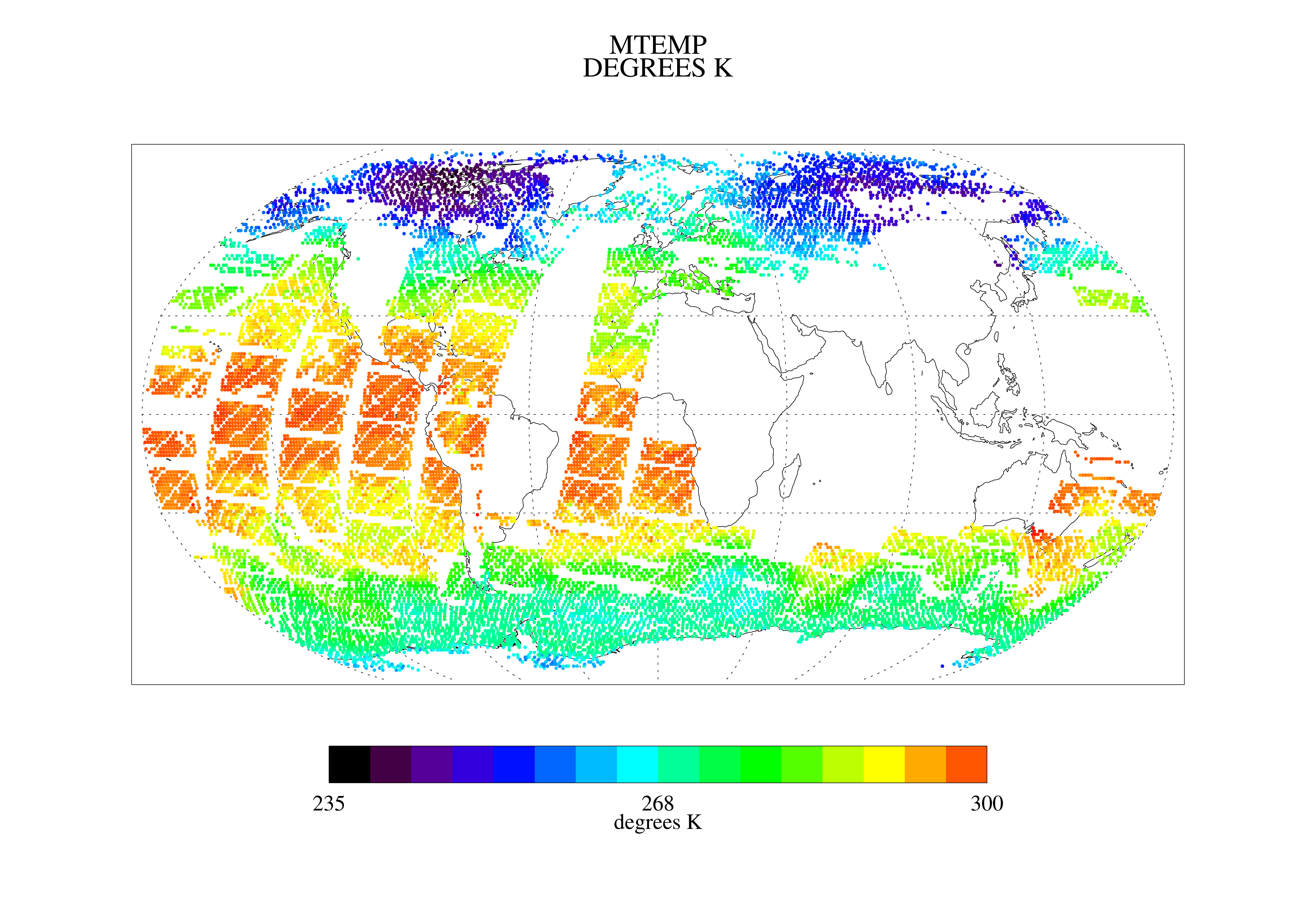
TOVS LMD DAILY GRIDS from NOAA-10 V01 (TOVSBDNG) at GES DISC
National Aeronautics and Space Administration —
Level 3 parameters from HIRS/2 and MSU radiances using the Improved Initialization Inversion (3I) classification retrieval scheme by the Laboratoire de Meteorologie... -
Federal
U.S. Climate Normals 2020: U.S. Hourly Climate Normals (2006-2020)
National Oceanic and Atmospheric Administration, Department of Commerce —
The U.S. Hourly Climate Normals for 2006 to 2020 provide users supplemental hourly normals for specialized applications for hundreds of U.S. stations located across... -
Federal
NOAA GOES-R Series Advanced Baseline Imager (ABI) Level 2 Cloud Particle Size Distribution (CPS)
National Oceanic and Atmospheric Administration, Department of Commerce —
The GOES-R Advanced Baseline Imager (ABI) Cloud Particle Size product contains an image with pixel values identifying a measure of the effective radius of the... -
Federal
Cloud-Aerosol Lidar and Infrared Pathfinder Satellite Observations (CALIPSO)
National Aeronautics and Space Administration —
Cloud-Aerosol Lidar and Infrared Pathfinder Satellite Observations (CALIPSO) was launched on April 28, 2006 to study the impact of clouds and aerosols on the Earth’s... -
Federal
TOVS GLA 5 DAY GRIDS from NOAA-11 V01 (TOVSA5NH) at GES DISC
National Aeronautics and Space Administration —
This dataset (TOVSA5NH) contains the TIROS Operational Vertical Sounder (TOVS) level 3 geophysical parameters derived using data from NOAA-11 and the physical... -
Federal
AMSR-E/AMSR2 Unified L3 Global Monthly Ascending/Descending .25x.25 deg Ocean Grids V001
National Aeronautics and Space Administration —
The AMSR-E/AMSR2 Unified L3 Global Monthly Ascending/Descending .25x.25 deg Ocean Grids data set is a gridded product that reports monthly estimates of water vapor,... -
Federal
TRMM PR Gridded Orbital Spectral Latent Heating Profiles L3 1.5 hours 0.5 degree x 0.5 degree V7 (TRMM_3G25) at GES DISC
National Aeronautics and Space Administration —
3G25, "Gridded Orbital Spectral Latent Heating", produces 0.5 degree x 0.5 degree latent heating, Q1-QR, and Q2 profiles from Precipitation Radar (PR) rain. The... -
Federal
Cloudmask, CLAVR-1, POES AVHRR, Alaska, Daytime, 2005-2008 (Hourly)
National Oceanic and Atmospheric Administration, Department of Commerce —
The CLAVR-1 cloudmask (Stowe, 1999) is used to cloudmask AVHRR high resolution sea surface temperature products. The cloudmask runs a series of tests on each surface... -
Federal
TES/Aura L2 Methanol Nadir Special Observation V007
National Aeronautics and Space Administration —
TL2MTLNS_7 is the Tropospheric Emission Spectrometer (TES)/Aura Level 2 Methanol Nadir Special Observation Version 7 data product. It consists of information for one... -
Federal
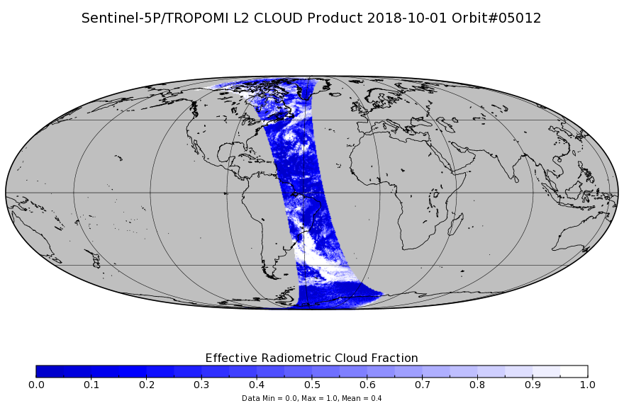
Sentinel-5P TROPOMI Cloud 1-Orbit L2 7km x 3.5km V1 (S5P_L2__CLOUD_) at GES DISC
National Aeronautics and Space Administration —
Starting from August 6th in 2019, Sentinel-5P TROPOMI along-track high spatial resolution (~5.5km at nadir) has been implemented. Starting from July 13th in 2020,... -
Federal
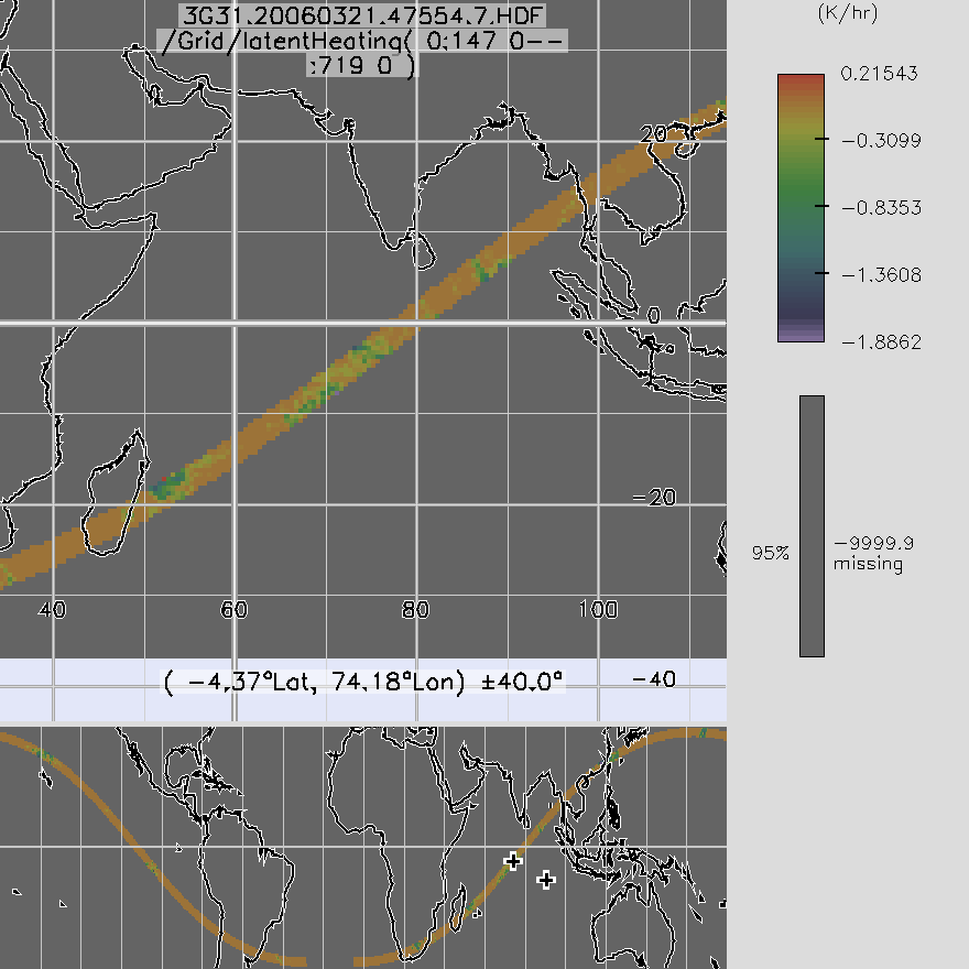
TRMM TMI/PR Combined Gridded Orbital Spectral Latent Heating L3 1.5 hours 0.5 degree x 0.5 degree V7 (TRMM_3G31) at GES DISC
National Aeronautics and Space Administration —
3G31, Gridded Orbital Convective Stratiform Heating from Combined, produces 0.5 degree x 0.5 degree orbital apparent heating profiles from surface convective rainfall... -
Federal
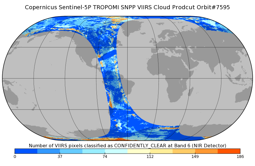
Sentinel-5P TROPOMI SNPP VIIRS cloud product band 6 (NIR detector) 1-Orbit L2 7km x 3.5km V1 (S5P_L2__NP_BD6) at GES DISC
National Aeronautics and Space Administration —
Starting from August 6th in 2019, Sentinel-5P TROPOMI along-track high spatial resolution (~5.5km at nadir) has been implemented. For data after August 6th of 2019,... -
Federal
AERONET Level 2.0 SDA
National Aeronautics and Space Administration —
The aerosol optical depth processing includes the spectral de-convolution algorithm (SDA) described in O'Neill et al. (2003). This algorithm yields fine (sub-micron)... -
Federal
International Satellite Cloud Climatology Project (ISCCP)
National Aeronautics and Space Administration —
International Satellite Cloud Climatology Project (ISCCP) focuses on the distribution and variation of cloud radiative properties to improve the understanding of the... -
Federal
FLASHFlux Daily Gridded TOA and Surfaces/Clouds data Version 4C
National Aeronautics and Space Administration —
FLASH_TISA_Terra-NOAA20_Version4C is the Fast Longwave And SHortwave Fluxes (FLASHFlux) Daily Gridded Top-of-Atmosphere (TOA) and Surfaces/Clouds Version 4C data... -
Federal
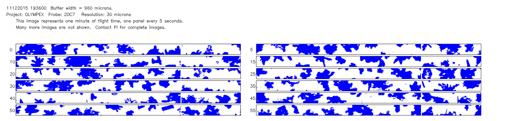
GPM Ground Validation NCAR Particle Probes OLYMPEX V1
National Aeronautics and Space Administration —
The GPM Ground Validation NCAR Particle Probes OLYMPEX dataset consists of ice water content, particle concentration normalized by bin width, and total particle... -
Federal
AMSR-E/AMSR2 Unified L2B Global Swath Ocean Products V001
National Aeronautics and Space Administration —
This AMSR Unified global ocean data set reports integrated water vapor and cloud liquid water content in the atmospheric column, plus 10-meter sea surface wind... -
Federal
Level 2.0 Almucantar Inversion Products Phase Functions
National Aeronautics and Space Administration —
AERONET inversion code provides aerosoloptical properties in the total atmospheric column derived from the direct and diffuse radiation measured byAERONETCimel...

Official websites use .gov
A
.gov website belongs to an official government
organization in the United States.
Secure .gov websites use HTTPS
A
lock (
) or https:// means you’ve safely connected to
the .gov website. Share sensitive information only on official,
secure websites.